MyTopo
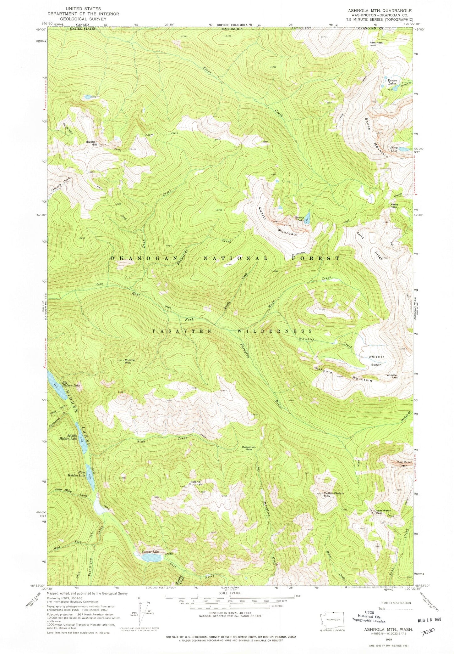
Classic USGS Ashnola Mountain Washington 7.5'x7.5' Topo Map
Couldn't load pickup availability
Historical USGS topographic quad map of Ashnola Mountain in the state of Washington. Map scale may vary for some years, but is generally around 1:24,000. Print size is approximately 24" x 27"
This quadrangle is in the following counties: Okanogan.
The map contains contour lines, roads, rivers, towns, and lakes. Printed on high-quality waterproof paper with UV fade-resistant inks, and shipped rolled.
Contains the following named places: Ashnola Mountain, Boundary Trail, Bunker Hill, Cougar Lake, Dean Creek, Deception Pass, Dollar Watch Mountain, Dollar Watch Pass, First Hidden Lake, Gray Mountain, Gunbarrel Creek, Hidden Lakes, Island Lake, Island Mountain, Little Willy Creek, Mayo Creek, McCall Gulch, Middle Hidden Lake, Middle Mountain, Murphy Creek, Park Pass, Peeve Pass, Ptarmigan Creek, Quartz Creek, Quartz Lake, Quartz Mountain, Ramon Lakes, Sand Ridge, Sheep Lake, Sheep Mountain, Snowslide Creek, Stub Creek, Two Point Mountain, West Fork Ptarmigan Creek, Whistler Basin, Whistler Creek, Whistler Pass