MyTopo
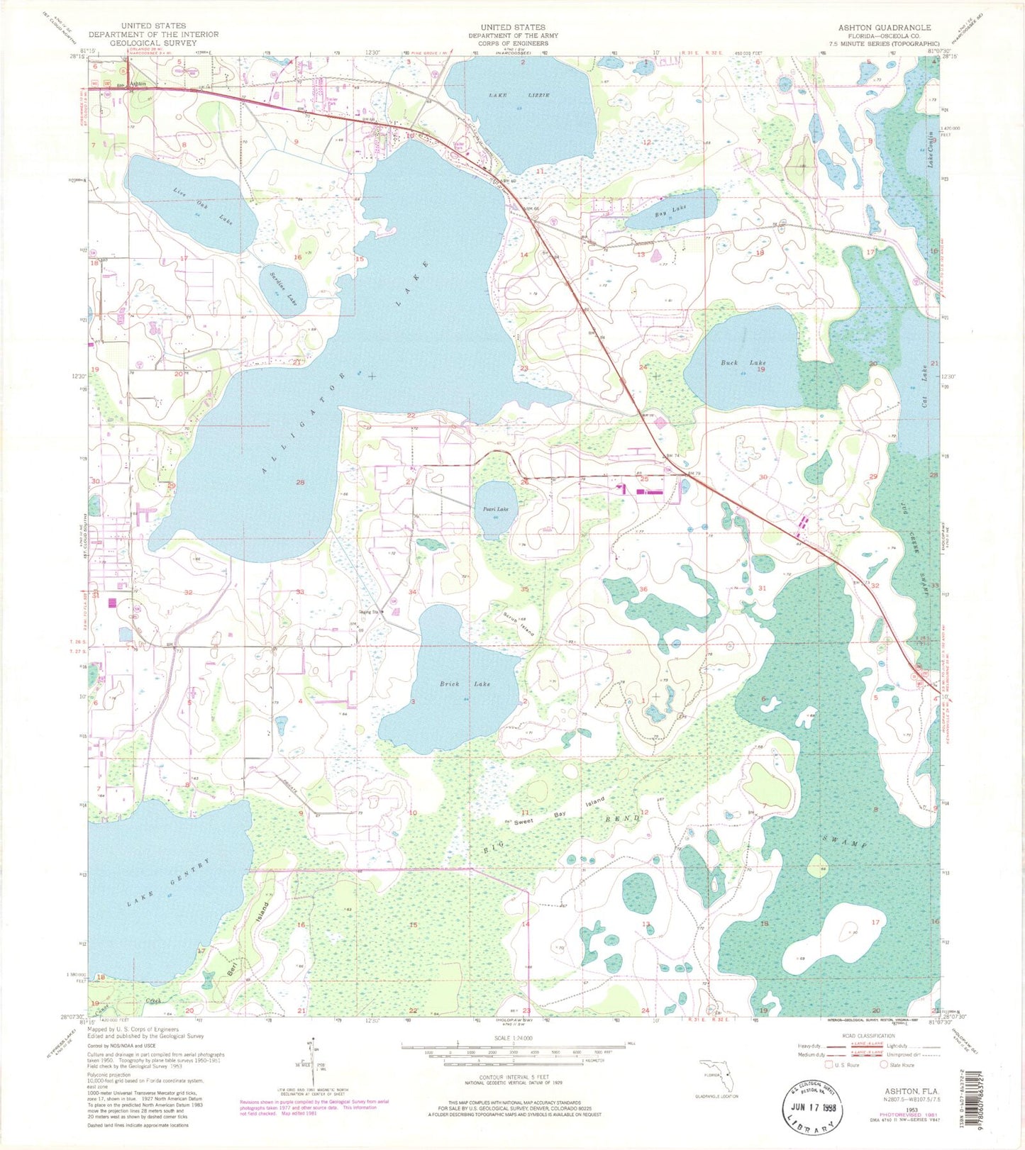
Classic USGS Ashton Florida 7.5'x7.5' Topo Map
Couldn't load pickup availability
Historical USGS topographic quad map of Ashton in the state of Florida. Map scale may vary for some years, but is generally around 1:24,000. Print size is approximately 24" x 27"
This quadrangle is in the following counties: Osceola.
The map contains contour lines, roads, rivers, towns, and lakes. Printed on high-quality waterproof paper with UV fade-resistant inks, and shipped rolled.
Contains the following named places: Alligator Lake, Ashton, Bay Lake, Berl Island, Big Bend Swamp, Brick Lake, Buck Lake, Canoe Creek, Cat Lake, Colonial Mobile Home Park, Gator Airpark, Harmony, Harmony High School, Lake Gentry, Lake Lizzie, Lakeview Trailer Terrace, Live Oak Lake, Osceola County Fire Rescue and Emergency Medical Services Department Station 53, Pearl Lake, Sardine Lake, Scrub Island, Sharps Mobile Home Park, Sweet Bay Island