MyTopo
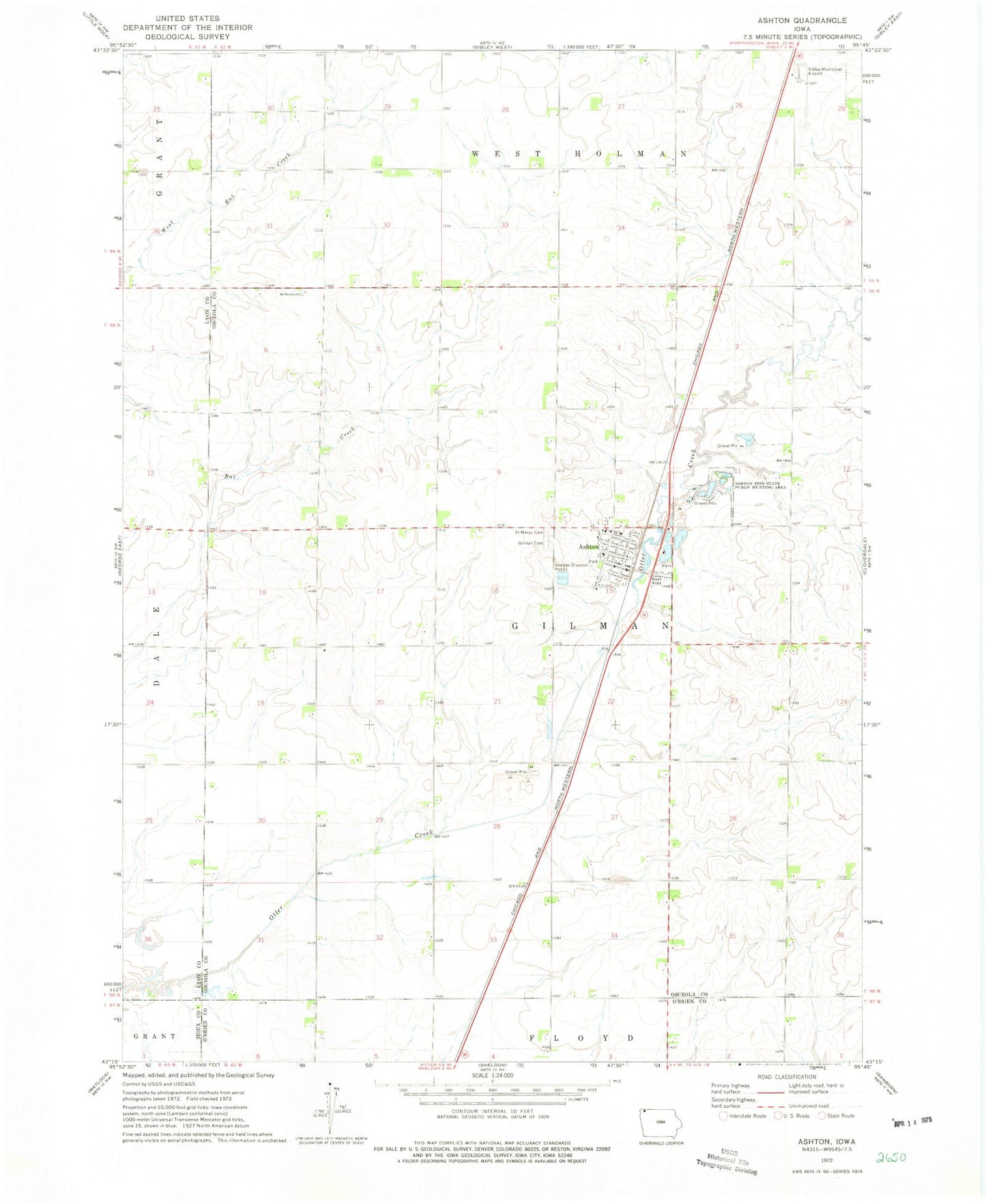
Classic USGS Ashton Iowa 7.5'x7.5' Topo Map
Couldn't load pickup availability
Historical USGS topographic quad map of Ashton in the state of Iowa. Map scale may vary for some years, but is generally around 1:24,000. Print size is approximately 24" x 27"
This quadrangle is in the following counties: Lyon, O'Brien, Osceola, Sioux.
The map contains contour lines, roads, rivers, towns, and lakes. Printed on high-quality waterproof paper with UV fade-resistant inks, and shipped rolled.
Contains the following named places: Ashton, Ashton Bible Church, Ashton Fire Department, Ashton Park, Ashton Pits State Public Hunting Area, Ashton Post Office, Ashton Public Library, City of Ashton, D and J Farm, Gilman Cemetery, Kappes Creek, Luitjens Farms, Northwest Iowa Cooperative Elevator, Osceola County Ambulance Service Ashton Division, Our Lady of Perpetual Help Church, Pair - A - Dice Ranch, Presbyterian Church, Quaker Cemetery, Saint Marys Cemetery, Sibley Dairy, Sibley Municipal Airport, Strouth Wildlife Management Area, Township of Gilman, Wagner Creek, Wheeler Wildlife Refuge, Zylstra Feedlot, ZIP Code: 51232