MyTopo
Classic USGS Ashurst Lake Arizona 7.5'x7.5' Topo Map
Couldn't load pickup availability
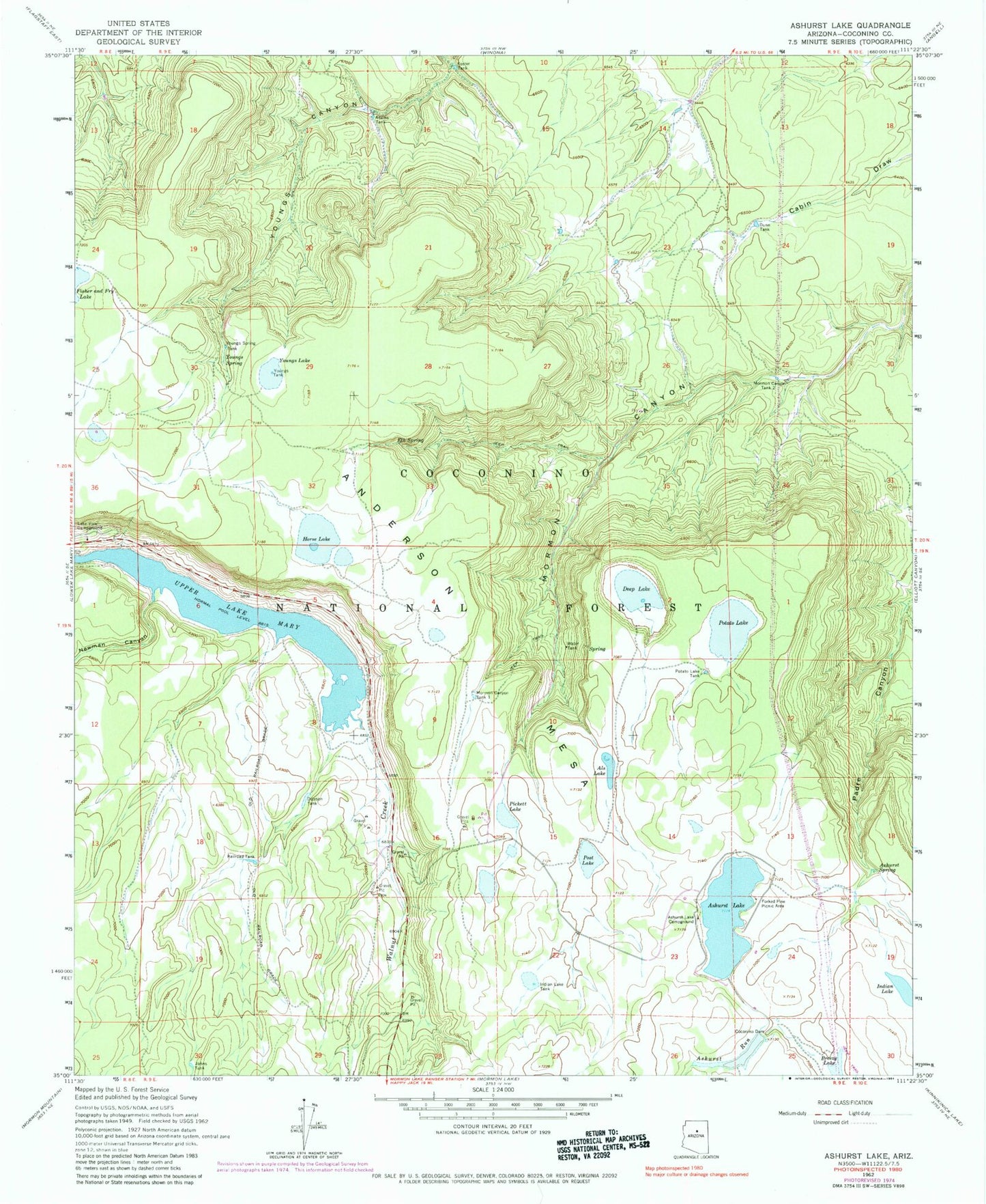
Historical USGS topographic quad map of Ashurst Lake in the state of Arizona. Typical map scale is 1:24,000, but may vary for certain years, if available. Print size: 24" x 27"
This quadrangle is in the following counties: Coconino.
The map contains contour lines, roads, rivers, towns, and lakes. Printed on high-quality waterproof paper with UV fade-resistant inks, and shipped rolled.
Contains the following named places: Adams Tank, Als Lake, Ashurst Lake, Ashurst Lake Campground, Ashurst Run, Ashurst Spring, Coconino Dam, Deep Lake, Dunn Tank, Elk Spring, Forked Pine Picnic Area, Foster Tank, Horse Lake, Indian Lake, Indian Lake Tank, Lake View Campground, Mormon Canyon Tank One, Mormon Canyon Tank Two, Newman Canyon, Otteson Tank, Pickett Lake, Post Lake, Potato Lake, Potato Lake Tank, Railroad Tank, Upper Lake Mary, Youngs Lake, Youngs Spring, Youngs Spring Tank, Youngs Tank, Ashurst Lake Dam, Breezy Number One Tank, Cabin Tank, Coconino Lake, Deep Lake Tank (historical), Forked Pine Campground, Johns Tank, Pine Grove Campground, Pine Grove Camp and Picnic Grounds, Railroad Trick Tank, Flagstaff Division, Horse Tank, Indian Lake Tank, Rye Tank, Canyon Tank, Juniper Tank, Red Tank, Snag Tank, Antelope Tank, Ashurst Tank, Ashurst Lake Boat Launch