
MyTopo
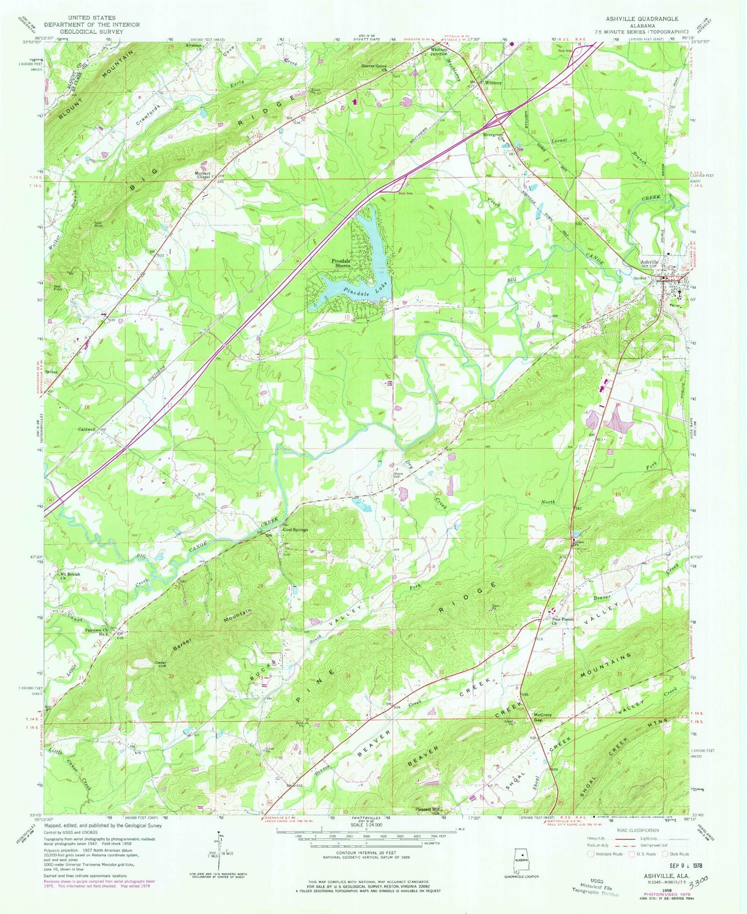
Classic USGS Ashville Alabama 7.5'x7.5' Topo Map
Couldn't load pickup availability
Historical USGS topographic quad map of Ashville in the state of Alabama. Map scale may vary for some years, but is generally around 1:24,000. Print size is approximately 24" x 27"
This quadrangle is in the following counties: Blount, St. Clair.
The map contains contour lines, roads, rivers, towns, and lakes. Printed on high-quality waterproof paper with UV fade-resistant inks, and shipped rolled.
Contains the following named places: Alverson Church, Appalachian Highlands, Ashville, Ashville Academy, Ashville Fire Department, Ashville High School, Ashville Police Department, Ashville Post Office, Barker Mountain, Beaver Creek Mountains, Big Ridge, Bucks Valley, Caldwell, Cedar Cliff, City of Ashville, Coal Springs Church, Cobb Dam, Cobb Lake, Cool Springs, Cool Springs Volunteer Fire Department, Dry Creek, Early Church, Evergreen Church, Fairview Church Number 2, Farr Dam, Farr S Lake, Fellowship Church, Goat Hill School, Left Hand Prong Little Canoe Creek, Lighthouse Church, Little Canoe Creek, Littlefatche, Locust Branch, McCrory Gap, Moore Cemetery, Mount Beulah Church, Muckleroy Creek, Murrays Chapel, New Haven Church, North Fork Dry Creek, Peterson Field, Pine Forest Church, Pinedale Dam, Pinedale Lake, Pinedale Shores, Pinedale Shores Church, Pinedale Volunteer Fire and Rescue Station, Pleasant Hill Church, Reeves Grove Cemetery, Reeves Grove Church, Saint Clair County Farm, Saint Clair Sheriff's Office, South Fork Dry Creek, Stolle Dam, Stolle Lake, Walker Branch, Whitney, Whitney Junction, Woodall


