
MyTopo
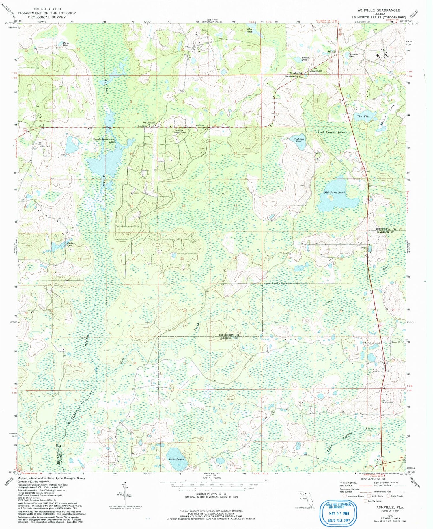
Classic USGS Ashville Florida 7.5'x7.5' Topo Map
Couldn't load pickup availability
Historical USGS topographic quad map of Ashville in the state of Florida. Map scale may vary for some years, but is generally around 1:24,000. Print size is approximately 24" x 27"
This quadrangle is in the following counties: Jefferson, Madison.
The map contains contour lines, roads, rivers, towns, and lakes. Printed on high-quality waterproof paper with UV fade-resistant inks, and shipped rolled.
Contains the following named places: Antioch Church, Ashville, Ashville Lookout Tower, Bethel School, Blue Pond, Brooks Pond, Finlayson Farm Airport, Ginhouse Pond, Gum Creek, Horse Pond, Jefferson Landings, Jerusalem Church, Lake Logan, Macedonia Church, Old Fern Pond, Old Greenville Church, Parker Pond, Pinckney Hill Pond, Reaper Church, Reed Branch Swamp, San Juan Ospalaga, Sanctified Church, Sessions Pond, Shehee Lake, Sneads Smokehouse Lake, The Flat, Wesleyan Church


