MyTopo
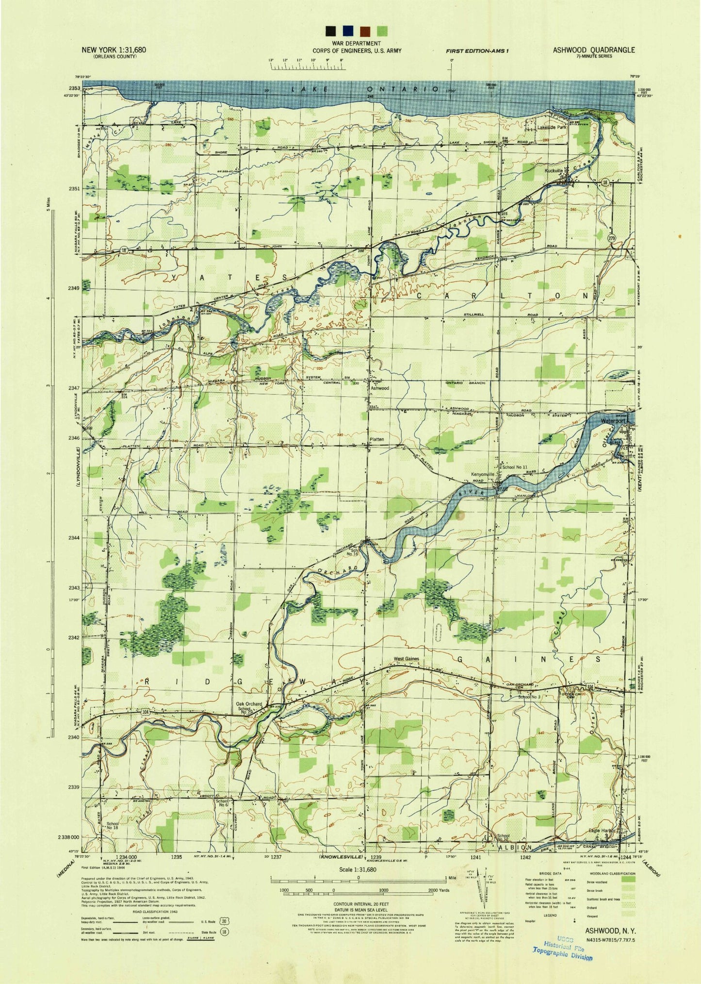
Classic USGS Ashwood New York 7.5'x7.5' Topo Map
Couldn't load pickup availability
Historical USGS topographic quad map of Ashwood in the state of New York. Map scale may vary for some years, but is generally around 1:24,000. Print size is approximately 24" x 27"
This quadrangle is in the following counties: Orleans.
The map contains contour lines, roads, rivers, towns, and lakes. Printed on high-quality waterproof paper with UV fade-resistant inks, and shipped rolled.
Contains the following named places: Allens Bridge, Ashwood, Ashwood Wesleyan Church, Bates Road Cemetery, Carlton Cemetery, Carlton Fire Company, Eagle Harbor, Eagle Harbor Road Bridge, Eagle Harbor United Methodist Church, Fish Creek, Fuller Cemetery, Giltner Farms, Green Harbor Marina, Greenman Cemetery, Imburgia Farms, Johnson Creek, Kenyonville, Kenyonville Cemetery, Kniland Dairy Farms, Kuckville, Lakeside, Lakeside Park, Lakeside Road Bridge, Long Bridge Cemetery, Lynoaken Farm, Marsh Creek, Navarra Farm and Greenhouse, Nice Farms, Oak Orchard, Oak Orchard Assembly of God, Oak Orchard Cemetery, Otter Creek, Otter Creek Cemetery, Platten, Rocky Haven Farm, Sandy Knoll Farms, School Number 11, School Number 12, School Number 15, School Number 16, School Number 18, School Number 3, School Number 6, School Number 7, Sunset Beach, Syren Creek, The Marsh, Waterport, Waterport Cemetery, Waterport Pond, Waterport Post Office, West Gaines, ZIP Code: 14571