
MyTopo
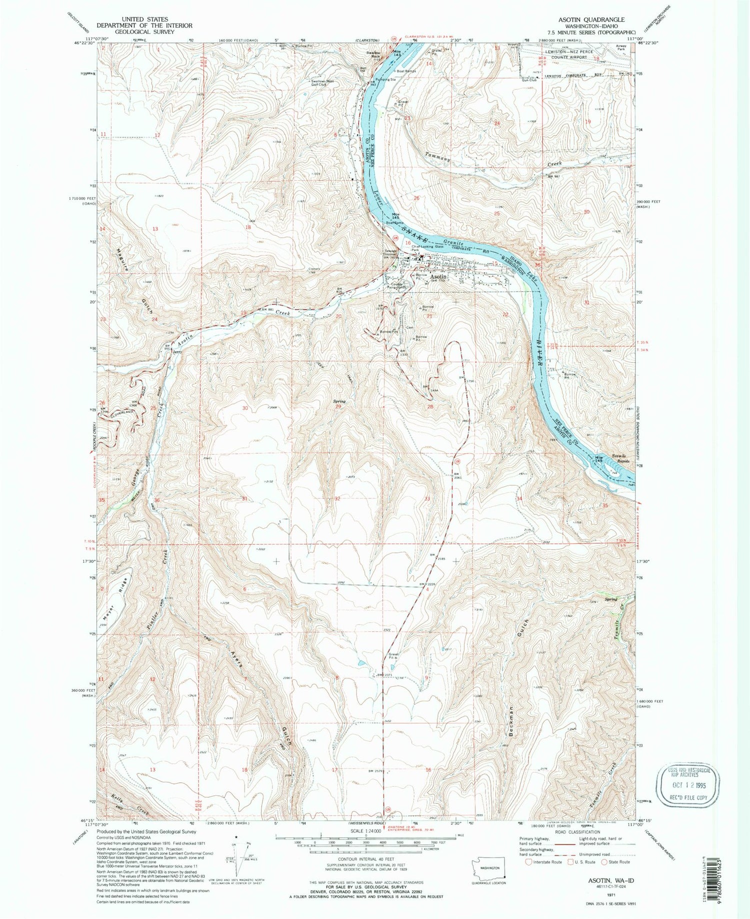
Classic USGS Asotin Washington 7.5'x7.5' Topo Map
Couldn't load pickup availability
Historical USGS topographic quad map of Asotin in the states of Washington, Idaho. Map scale may vary for some years, but is generally around 1:24,000. Print size is approximately 24" x 27"
This quadrangle is in the following counties: Asotin, Nez Perce.
The map contains contour lines, roads, rivers, towns, and lakes. Printed on high-quality waterproof paper with UV fade-resistant inks, and shipped rolled.
Contains the following named places: Airway Park, Asotin, Asotin Cemetery, Asotin County Sheriff's Office, Asotin Creek, Asotin Dam, Asotin Elementary School, Asotin Fire Department, Asotin Junior Senior High School, Asotin Post Office, Ayers Gulch, Ayers Ridge, Beckman Gulch, Chief Lookin Glass Marina, Chief Looking Glass Marina, Chief Looking Glass Park, City of Asotin, Full Gospel Church, George Creek, Hells Gate State Recreation Area, Hells Gato Marina, Idaho State Correction Facility, Jerry, Lewiston-Nez Perce County Airport, Maguire Gulch, Pintler Creek, Swallows Nest, Swallows Nest Golf Club, Tammany Creek, Tenmile Rapids


