
MyTopo
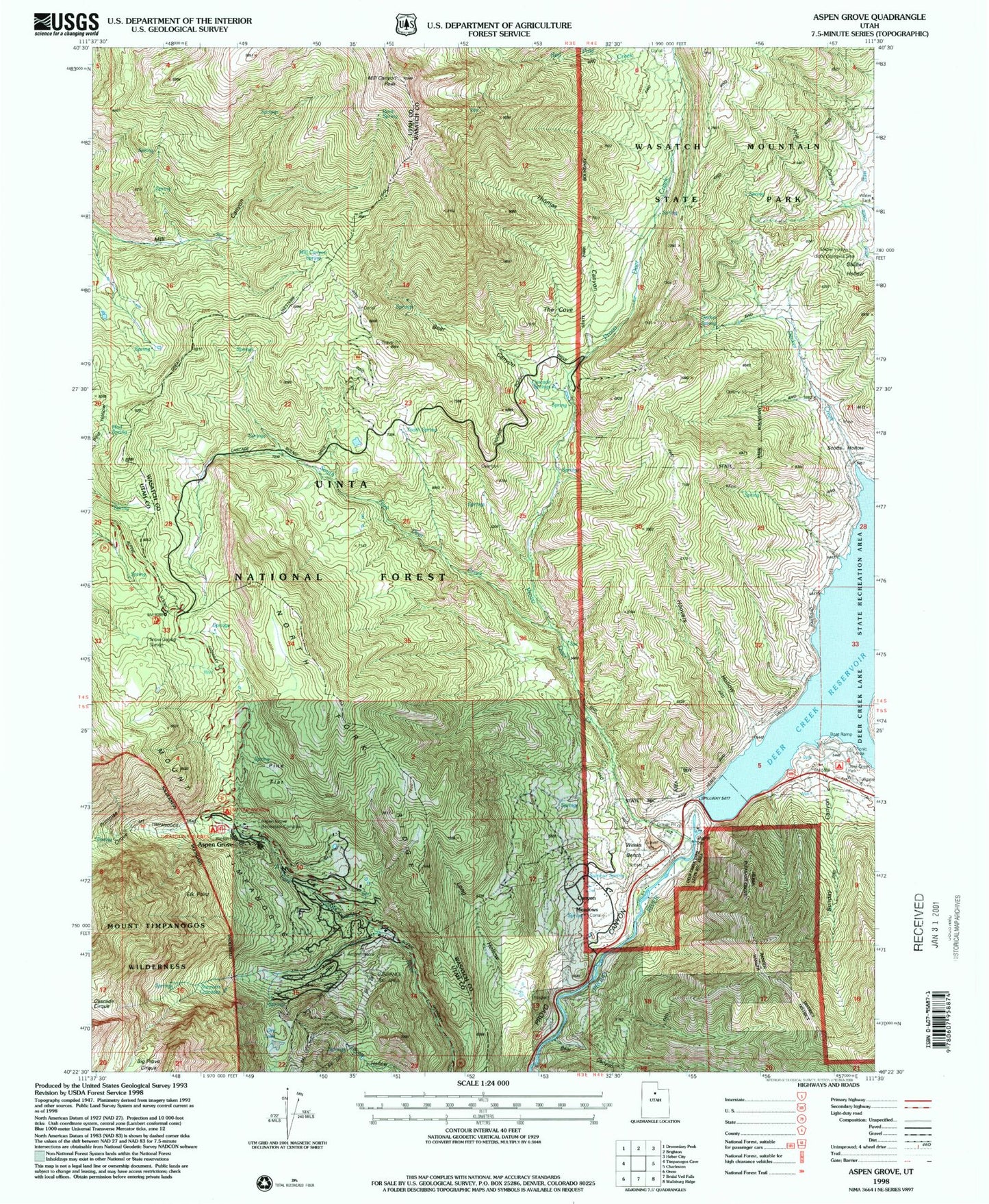
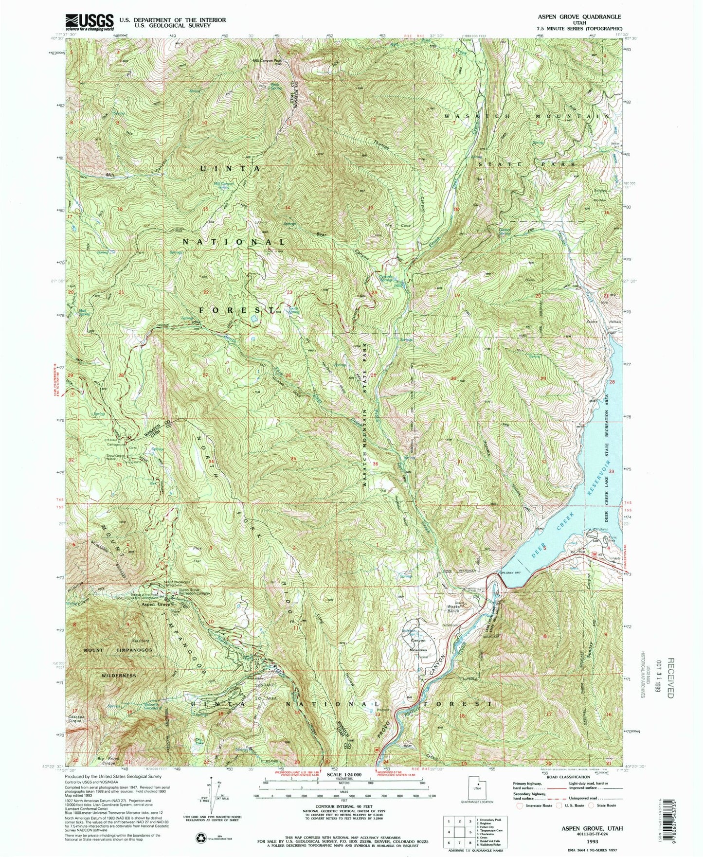
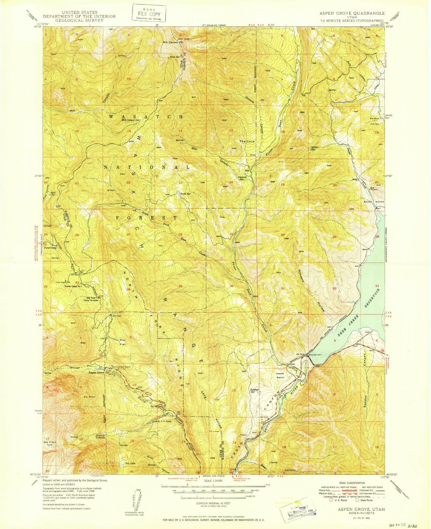
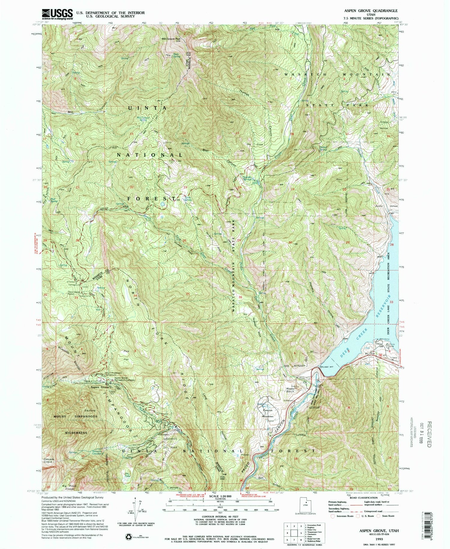
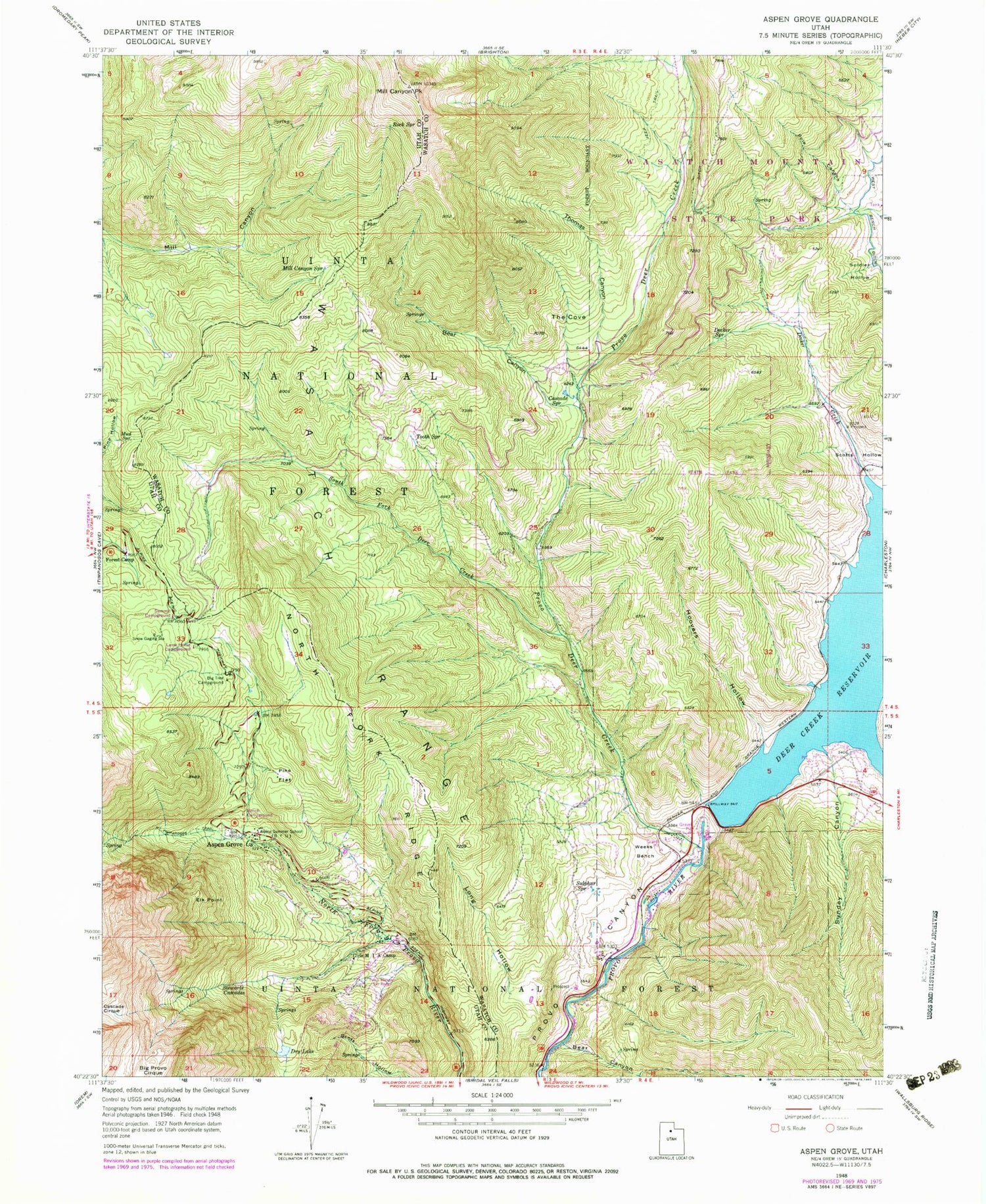
Classic USGS Aspen Grove Utah 7.5'x7.5' Topo Map
Couldn't load pickup availability
Historical USGS topographic quad map of Aspen Grove in the state of Utah. Typical map scale is 1:24,000, but may vary for certain years, if available. Print size: 24" x 27"
This quadrangle is in the following counties: Utah, Wasatch.
The map contains contour lines, roads, rivers, towns, and lakes. Printed on high-quality waterproof paper with UV fade-resistant inks, and shipped rolled.
Contains the following named places: Alpine Summer School, Aspen Grove, Bear Canyon, Bear Canyon, Mount Timpanogos Campground, Big Tree Campground, Cascade Springs, Decker Creek, Decker Spring, Dry Lake, Elk Point, Forest Camp, Girls M I A Camp, Hoovers Hollow, Lame Horse Campground, Long Hollow, Mill Canyon Peak, Mill Canyon Spring, Mount Timpanogos Trail, Mud Spring, North Fork Ridge, Pine Flat, Pole Canyon, Provo Deer Creek, Rock Spring, Scotts Hollow, Soldier Hollow, South Fork Deer Creek, Stewarts Cascades, Sulphur Spring, Summit Campground, Sunday Canyon, The Cove, Thomas Canyon, Tooth Spring, Wasatch Mountain State Park, Weeks Bench, Deer Creek Dam, Riverbend Trailer Park, Red Pine Creek, Theater in the Pines, Deer Creek State Park, Sundance Ski Area, Sundance, Heber City West Division, North Fork Fire Department, Sundance Census Designated Place, Alpine Summer School, Aspen Grove, Bear Canyon, Bear Canyon, Mount Timpanogos Campground, Big Tree Campground, Cascade Springs, Decker Creek, Decker Spring, Dry Lake, Elk Point, Forest Camp, Girls M I A Camp, Hoovers Hollow, Lame Horse Campground, Long Hollow, Mill Canyon Peak, Mill Canyon Spring, Mount Timpanogos Trail, Mud Spring, North Fork Ridge, Pine Flat, Pole Canyon, Provo Deer Creek, Rock Spring, Scotts Hollow, Soldier Hollow, South Fork Deer Creek, Stewarts Cascades, Sulphur Spring, Summit Campground, Sunday Canyon, The Cove, Thomas Canyon, Tooth Spring, Wasatch Mountain State Park, Weeks Bench, Deer Creek Dam, Riverbend Trailer Park, Red Pine Creek, Theater in the Pines, Deer Creek State Park, Sundance Ski Area, Sundance, Heber City West Division, North Fork Fire Department, Sundance Census Designated Place, Alpine Summer School, Aspen Grove, Bear Canyon, Bear Canyon, Mount Timpanogos Campground, Big Tree Campground, Cascade Springs, Decker Creek, Decker Spring, Dry Lake, Elk Point, Forest Camp, Girls M I A Camp, Hoovers Hollow, Lame Horse Campground, Long Hollow, Mill Canyon Peak, Mill Canyon Spring, Mount Timpanogos Trail, Mud Spring, North Fork Ridge, Pine Flat, Pole Canyon, Provo Deer Creek, Rock Spring, Scotts Hollow, Soldier Hollow, South Fork Deer Creek, Stewarts Cascades, Sulphur Spring, Summit Campground, Sunday Canyon, The Cove, Thomas Canyon, Tooth Spring, Wasatch Mountain State Park, Weeks Bench, Deer Creek Dam, Riverbend Trailer Park, Red Pine Creek, Theater in the Pines, Deer Creek State Park, Sundance Ski Area, Sundance, Heber City West Division, North Fork Fire Department, Sundance Census Designated Place