MyTopo
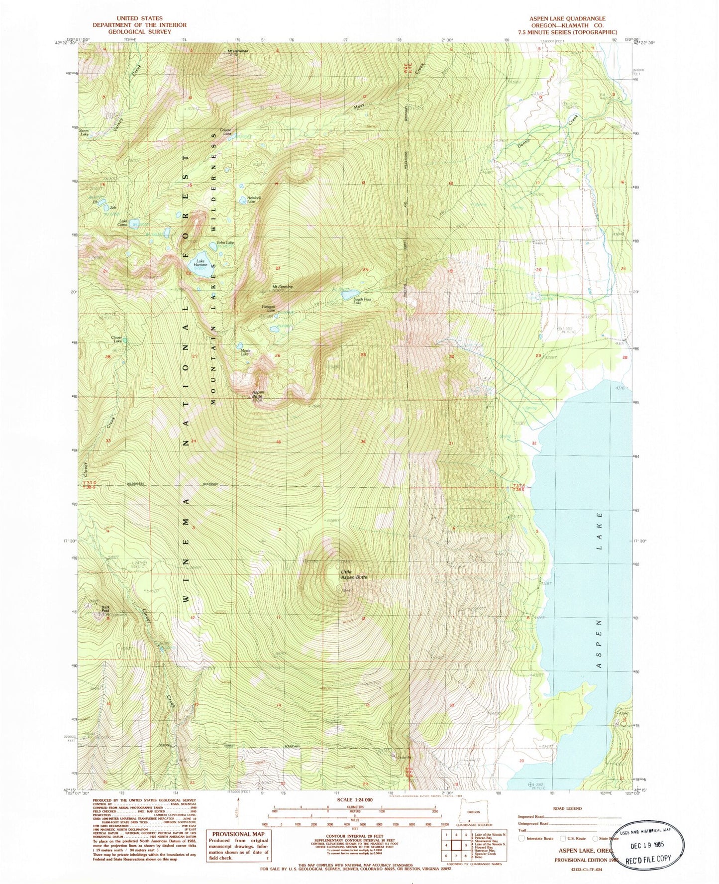
Classic USGS Aspen Lake Oregon 7.5'x7.5' Topo Map
Couldn't load pickup availability
Historical USGS topographic quad map of Aspen Lake in the state of Oregon. Typical map scale is 1:24,000, but may vary for certain years, if available. Print size: 24" x 27"
This quadrangle is in the following counties: Klamath.
The map contains contour lines, roads, rivers, towns, and lakes. Printed on high-quality waterproof paper with UV fade-resistant inks, and shipped rolled.
Contains the following named places: Aspen Butte, Buck Peak, Mount Carmine, Clover Lake, Lake Como, Coyote Lake, Denny Creek, Eb Lake, Echo Lake, Lake Harriette, Mount Harriman, Hemlock Lake, Little Aspen Butte, Moss Creek Trail, Mystic Lake, Paragon Lake, South Pass Lake, South Pass Lake Trail, Storm Lake, Zeb Lake, Grampian Hills, South Pass, South Creek, Bridge Creek, Swan Creek, Camp Creek, Aspen Lake Cinder Pit, Aspen Lake, Aspen Butte Cinder Pit, Mountain Lakes Wilderness