MyTopo
Classic USGS Assawompset Pond Massachusetts 7.5'x7.5' Topo Map
Couldn't load pickup availability
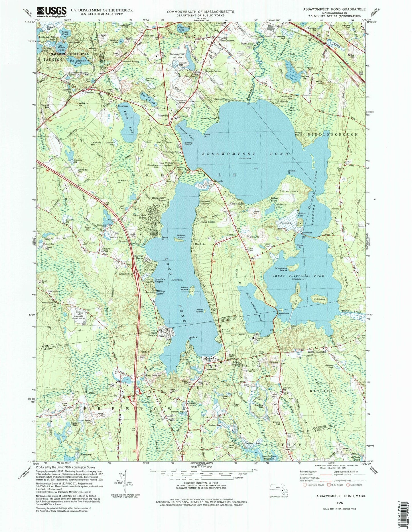
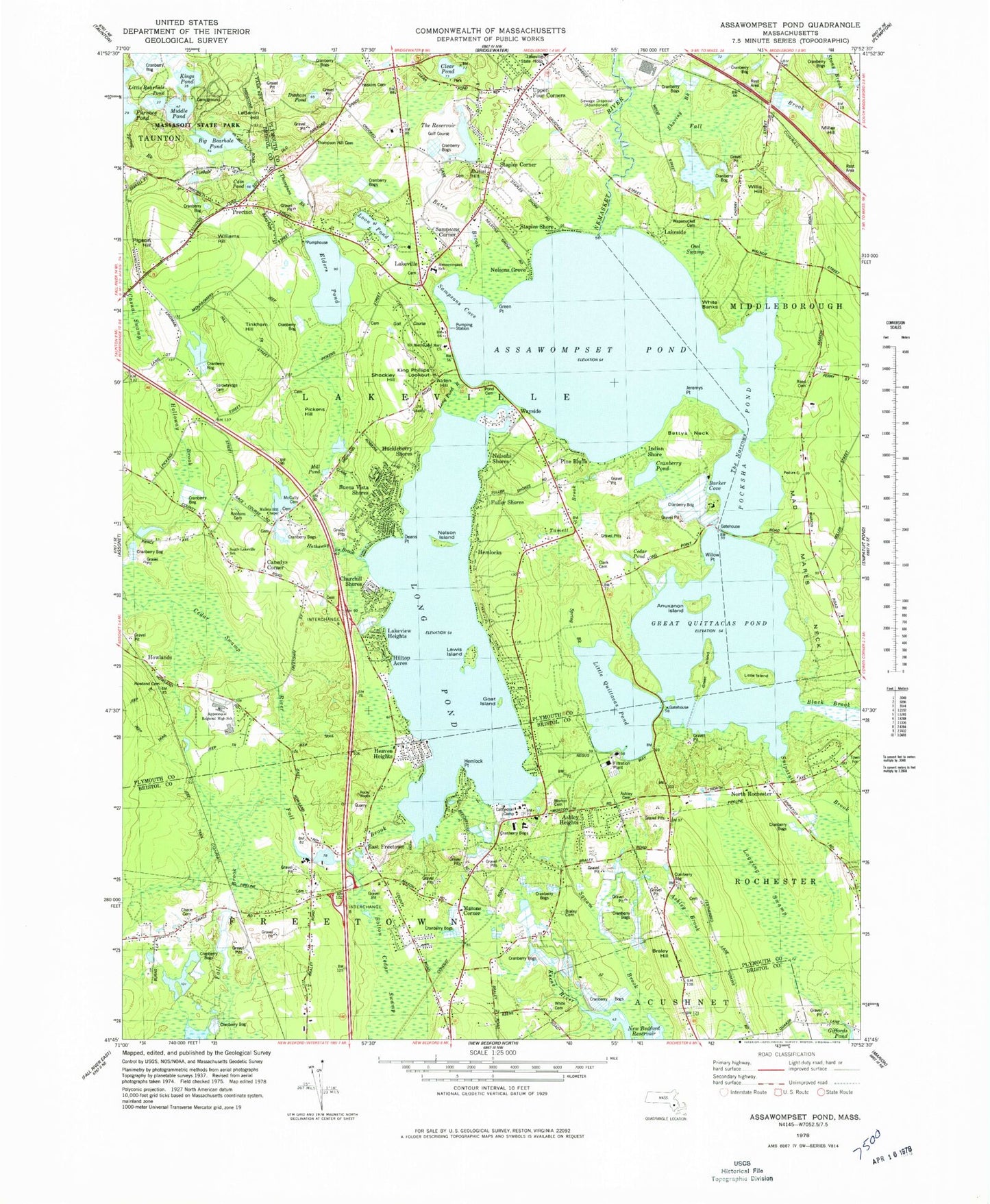
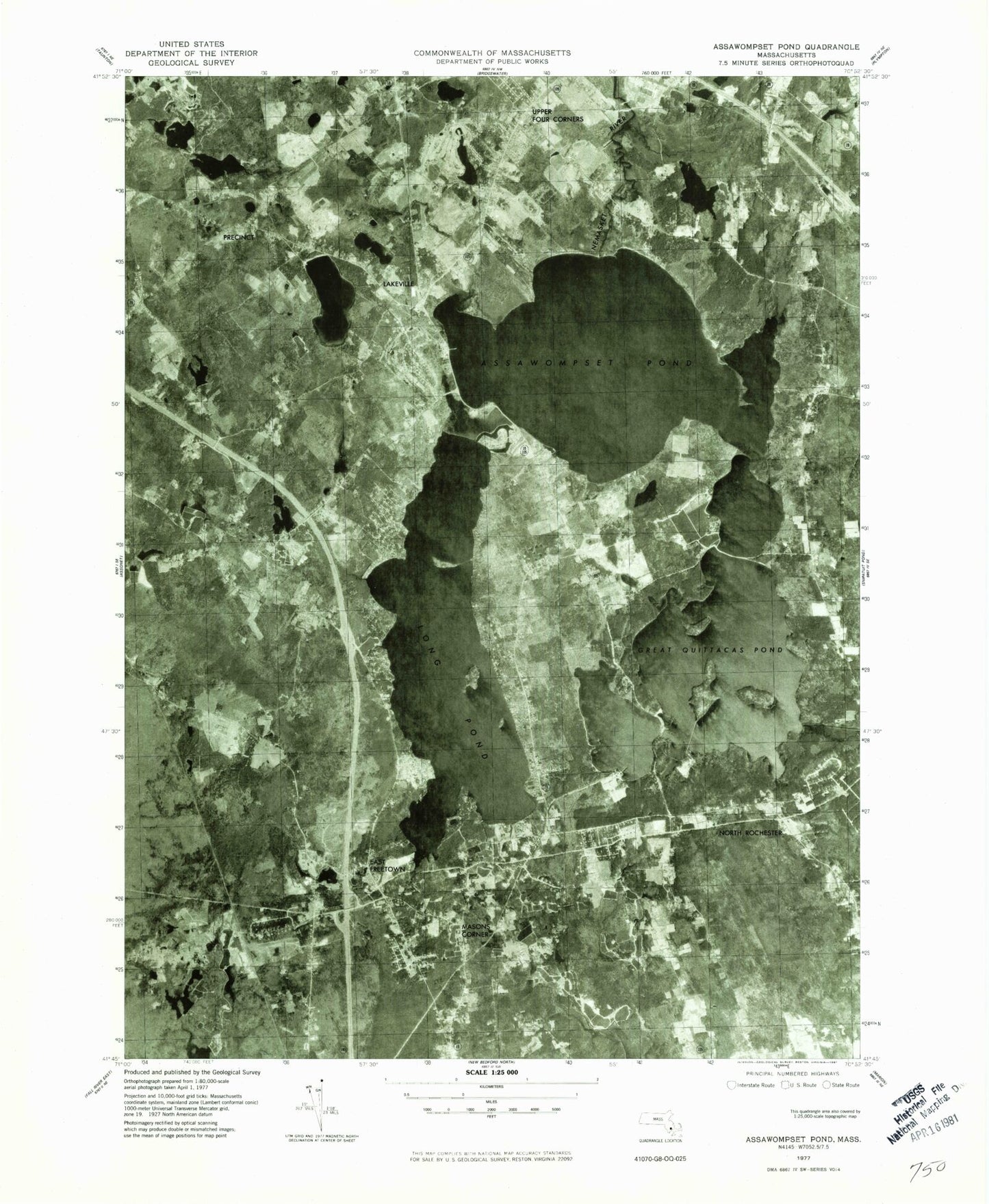
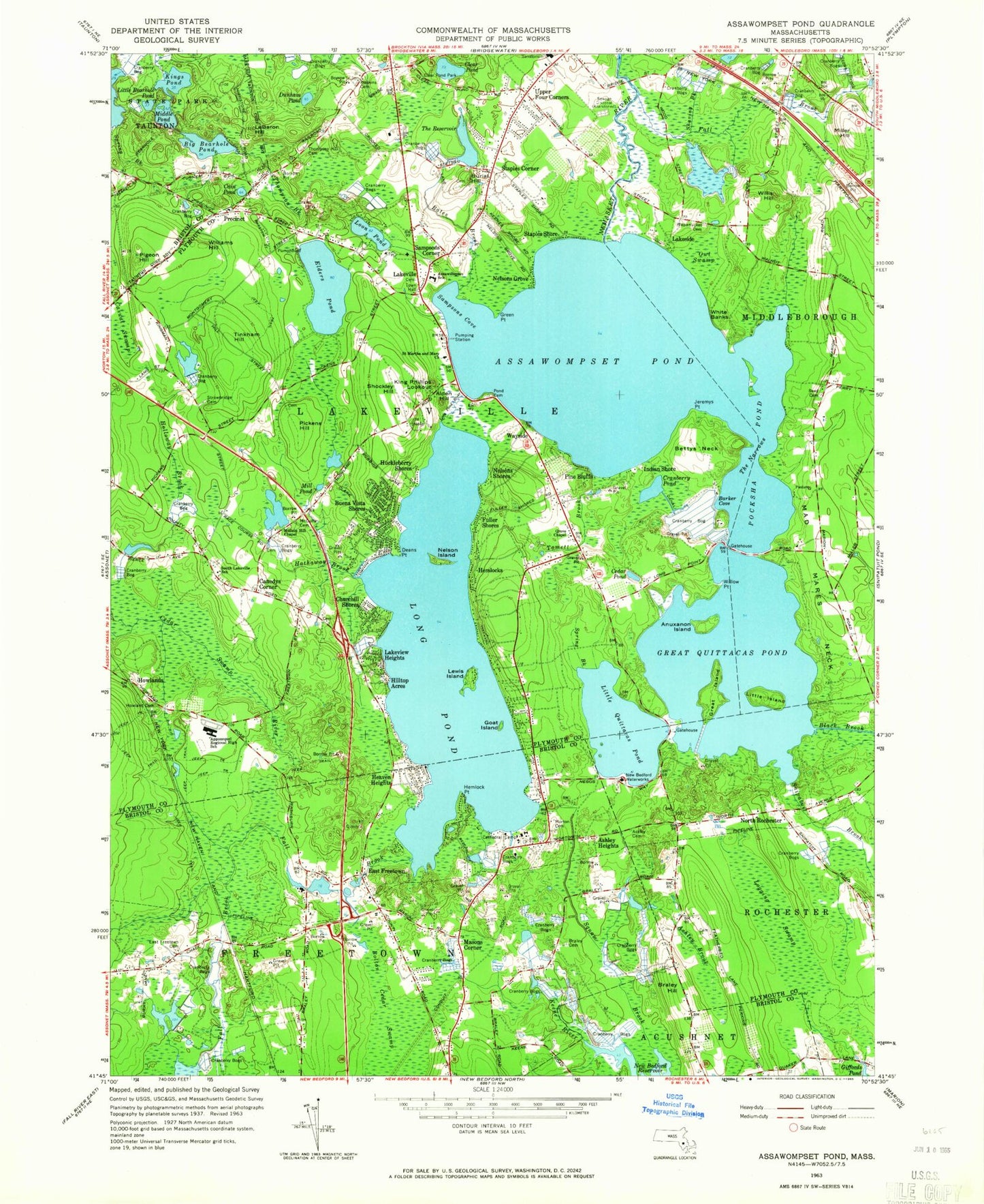
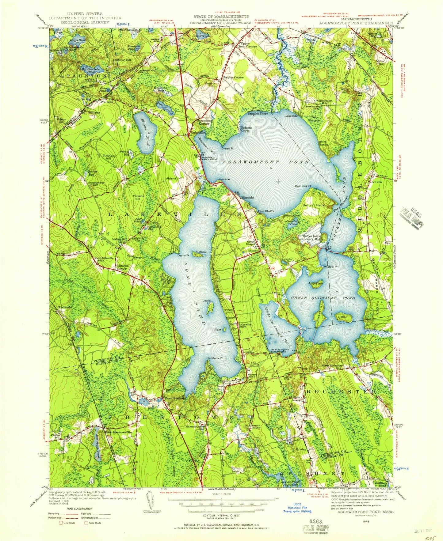
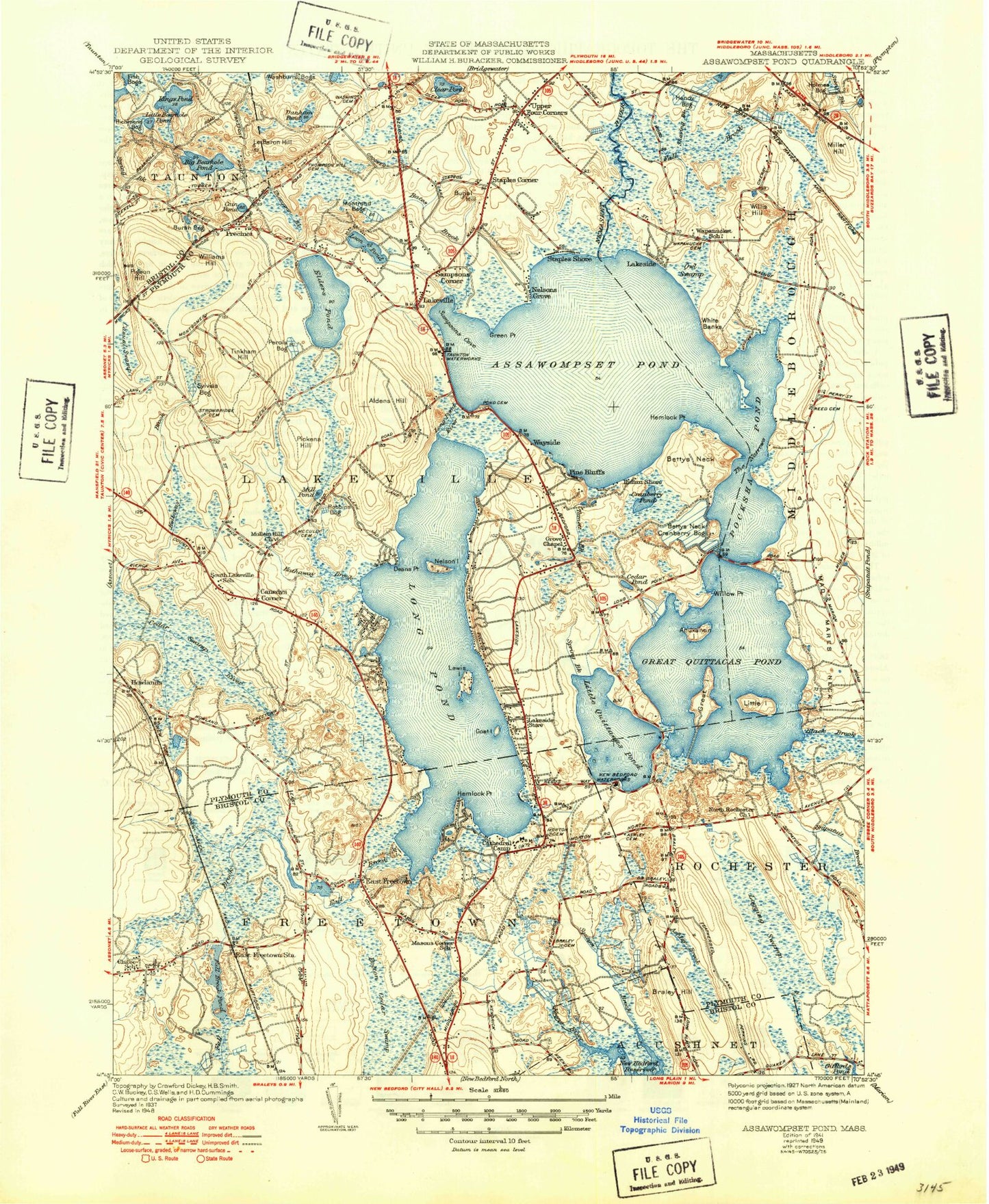
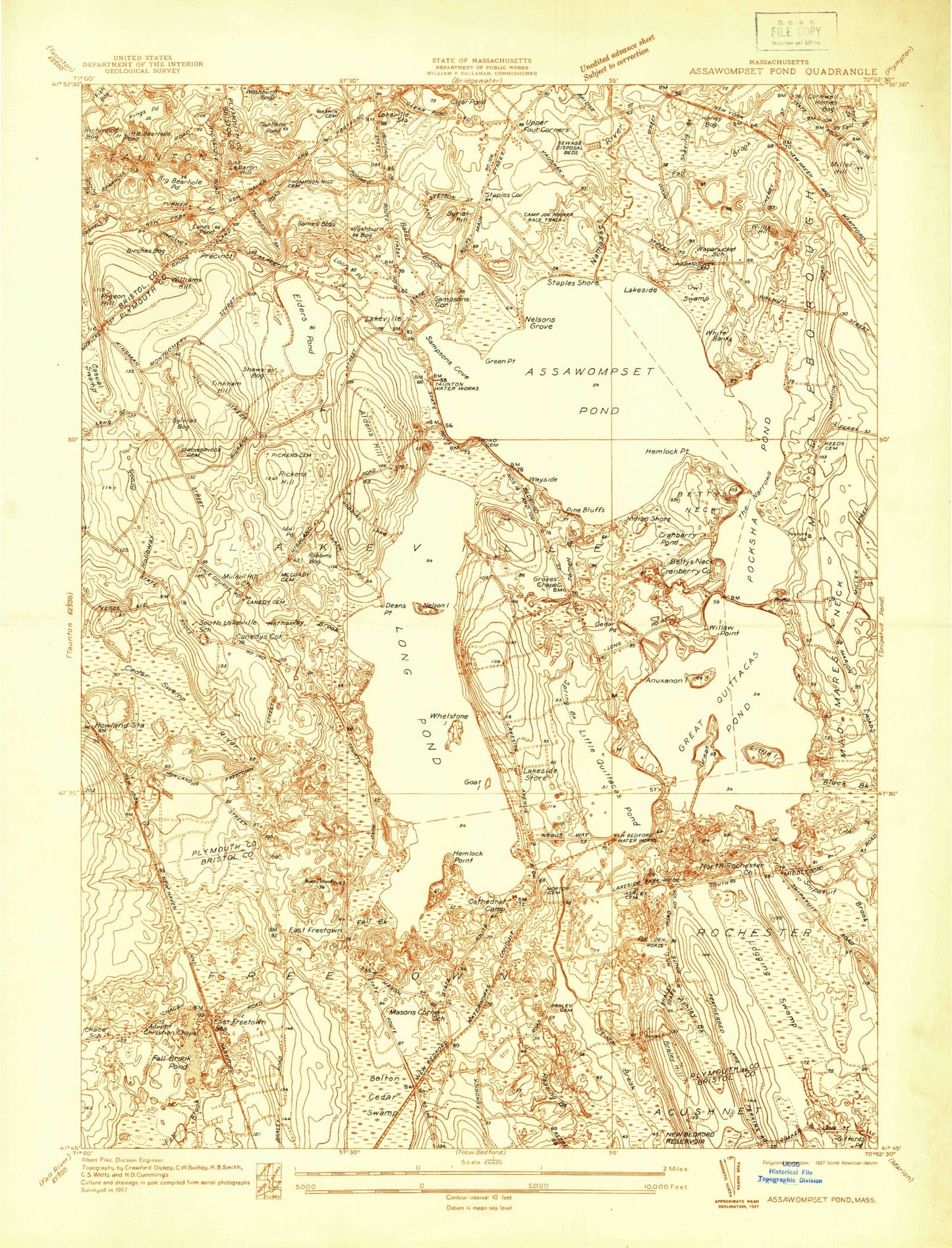
Historical USGS topographic quad map of Assawompset Pond in the state of Massachusetts. Typical map scale is 1:24,000, but may vary for certain years, if available. Print size: 24" x 27"
This quadrangle is in the following counties: Bristol, Plymouth.
The map contains contour lines, roads, rivers, towns, and lakes. Printed on high-quality waterproof paper with UV fade-resistant inks, and shipped rolled.
Contains the following named places: Cranberry Pond, The Reservoir, Cathedral Camp, Strobridge Cemetery, McCully Cemetery, Robbins Cemetery, Howland Cemetery, Thompson Hill Cemetery, Haskins Cemetery, Reed Cemetery, Pond Cemetery, Clark Cemetery, Ashley Cemetery, Morton Cemetery, Doctor Bradford Braley Cemetery, Chace Cemetery, White Cemetery, Saint Martha and Saint Mary Church, Mullein Hill Chapel, South Lakeville School, Apponequel Regional High School, Assawompset School, Pierce Avenue Dam, Pierce Avenue Pond, Egger Bog Pond, Egger Bog Dam, Mill Pond Dam, Saint Yues Bog Dam (historical), Saint Yues Bog Reservoir, The Reservoir Dam, Big Bearhole Pond Dam, Alden Hill, Anuxanon Island, Ashley Brook, Ashley Heights, Assawompset Pond, Bates Brook, Bettys Neck, Black Brook, Braley Hill, Buena Vista Shores, Burial Hill, Cain Pond, Canedys Corner, Cedar Pond, Churchill Shores, Clear Pond, Deans Point, Dunham Pond, East Freetown, Elders Pond, Fall Brook, Fall Brook, Fuller Shores, Giffords Pond, Goat Island, Great Island, Great Quittacas Pond, Green Point, Hathaway Brook, Heaven Heights, Hemlock Point, Hemlocks, Hilltop Acres, Huckleberry Shores, Indian Shore, Jeremys Point, King Phillips Lookout, Kings Pond, Lakeside, Lakeview Heights, Lakeville, Lewis Island, Le Baron Hill, Little Island, Little Quittacas Pond, Logging Swamp, Long Pond, Long Pond River, Loon Pond, Masons Corner, Miller Hill, Mill Pond, The Narrows, Nelson Island, Nelsons Grove, Nelsons Shores, North Rochester, Owl Swamp, Pickens Hill, Pigeon Hill, Pine Bluffs, Pocksha Pond, Precinct, Sampsons Corner, Shaving Brook, Shockley Hill, Spring Brook, Staples Corner, Staples Shore, Stony Brook, Tamett Brook, Tinkham Hill, Upper Four Corners, Wayside, White Banks, Williams Hill, Willis Hill, Willow Point, Bolton Cedar Swamp, Middle Pond, Casual Swamp, Little Bearhole Pond, Long Point, Spring Brook, Furnace Pond, Town of Lakeville, Barker Cove, Sampsons Cove, North Rochester Post Office (historical), WFDG-TV (New Bedford), North Lakeville, George R Austin Middle School, Heritage Hill Country Club, Lakeside Shore, Lakeville Church of the Nazarene, Lakeville Public Library, Lakeville United Church, Pine Haven, Reservoir Heights Golf Club, Lakeville Free Public Library, Mullein Hill Christian Academy, Bishop Ruocco House School, Freetown Elementary School Library, Freetown-Lakeville Middle School, Whitney Academy, North Lakeville Census Designated Place, Lakeville Post Office, Lakeville Fire Department, Freetown Fire Department Station 2, Lakeville Police Department, East Freetown Post Office, Alms House Cemetery, Cranberry Pond, The Reservoir, Cathedral Camp, Strobridge Cemetery, McCully Cemetery, Robbins Cemetery, Howland Cemetery, Thompson Hill Cemetery, Haskins Cemetery, Reed Cemetery, Pond Cemetery, Clark Cemetery, Ashley Cemetery, Morton Cemetery, Doctor Bradford Braley Cemetery, Chace Cemetery, White Cemetery, Saint Martha and Saint Mary Church, Mullein Hill Chapel, South Lakeville School, Apponequel Regional High School, Assawompset School, Pierce Avenue Dam, Pierce Avenue Pond, Egger Bog Pond, Egger Bog Dam, Mill Pond Dam, Saint Yues Bog Dam (historical), Saint Yues Bog Reservoir, The Reservoir Dam, Big Bearhole Pond Dam, Alden Hill, Anuxanon Island, Ashley Brook, Ashley Heights, Assawompset Pond, Bates Brook, Bettys Neck, Black Brook, Braley Hill, Buena Vista Shores, Burial Hill, Cain Pond, Canedys Corner, Cedar Pond, Churchill Shores, Clear Pond, Deans Point, Dunham Pond, East Freetown, Elders Pond, Fall Brook, Fall Brook, Fuller Shores, Giffords Pond, Goat Island, Great Island, Great Quittacas Pond, Green Point, Hathaway Brook, Heaven Heights, Hemlock Point, Hemlocks, Hilltop Acres, Huckleberry Shores, Indian Shore, Jeremys Point, King Phillips Lookout, Kings Pond, Lakeside, Lakeview Heights, Lakeville, Lewis Island, Le Baron Hill, Little Island, Little Quittacas Pond, Logging Swamp, Long Pond, Long Pond River, Loon Pond, Masons Corner, Miller Hill, Mill Pond, The Narrows, Nelson Island, Nelsons Grove, Nelsons Shores, North Rochester, Owl Swamp, Pickens Hill, Pigeon Hill, Pine Bluffs, Pocksha Pond