MyTopo
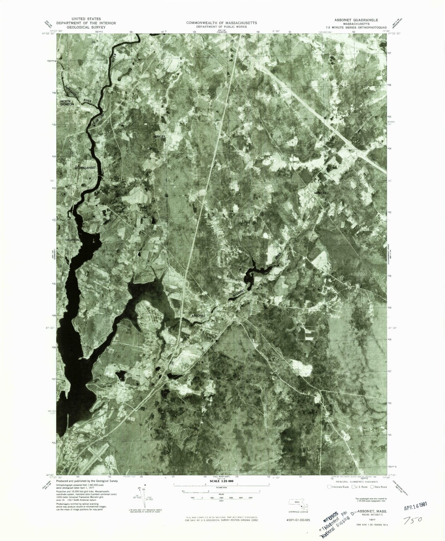
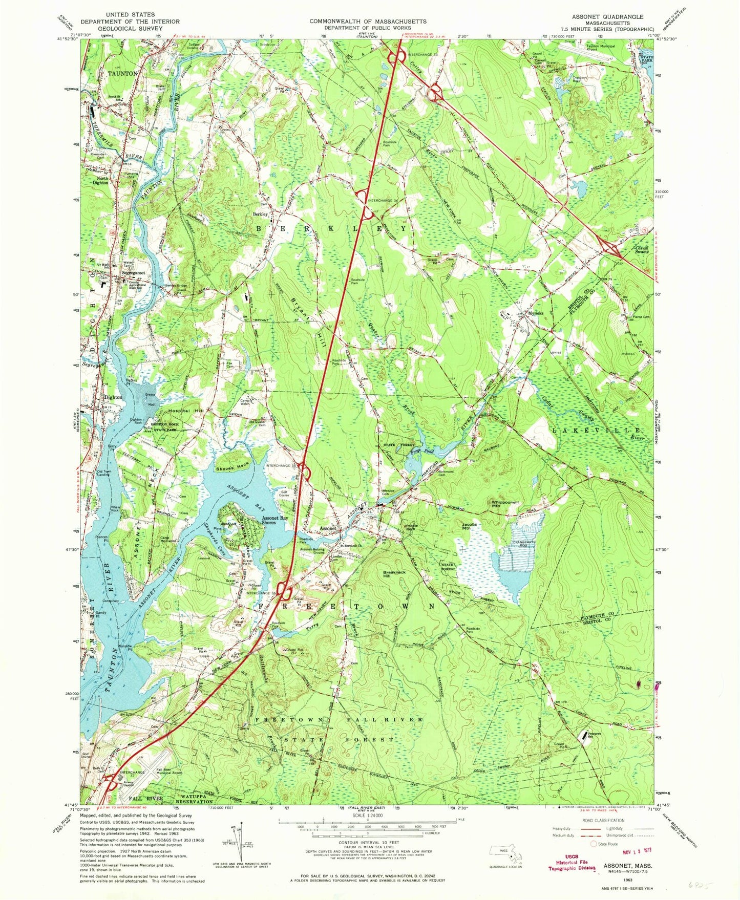
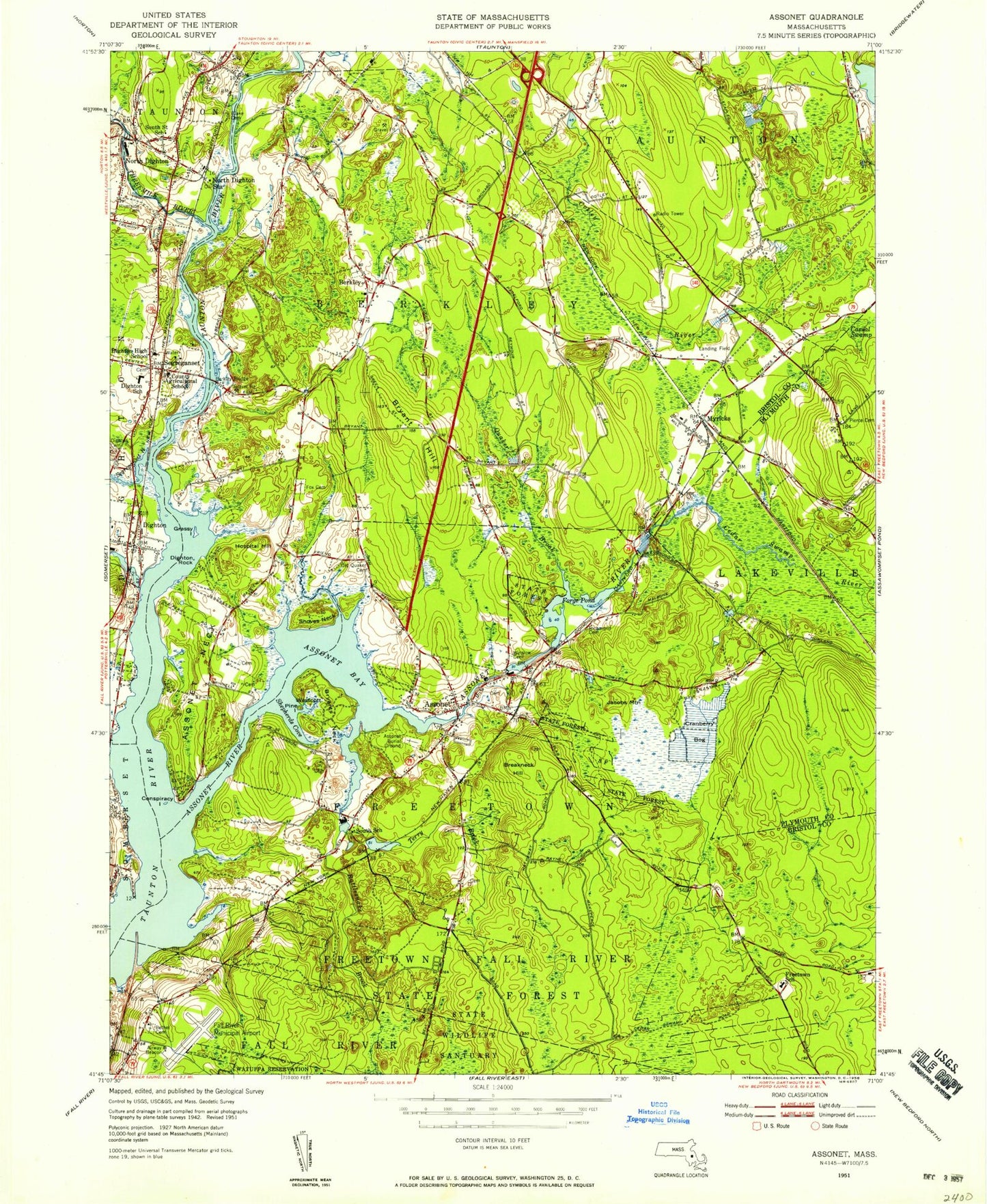
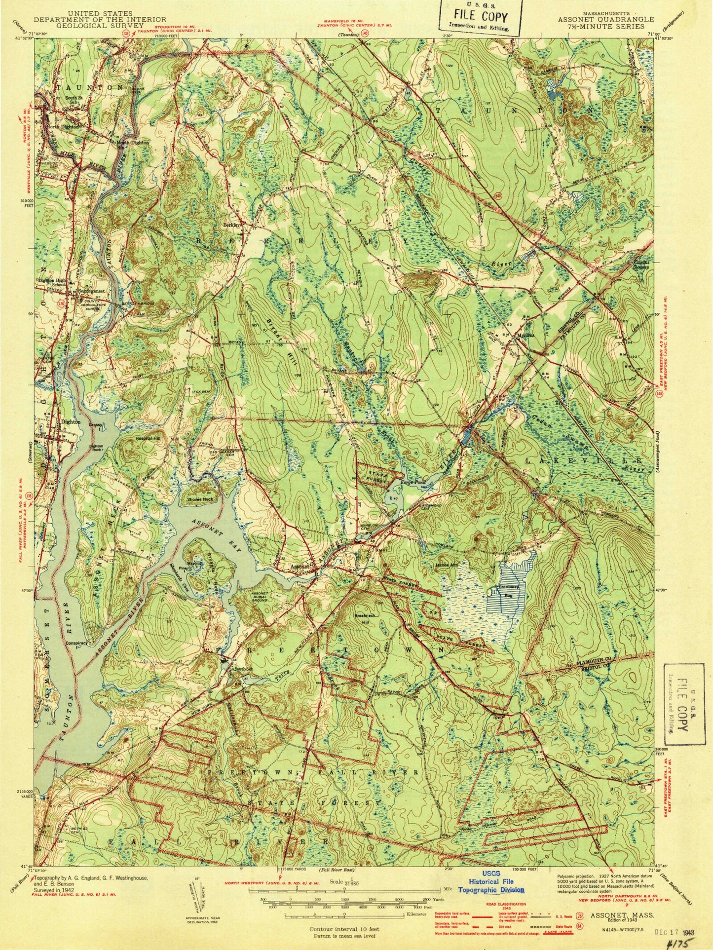
Classic USGS Assonet Massachusetts 7.5'x7.5' Topo Map
Couldn't load pickup availability
Historical USGS topographic quad map of Assonet in the state of Massachusetts. Typical map scale is 1:24,000, but may vary for certain years, if available. Print size: 24" x 27"
This quadrangle is in the following counties: Bristol, Plymouth.
The map contains contour lines, roads, rivers, towns, and lakes. Printed on high-quality waterproof paper with UV fade-resistant inks, and shipped rolled.
Contains the following named places: Segreganset, Village School, Caswell Street Burying Ground Cemetery, Dighton Town Cemetery, Beth El Cemetery, Segreganset Junior High School, Dighton Rock State Park, Camp Welch, Assonet Friends Cemetery, Fox Cemetery, Camp Merriwood, Crystal Springs School, Berkley School, Walker - Blake Graveyard, Freetown Fall River State Forest, Lawton Cemetery, Assonet Burying Ground Cemetery, Saint Bernards Church, Winslow Cemetery, Richmond Cemetery, Freetown Elementary School, Pierce Cemetery, Berkley Bridge, Bristol County Agricultural High School, Riverside Cemetery, Terry Brook Pond Dam, Terry Brook Pond, Forge Pond Dam, Assonet River Reservoir, Boynton Dam, Assonet Station (historical), Crystal Spring Station (historical), Forge Pond, Bristol County, Threemile River, Buffington Corner, Muddy Cove Brook, Assonet, Assonet Bay, Assonet Bay Shores, Assonet Neck, Berkley, Breakneck Hill, Bryant Hill, Bryants Neck, Camp Merriwood, Camp Welch, Conspiracy Island, Dighton, Dighton Rock, Ferry Point, Grassy Island, Hospital Hill, Jacobs Mountain, Myricks, Old Town Landing, Peters Point, Pierces Point, Pine Island, Profile Rock, Quaker Brook, Rattlesnake Brook, Sandy Point, Segreganset River, Shoves Neck, Wescott Island, Whale Rock, Whippoorwill Mountain, Winslow Point, Cedar Swamp River, North Dighton, Assonet River, Holloway Brook, Berkley Bridge, Mother Brook, Cedar Swamp, Shepherds Cove, Myricks Airport, Fall River Municipal Airport (historical), Taunton Municipal Airport - King Field, Princess House Heliport, Town of Berkley, Town of Freetown, Peirce Brook, Emma N F Hutt Forest, Berkley Middle School, Dighton Elementary School, East Taunton Elementary School, Southeast Alternative School-Berkley School, Assonet Post Office, North Dighton Post Office, Dighton Fire Department Station 1 Headquarters, Berkley Fire and Rescue Station 1 Headquarters, Freetown Fire Department Station 3 Headquarters, Berkley Fire Department Station 2, Fall River Fire Department Headquarters, Freetown Police Department, Berkley Police Department, Dighton Police Department, Dighton Post Office, Mashpee Wampanoag Trust Land, Taunton Wild and Scenic River, Segreganset, Village School, Caswell Street Burying Ground Cemetery, Dighton Town Cemetery, Beth El Cemetery, Segreganset Junior High School, Dighton Rock State Park, Camp Welch, Assonet Friends Cemetery, Fox Cemetery, Camp Merriwood, Crystal Springs School, Berkley School, Walker - Blake Graveyard, Freetown Fall River State Forest, Lawton Cemetery, Assonet Burying Ground Cemetery, Saint Bernards Church, Winslow Cemetery, Richmond Cemetery, Freetown Elementary School, Pierce Cemetery, Berkley Bridge, Bristol County Agricultural High School, Riverside Cemetery, Terry Brook Pond Dam, Terry Brook Pond, Forge Pond Dam, Assonet River Reservoir, Boynton Dam, Assonet Station (historical), Crystal Spring Station (historical), Forge Pond, Bristol County, Threemile River, Buffington Corner, Muddy Cove Brook, Assonet, Assonet Bay, Assonet Bay Shores, Assonet Neck, Berkley, Breakneck Hill, Bryant Hill, Bryants Neck, Camp Merriwood, Camp Welch, Conspiracy Island, Dighton, Dighton Rock, Ferry Point, Grassy Island, Hospital Hill, Jacobs Mountain, Myricks, Old Town Landing, Peters Point, Pierces Point, Pine Island, Profile Rock, Quaker Brook, Rattlesnake Brook, Sandy Point, Segreganset River, Shoves Neck, Wescott Island, Whale Rock, Whippoorwill Mountain, Winslow Point, Cedar Swamp River, North Dighton, Assonet River, Holloway Brook, Berkley Bridge, Mother Brook, Cedar Swamp, Shepherds Cove, Myricks Airport, Fall River Municipal Airport (historical), Taunton Municipal Airport - King Field, Princess House Heliport, Town of Berkley, Town of Freetown, Peirce Brook, Emma N F Hutt Forest, Berkley Middle School, Dighton Elementary School, East Taunton Elementary School, Southeast Alternative School-Berkley School, Assonet Post Office, North Dighton Post Office, Dighton Fire Department Station 1 Headquarters, Berkley Fire and Rescue Station 1 Headquarters, Freetown Fire Department Station 3 Headquarters, Berkley Fire Department Station 2, Fall River Fire Department Headquarters, Freetown Police Department, Berkley Police Department, Dighton Police Department, Dighton Post Office, Mashpee Wampanoag Trust Land, Taunton Wild and Scenic River, Segreganset, Village School, Caswell Street Burying Ground Cemetery, Dighton Town Cemetery, Beth El Cemetery, Segreganset Junior High School, Dighton Rock State Park, Camp Welch, Assonet Friends Cemetery, Fox Cemetery, Camp Merriwood, Crystal Springs School, Berkley School, Walker - Blake Graveyard, Freetown Fall River State Forest, Lawton Cemetery, Assonet Burying Ground Cemetery, Saint Bernards Church, Winslow Cemetery, Richmond Cemetery, Freetown Elementary School, Pierce Cemetery, Berkley Bridge, Bristol County Agricultural High School, Riverside Cemetery, Terry Brook Pond Dam, Terry Brook Pond, Forge Pond Dam, Assonet River Reservoir, Boynton Dam, Assonet Station (historical), Crystal Spring Station (historical)