MyTopo
Classic USGS Astor Florida 7.5'x7.5' Topo Map
Couldn't load pickup availability
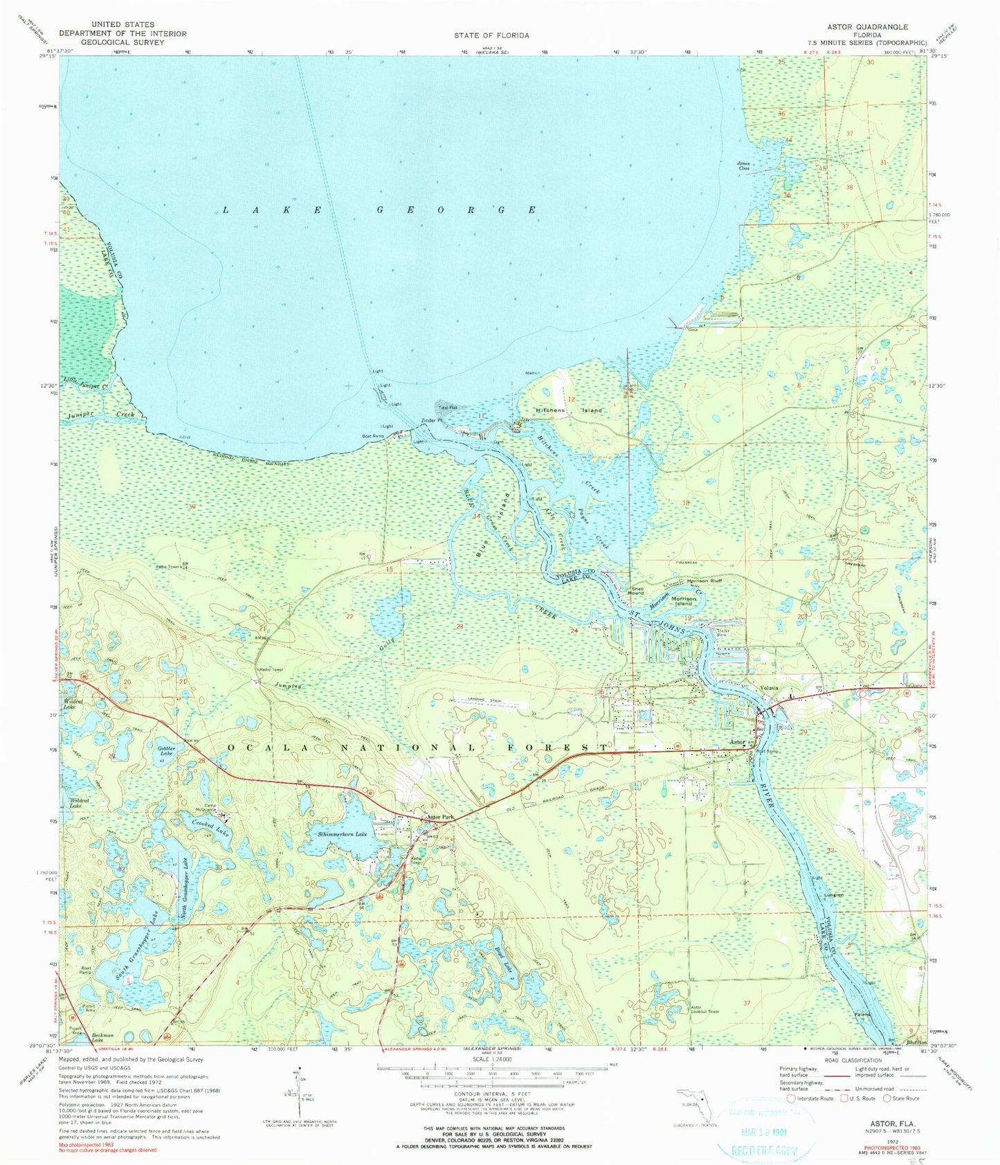
Historical USGS topographic quad map of Astor in the state of Florida. Typical map scale is 1:24,000, but may vary for certain years, if available. Print size: 24" x 27"
This quadrangle is in the following counties: Lake, Volusia.
The map contains contour lines, roads, rivers, towns, and lakes. Printed on high-quality waterproof paper with UV fade-resistant inks, and shipped rolled.
Contains the following named places: Manhatten, Astor, Astor Lookout Tower, Astor Park, Axle Creek, Blue Creek, Blue Island, Bluffton, Boyd Lake, Camp McQuarrie, Crooked Lake, Cross Creek, Falana Island, Gobbler Lake, Hitchens Creek, Hitchens Island, Jones Cove, Jumping Gully, Juniper Creek, Little Juniper Creek, Lungren Island, Morrison Bluff, Morrison Creek, Morrison Island, North Grasshopper Lake, Payne Creek, Schimmerhorn Lake, Shell Mound, South Grasshopper Lake, Volusia, Beakman Lake Recreation Area, R Wightman Grant, Volusia Bar Wharf, Volusia Bar, Astor Volunteer Fire Department (historical), Lake County Fire Rescue Station 10, Lake County Sheriff's Office - Astor Substation, Astor Park Cemetery, Astor Public Library, Astor Recreation Park, Astor Post Office, First Baptist Church, Astor Community Center, Astor Census Designated Place, Parramores Camp Marina, South Moon Fish Camp Marina, A and B Mobile Home Park, Blairs Jungle Den Mobile Home Park, First Baptist Church of Astor, Volusia Bar Fish Camp Marina, Lake County Sheriff's Office Astor Substation