MyTopo
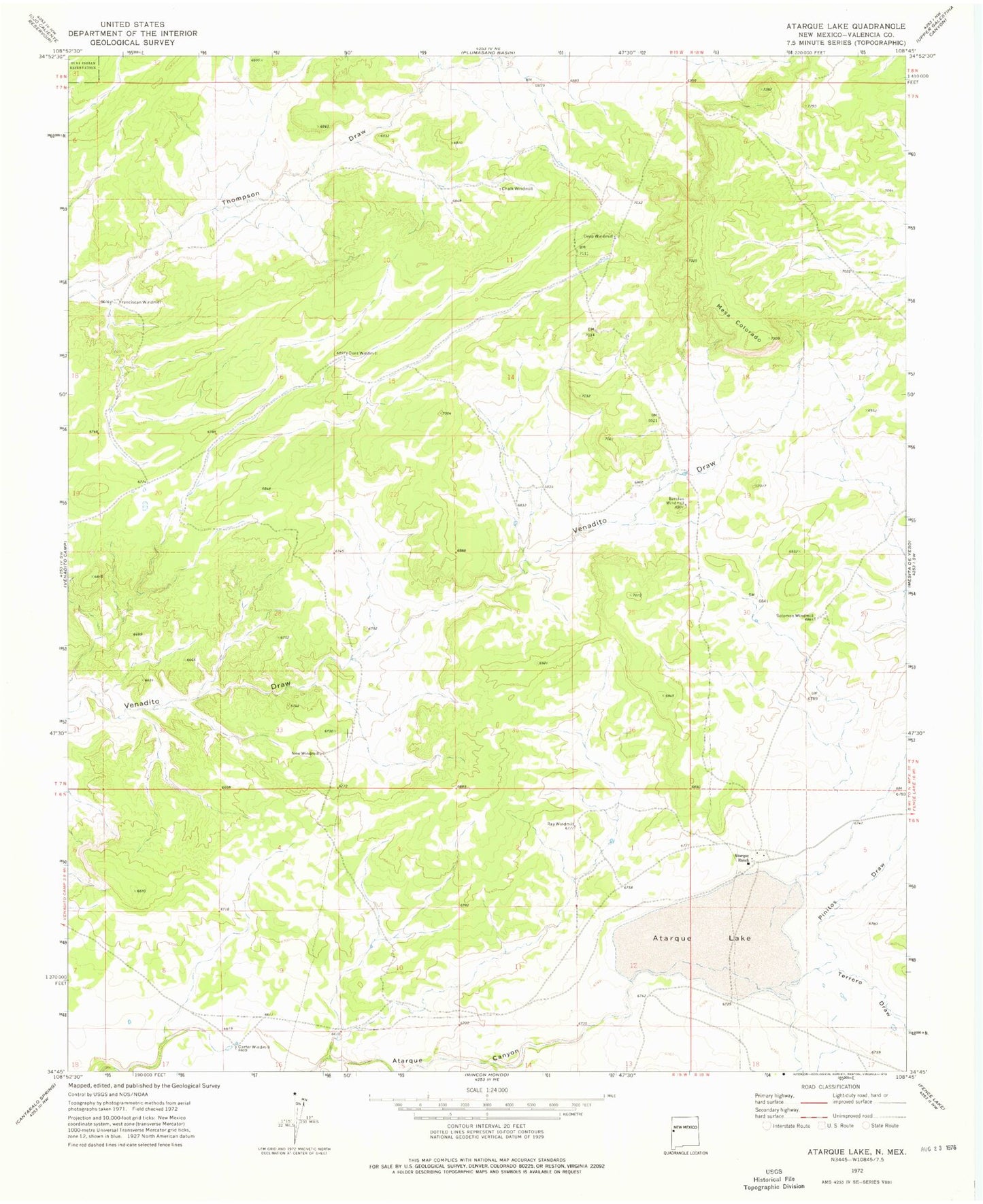
Classic USGS Atarque Lake New Mexico 7.5'x7.5' Topo Map
Couldn't load pickup availability
Historical USGS topographic quad map of Atarque Lake in the state of New Mexico. Map scale may vary for some years, but is generally around 1:24,000. Print size is approximately 24" x 27"
This quadrangle is in the following counties: Cibola.
The map contains contour lines, roads, rivers, towns, and lakes. Printed on high-quality waterproof paper with UV fade-resistant inks, and shipped rolled.
Contains the following named places: Atarque Lake, Atarque Ranch, Barelas Water Well, Barelas Windmill, Beggs Cattle Company, Carter Windmill, Chalk Windmill, Chalk Windmill Water Well, Deep Windmill, Deep Windmill Water Well, Dent Windmill, Dent Windmill Water Well, Franciscan Water Well, Franciscan Windmill, Mesa Colorado, New Windmill, New Windmill Water Well, Pinitos Draw, Ray Windmill, Solomon Water Well, Solomon Windmill, Terrero Draw