MyTopo
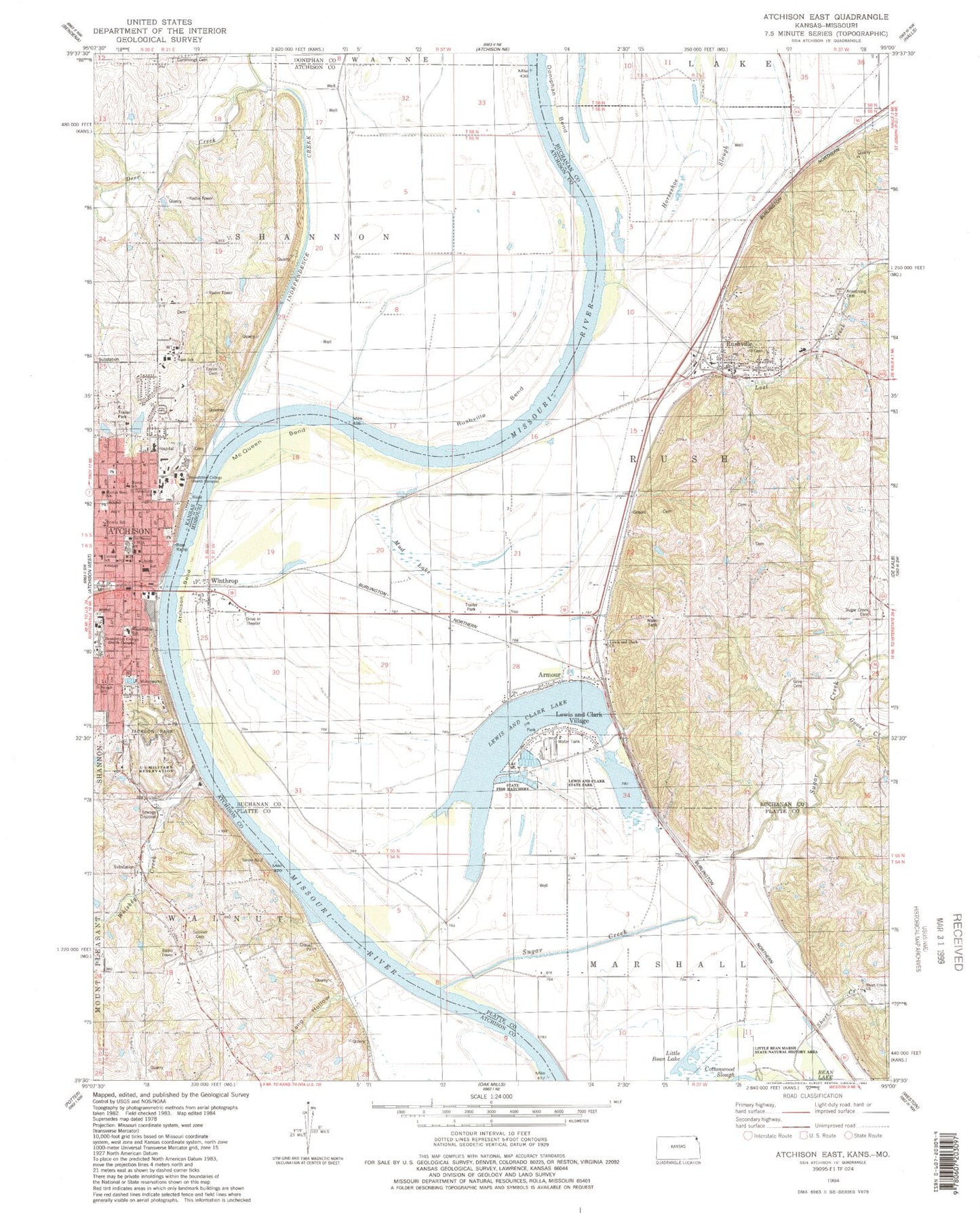
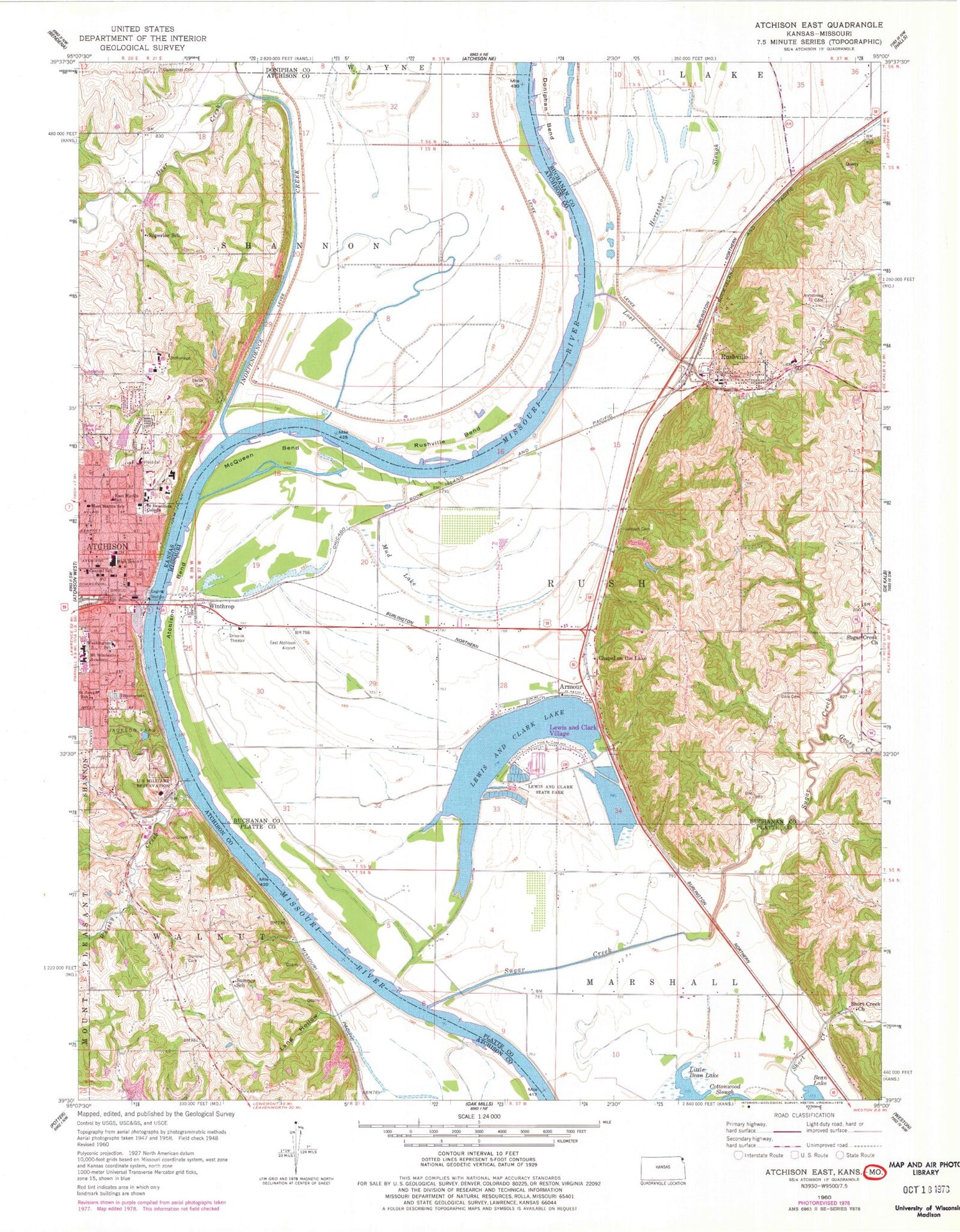
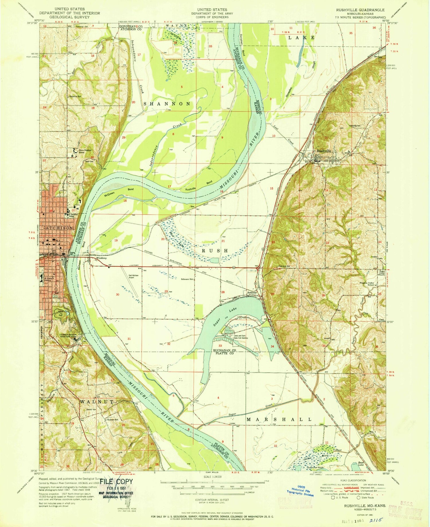
Classic USGS Atchison East Kansas 7.5'x7.5' Topo Map
Couldn't load pickup availability
Historical USGS topographic quad map of Atchison East in the states of Kansas, Missouri. Map scale may vary for some years, but is generally around 1:24,000. Print size is approximately 24" x 27"
This quadrangle is in the following counties: Atchison, Buchanan, Doniphan, Platte.
The map contains contour lines, roads, rivers, towns, and lakes. Printed on high-quality waterproof paper with UV fade-resistant inks, and shipped rolled.
Contains the following named places: Amelia Earhart Birthplace Museum, Armour, Armstrong Cemetery, Atchinson Bend, Atchison, Atchison Alternative School, Atchison City Hall, Atchison County Courthouse, Atchison County Fire District 3, Atchison County Jail, Atchison County Sheriff's Office, Atchison Fire Department, Atchison Heritage Conference Center, Atchison Juvenile Correctional Facility, Atchison Mall, Atchison Middle School, Atchison Police Department, Atchison Post Office, Atchison Public Library, Atchison Public Schools District Offices, Atchison United Methodist Church, Atchison Water Treatment Facility, Benedictine College, Bert Nash Intermediate School Atchison Juvenile Correctional Facility, Block School, Campbell Chapel African Methodist Episcopal Church, Carol Baptist Church, Church of the Living God, Church of the Nazarene, Community of Christ, Cummings Cemetery, Dead Mans Hole, Dead Mans Hole Dam, Deer Creek, Doniphan Bend, East Atchison Airport, East Atchison School, Ebenezer Baptist Church, Enterprise School, Evah C Cray Historical Home Museum, Fairview School, First Christian Church, First Presbyterian Church, Goose Creek, Gore Cemetery, Horseshoe Slough, Hudspeth Cemetery, Independence Creek, Jackson Park, Lang Hollow, Lewis and Clark Church, Lewis and Clark Lake, Lewis and Clark State Park, Lewis and Clark Village, Little Bean Lake, Little Bean Marsh State Natural History Area, Lost Creek, Martin School, Martin West School, McQueen Bend, Mount Saint Scholastica High School, Muchnic Art Gallery, Mud Lake, New Life Assembly of God Church, Northeast Kansas Multi - County Health Department Atchison County, Orphans Home Cemetery, Pleasant Valley School, Rushville, Rushville Bend, Rushville Elementary School, Rushville Post Office, Rushville Volunteer Fire Department, Saint Benedict Catholic School, Saint Benedict's Abbey, Saint Benedicts Abbey Cemetery, Saint Joseph School, Saint Joseph's Catholic Church, Saint Mark's Lutheran Church, Second Christian Church, Shearer School, Shiloh Baptist Church, Short Creek, Short Creek Church, Southwest Buchanan Fire Protection District, Sugar Creek, Sugar Creek Cemetery, Sugar Creek Church, Sugar Lake, Summer School, Sumner, Sumner Cemetery, Superior School, Taylor Cemetery, Town of Lewis and Clark Village, Town of Rushville, Township of Rush, Trinity Episcopal Church, Trinity Lutheran Church, Trinity Lutheran School, Washington School, Whiskey Creek, White Clay Creek, Winthrop, ZIP Code: 64484