MyTopo
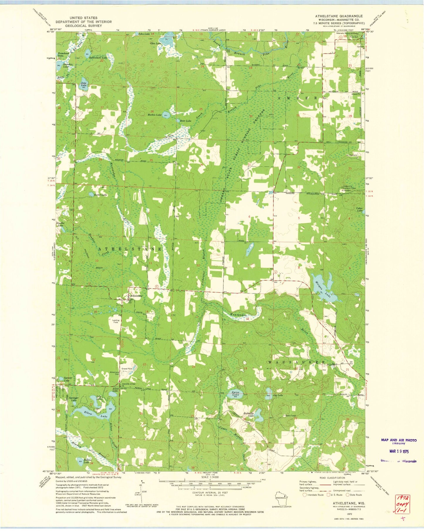
Classic USGS Athelstane Wisconsin 7.5'x7.5' Topo Map
Couldn't load pickup availability
Historical USGS topographic quad map of Athelstane in the state of Wisconsin. Map scale may vary for some years, but is generally around 1:24,000. Print size is approximately 24" x 27"
This quadrangle is in the following counties: Marinette.
The map contains contour lines, roads, rivers, towns, and lakes. Printed on high-quality waterproof paper with UV fade-resistant inks, and shipped rolled.
Contains the following named places: Amberg State Public Hunting Grounds, Assembly of God Church, Athelstane, Athelstane Cemetery, Athelstane Post Office, Athelstane Volunteer Fire Department, Bear Lake, Brown School, Butterfly Lake, Cedarville Lookout Tower, Coldwater Brook, Cowie School, Elbow Creek, Elbow Lake, Glen Lake, Glendale School, Heubler Creek, Heubler Lake, John Lake, Jug Lake, June Lake, Kellinbach Lake, Lauenmans Lake, Lily Lake, Little South Branch Pike River, Mathis Church, Mathis Lake, Meadow Brook, Morgan Lake, Rector Lake, Rector School, Rollins Lake, Rosey Creek, Silver Lake, Spencer Lake, Spies Lake, Springer Lake, Stovekin Lake