MyTopo
Classic USGS Athens Arkansas 7.5'x7.5' Topo Map
Couldn't load pickup availability
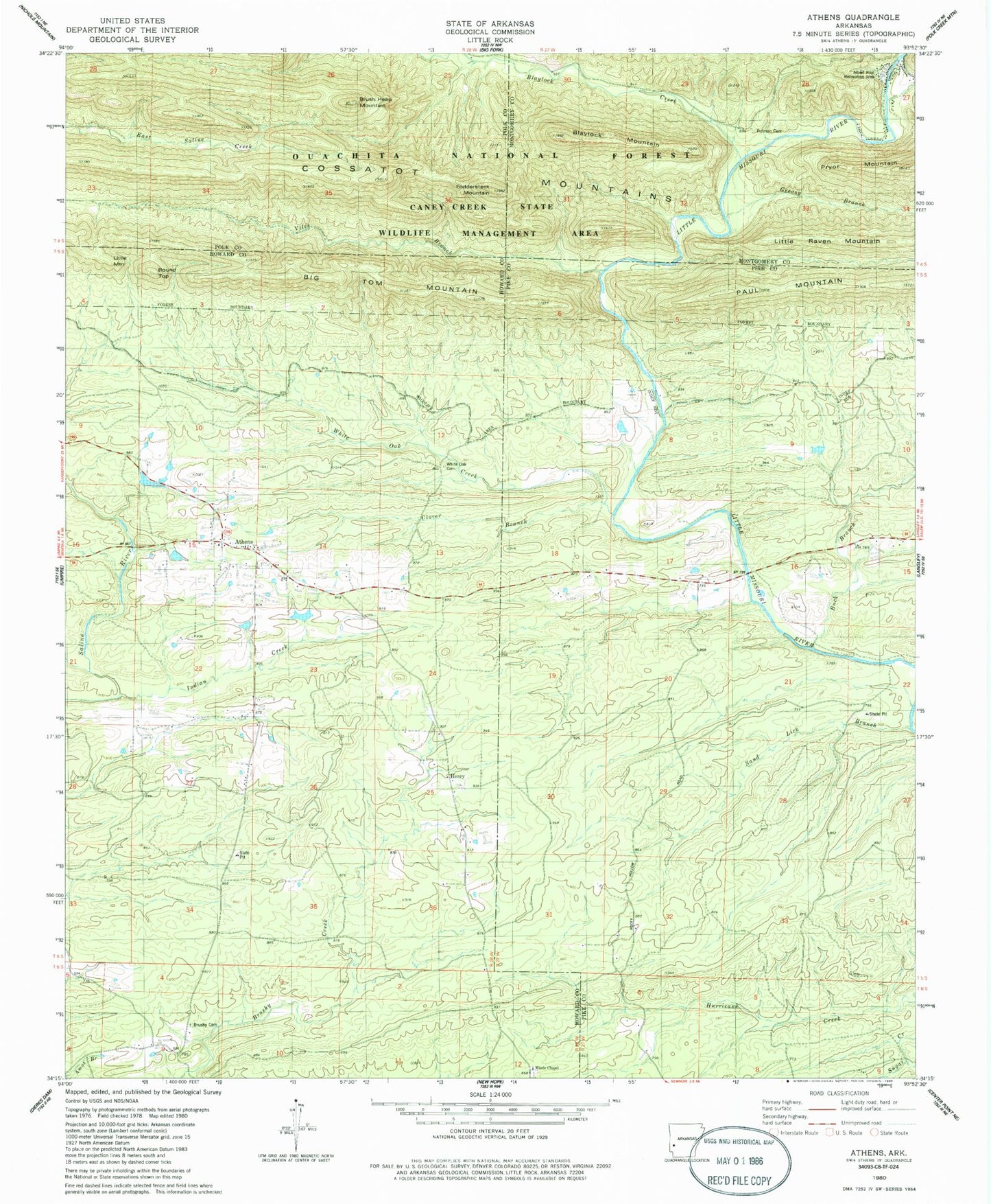
Historical USGS topographic quad map of Athens in the state of Arkansas. Typical map scale is 1:24,000, but may vary for certain years, if available. Print size: 24" x 27"
This quadrangle is in the following counties: Howard, Montgomery, Pike, Polk.
The map contains contour lines, roads, rivers, towns, and lakes. Printed on high-quality waterproof paper with UV fade-resistant inks, and shipped rolled.
Contains the following named places: Athens Cemetery, Brushy (historical), Brushy Cemetery, Henry, New Thompson (historical), Old Thompson (historical), Pates (historical), White Oak Cemetery, Albert Pike Recreation Area, Albert School (historical), Putman Cemetery, Township of Mountain, Big Tom Mountain, Blaylock Creek, Blaylock Mountain, Brushy School, Buck Branch, Clover Branch, Fodderstack Mountain, Henry School, Indian Creek, Little Mountain, Miller School, Misels Chapel, Pleasant Hill School, Round Top, Sand Lick Branch, Viles Branch, White Oak Creek, Henry, White Oak Cemetery, Roaring Branch Natural Area, Brushy Cemetery, Putman Cemetery, Albert Pike Recreation Area, Athens, Brush Heap Mountain, Athens Fire Department