
MyTopo
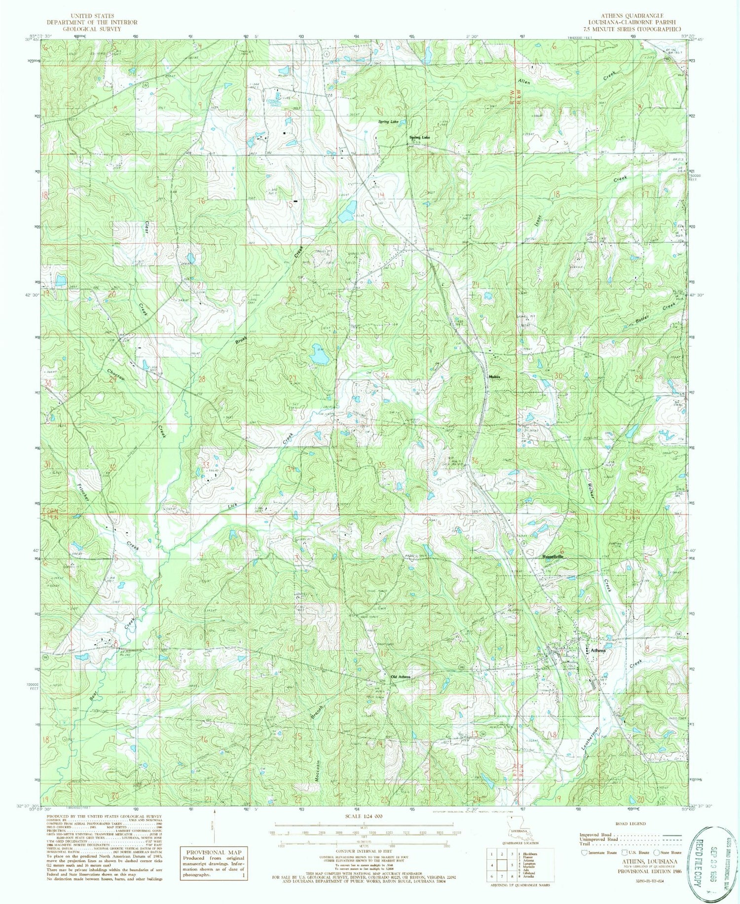
Classic USGS Athens Louisiana 7.5'x7.5' Topo Map
Couldn't load pickup availability
Historical USGS topographic quad map of Athens in the state of Louisiana. Map scale may vary for some years, but is generally around 1:24,000. Print size is approximately 24" x 27"
This quadrangle is in the following counties: Claiborne.
The map contains contour lines, roads, rivers, towns, and lakes. Printed on high-quality waterproof paper with UV fade-resistant inks, and shipped rolled.
Contains the following named places: Athens, Athens Elementary School, Athens Gas Field, Athens High School, Athens Lookout Tower, Athens Post Office, Atkins Cemetery, Brush Creek, Choctaw Creek, Claiborne Parish Fire Protection District 5, Clear Creek, Cooksey Cemetery, Frincher Creek, Kimbel School, Kimbell Cemetery, Leatherman Creek Oil and Gas Field, Lick Creek, Lower Old Athens Cemetery, Mount Olive Christian School, Mount Paron Cemetery, Mount Paron Primitive Baptist Church, Mount Piller Church, Mount Supeal School, Mount Superior Church, Mulnix, Old Athens, Old Athens Cemetery, Parish Governing Authority District 10, Parish Governing Authority District 5, Pleasant Valley School, Russellville, Saint Johns Church, Salem Cemetery, Sanctified Church, Sandy Creek, Spring Lake, Village of Athens, Walker Creek, Ward Five, ZIP Code: 71003


