MyTopo
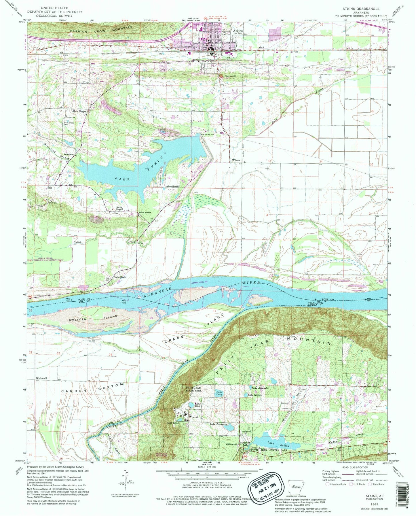
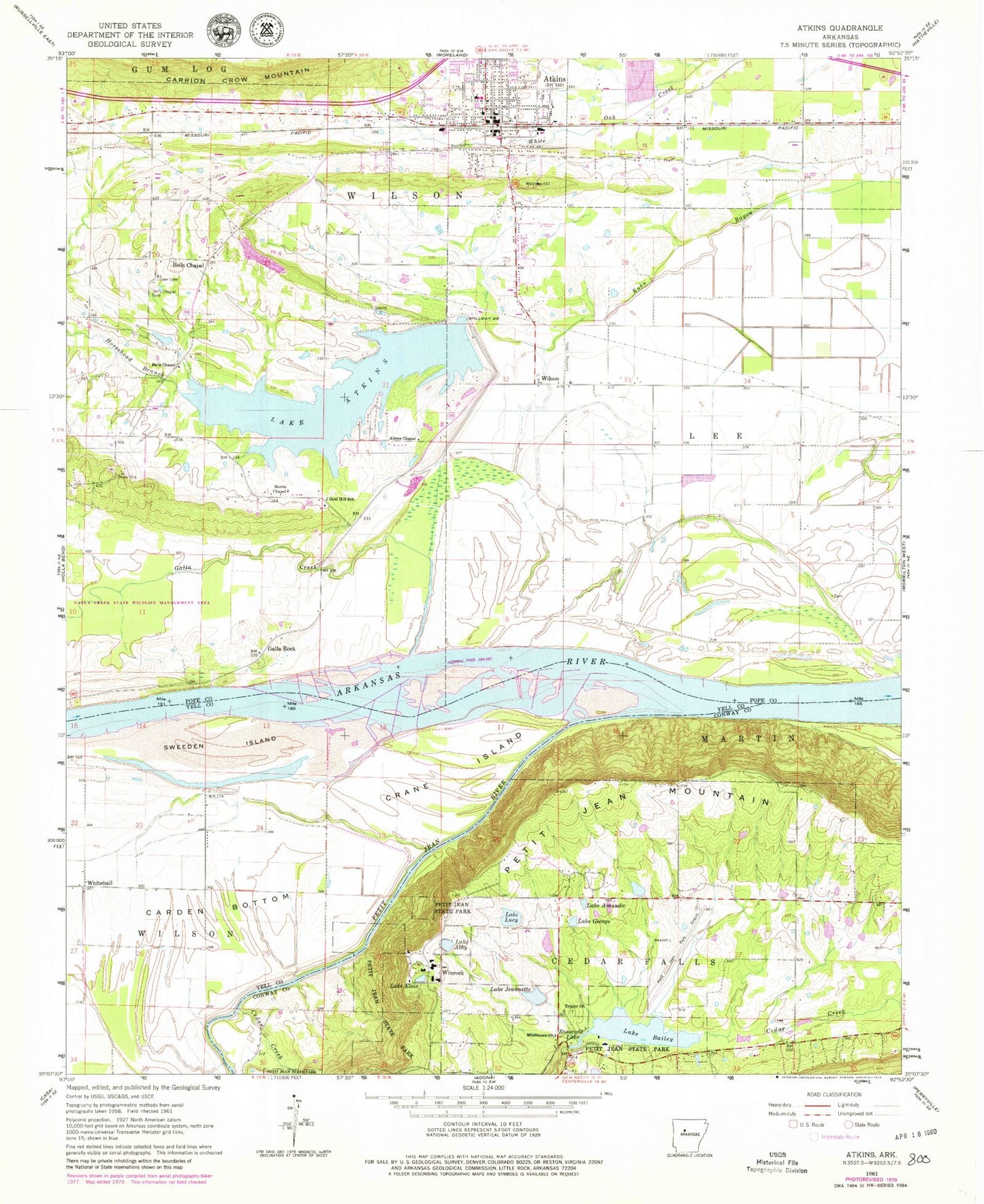
Classic USGS Atkins Arkansas 7.5'x7.5' Topo Map
Couldn't load pickup availability
Historical USGS topographic quad map of Atkins in the state of Arkansas. Map scale may vary for some years, but is generally around 1:24,000. Print size is approximately 24" x 27"
This quadrangle is in the following counties: Conway, Pope, Yell.
The map contains contour lines, roads, rivers, towns, and lakes. Printed on high-quality waterproof paper with UV fade-resistant inks, and shipped rolled.
Contains the following named places: Allens Chapel, Atkins, Atkins Catholic Cemetery, Atkins Cemetery, Atkins Elementary School, Atkins High School, Atkins Middle School, Atkins Police Department, Atkins Post Office, Atkins Volunteer Fire Department, Austin School, Bells Chapel, Bells Chapel Cemetery, Bells Chapel United Methodist Church, Byerly Cemetery, Carden Bottom, Cedar Creek, Cedar Creek Bridge, City of Atkins, Crane Island, Darr Cemetery, Froneberger School, Galla Creek, Galla Rock, Galla Rock Ferry, Galla Shoal, Gally Rock Cemetery, Gold Hill, Gold Hill School, Horsehead Branch, Lake Abby, Lake Abby Dam, Lake Amanda, Lake Atkins, Lake Atkins Dam, Lake Bailey, Lake Bailey Dam, Lake Elsie, Lake George, Lake Jeannette, Lake Jeannette Dam, Lake Lucy, Lake Lucy Dam, Libby Ferry, Missionary Church, Norris Chapel, Petit Jean Fire Department District 5, Petit Jean Mountain, Petit Jean Park Airport, Petit Jean River, Petit Jean Water Supply Dam, Pope County Emergency Medical Service Station 2, Roosevelt Lake, Sweeden Island, Township of Cedar Falls, Township of Lee, Township of Wilson, Trinity Lutheran Church, Union Church, Weathers School, White Hall School, Whitehall, Wilson, Wilson School, Winrock