
MyTopo
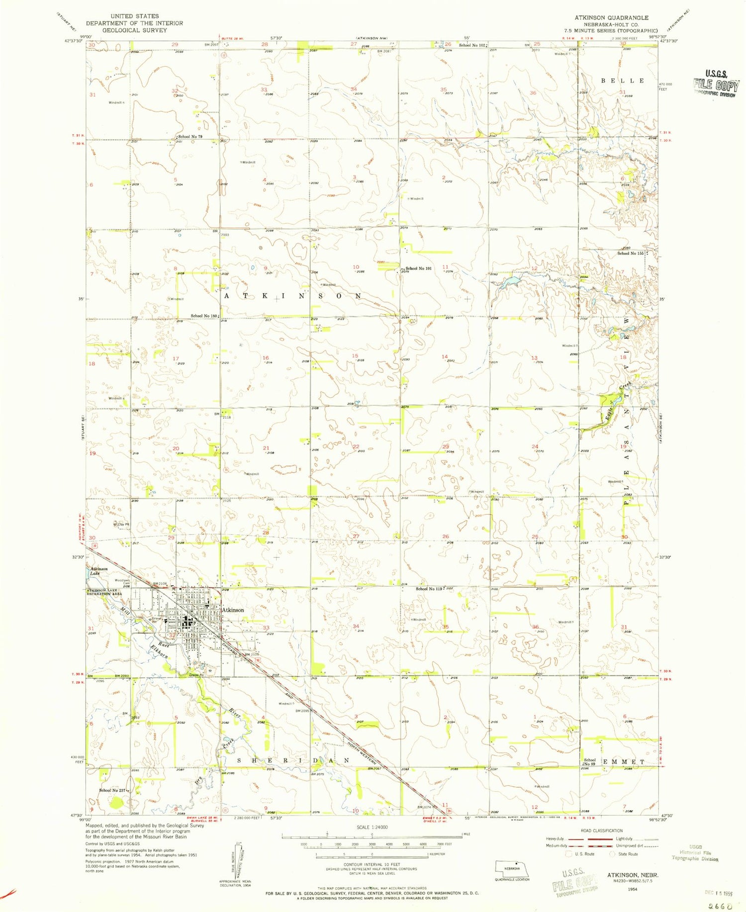
Classic USGS Atkinson Nebraska 7.5'x7.5' Topo Map
Couldn't load pickup availability
Historical USGS topographic quad map of Atkinson in the state of Nebraska. Map scale may vary for some years, but is generally around 1:24,000. Print size is approximately 24" x 27"
This quadrangle is in the following counties: Holt.
The map contains contour lines, roads, rivers, towns, and lakes. Printed on high-quality waterproof paper with UV fade-resistant inks, and shipped rolled.
Contains the following named places: Atkinson, Atkinson Elementary School, Atkinson Fire and Rescue, Atkinson Good Samaritan Center, Atkinson Junior High School, Atkinson Lake Recreation Area, Atkinson Police Department, Atkinson Post Office, Atkinson Township Library, C O Grain Incorporated Elevator, City of Atkinson, Dry Creek, Eagle Creek Dam, Eagle Creek Reservoir, Faith Wesleyan Church, Grassland Grain and Irrigation Elevator, Immanuel Lutheran Church, Mill Race, Presbyterian Church, Reorganized Church of Latter Day Saints, Ridgeway Public School, Saint Johns Lutheran Church, Saint Joseph Elementary School, Saint Josephs Catholic Church, School Number 101, School Number 102, School Number 119, School Number 155, School Number 237, School Number 79, School Number 89, Sturdevant-McKee Museum, Township of Atkinson, Tri County Medical Clinic, United Methodist Church, Vogel Grain Elevator, West Holt Assembly of God Church, West Holt Medical Clinic, West Holt Memorial Hospital, West Holt Rural High School, Wheel Inn Motel/Campground, Woodlawn Cemetery, ZIP Code: 68713


