MyTopo
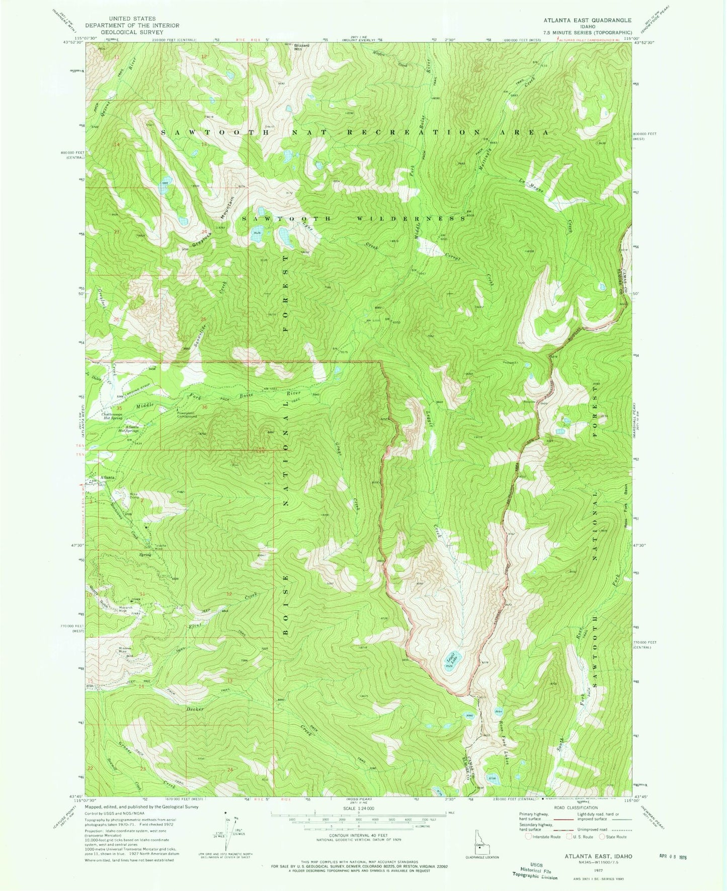
Classic USGS Atlanta East Idaho 7.5'x7.5' Topo Map
Couldn't load pickup availability
Historical USGS topographic quad map of Atlanta East in the state of Idaho. Typical map scale is 1:24,000, but may vary for certain years, if available. Print size: 24" x 27"
This quadrangle is in the following counties: Camas, Elmore.
The map contains contour lines, roads, rivers, towns, and lakes. Printed on high-quality waterproof paper with UV fade-resistant inks, and shipped rolled.
Contains the following named places: Atlanta Hot Springs, Chattanooga Hot Spring, Corral Creek, Flint Creek, Grays Creek, Greylock Creek, Greylock Mountain, Grouse Creek, Joe Daley Creek, La Moyne Creek, Leggit Creek, Leggit Lake, Lynx Creek, Mattingly Creek, Minerva Mine, Misfire Creek, Monarch Mine, Powerplant Campground, Ross Fork Lakes, Snowslide Creek, Tolache Mine, Atlanta Recreation Site, Sawmill Creek, Greene Tree Dam, Blizzard Mountain, Atlanta School, Atlanta Pioneer Cemetery