MyTopo
Classic USGS Atlanta Michigan 7.5'x7.5' Topo Map
Couldn't load pickup availability
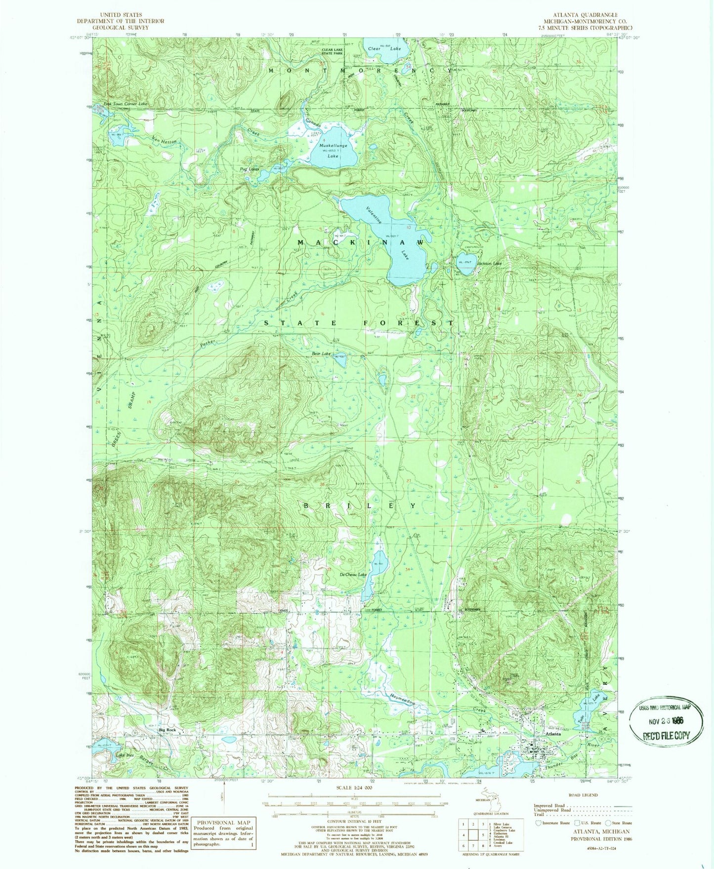
Historical USGS topographic quad map of Atlanta in the state of Michigan. Map scale is 1:24000. Print size is approximately 24" x 27"
This quadrangle is in the following counties: Montmorency.
The map contains contour lines, roads, rivers, towns, and lakes. Printed on high-quality waterproof paper with UV fade-resistant inks, and shipped rolled.
Contains the following named places: Atlanta, Atlanta Bible Church, Atlanta Census Designated Place, Atlanta Congregational Church, Atlanta Full Gospel Assembly, Atlanta Post Office, Atlanta Public Library, Atlanta Station (historical), Bear Lake, Big Rock, Big Rock Congregational Church, Big Rock Historical Marker, Big Rock Post Office (historical), Briley Cemetery, Church of Christ, Clear Lake, De Cheau Lake, East Town Corner Lake, Elk Ridge Golf Course, Haymeadow Creek, Jackson Lake, Jackson Lake State Forest Campground, Kingdom Hall of Jehovah's Witnesses, Lake Inez, Michigan Department of Natural Resources Atlanta Forest Area, Montmorency County, Montmorency County Courthouse, Montmorency County Fairgrounds, Montmorency County Sheriff's Office, Muskellunge Lake, Northern Michigan Restoration Branch Church, Packer Creek, Pug Lakes, Saint Marks Episcopal Church, Township of Briley, Tri - Township Emergency Medical Services, Tri - Township Fire Department, Twin Lake, Valentine Lake, Valentine Lake Station (historical), Valentine Post Office (historical), Van Hetton Creek