
MyTopo
Classic USGS Atlantic City Wyoming 7.5'x7.5' Topo Map
Couldn't load pickup availability
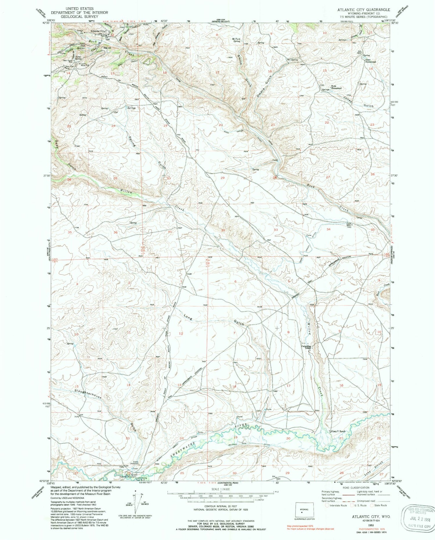
Historical USGS topographic quad map of Atlantic City in the state of Wyoming. Map scale may vary for some years, but is generally around 1:24,000. Print size is approximately 24" x 27"
This quadrangle is in the following counties: Fremont.
The map contains contour lines, roads, rivers, towns, and lakes. Printed on high-quality waterproof paper with UV fade-resistant inks, and shipped rolled.
Contains the following named places: Anthony Gulch, Atlantic City, Basket Gulch, Beaver Dam Ditch, Beer Garden Gulch, Big Atlantic Gulch, Burnt Ranch Ditch, Burnt Ranch Historical Monument, Carpenter Ranch, Custom Mill, Deep Gulch, Eight Lazy Y Ranch, Fremont County Fire Protection District Battalion 9 Atlantic City, Hyde Homestead, Last Crossing Ford Number 9, Little Atlantic Gulch, Little Beaver Creek, Long Gulch, Mary Ellen Mine, McTurk Spring, Mechanic and Emerald Lode, Obert Homestead, Omara Gulch, Oregon Slough, Rock Creek Ditch, Saint Louis Mines, Slaughterhouse Gulch, Smith Gulch, Spring Gulch, Tabor Grand Mine, Tabor Gulch, Tabor Spring, Willow Creek


