MyTopo
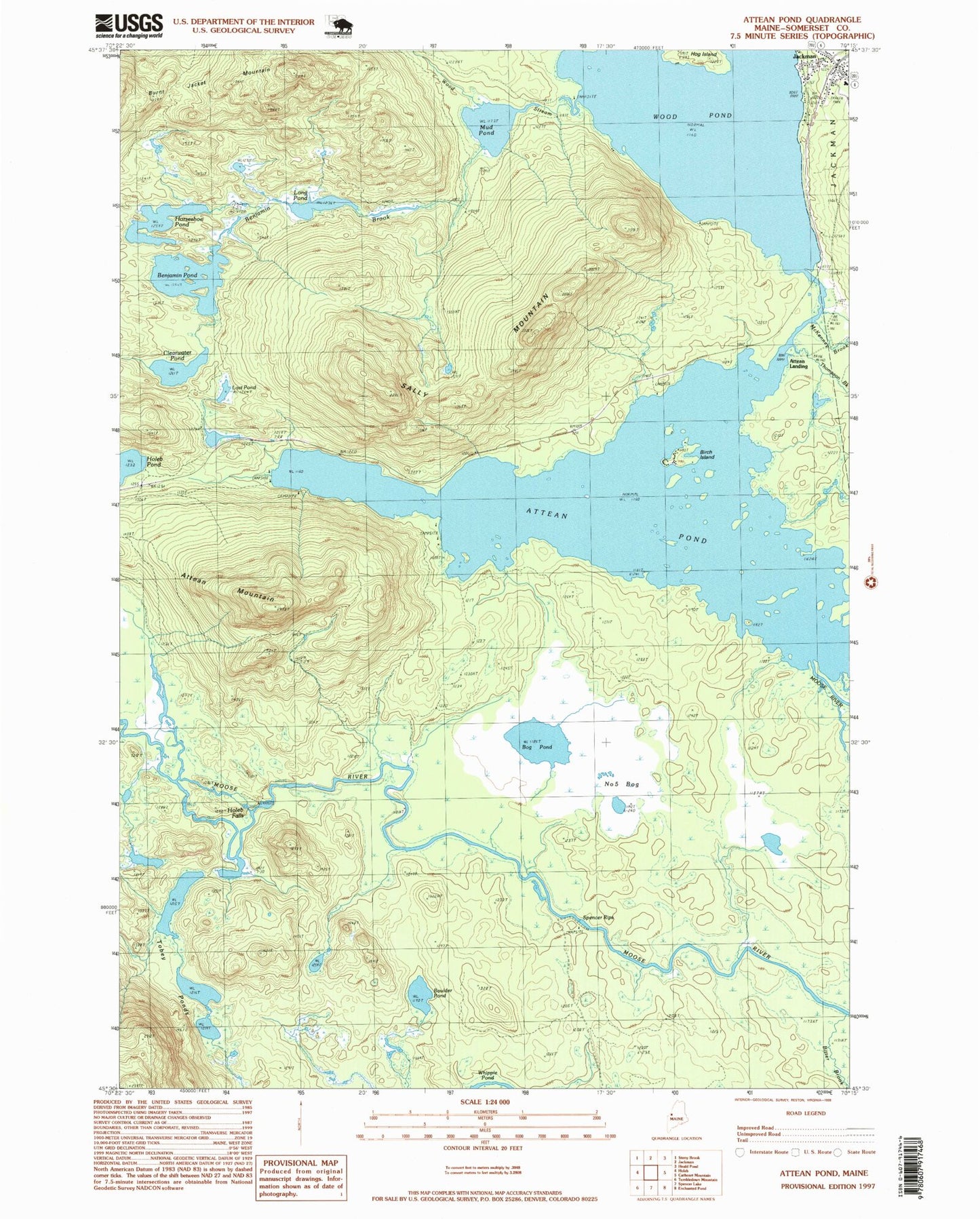
USGS Classic Attean Pond Maine 7.5'x7.5' Topo Map
Couldn't load pickup availability
Historical USGS topographic quad map of Attean Pond in the state of Maine. Scale: 1:24000. Print size: 24" x 27"
This quadrangle is in the following counties: Somerset.
The map contains contour lines, roads, rivers, towns, lakes, and grids including latitude / longitude and UTM / MGRS. Printed on high-quality waterproof paper with UV fade-resistant inks.
Contains the following named places: Attean Mountain, Attean Pond, Benjamin Brook, Benjamin Pond, Birch Island, Bitter Brook, Bog Pond, Boulder Pond, Clearwater Pond, Holeb Falls, Horseshoe Pond, Jackman, Long Pond, Lost Pond, McKenney Brook, Mud Pond, Number Five Bog, Number Five Farm (historical), Sally Mountain, Spencer Rips, Thompson Brook, Tobey Ponds, Williams Brook, Wood Pond, Wood Stream, Attean (historical), Attean Landing, Attean Township, T5 R7 BKP WKR