MyTopo
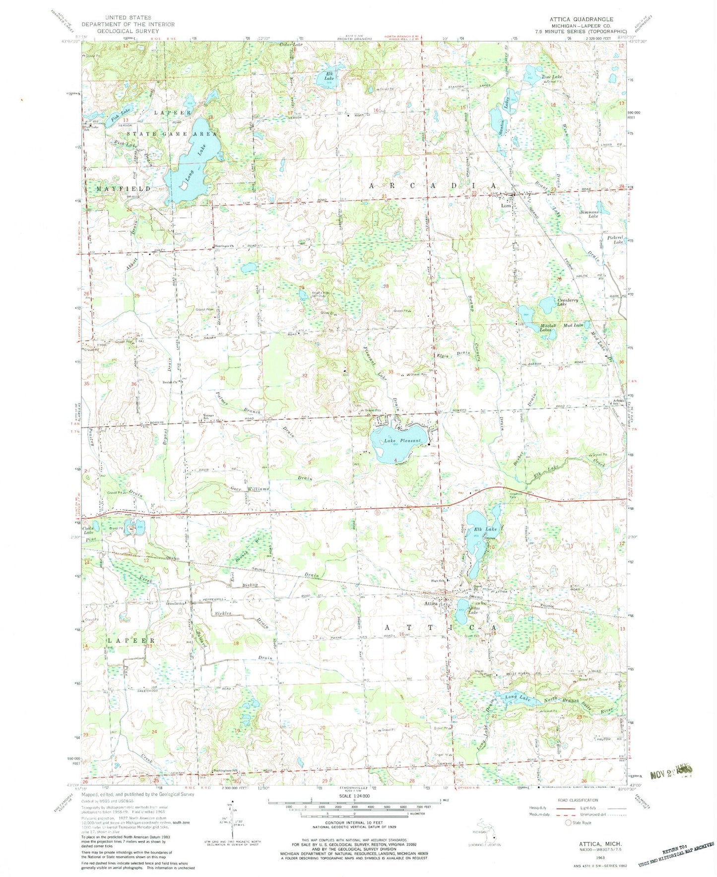
Classic USGS Attica Michigan 7.5'x7.5' Topo Map
Couldn't load pickup availability
Historical USGS topographic quad map of Attica in the state of Michigan. Map scale may vary for some years, but is generally around 1:24,000. Print size is approximately 24" x 27"
This quadrangle is in the following counties: Lapeer.
The map contains contour lines, roads, rivers, towns, and lakes. Printed on high-quality waterproof paper with UV fade-resistant inks, and shipped rolled.
Contains the following named places: Abbott Drain, Almont Station, Almont United Methodist Church, Arcadia Hills Golf Club, Arcadia Township Fire Department, Arkdale Post Office, Arkdale School, Attica, Attica Census Designated Place, Attica Post Office, Attica Township Cemetery, Attica Township Fire and Rescue Department, Attica Township Library, Bahel Cemetery, Ballard Drain, Barber Drain, Bearinger Church, Beulah Church, Bishop Drain, Brant Lake Drain, Bryant Drain, Buckingham School, Castle Creek Golf Club, Cooks Lake, Cranberry Lake, Earl Branch Drain, Elgin Drain, Elk Lake, Evangelical Wesleyan Church, First Baptist Church of Attica, Fish Lake, Fish Lake Drain, Fish Lake School, Five Lakes Rest Area, Geer Williams Drain, Grass Lake, Griswold School, Lake Pleasant, Lapeer County, Lapeer Educational and Technology Center, Long Lake, Long Lake Drain, Lum, Lum Cemetery, Lum Post Office, Lum Station, Mitchell Lakes, Mud Lake, Mud Lake Drain, New Life Christian Church, Palmer Branch Drain, Pleasant Lake Drain, Roscoe Cemetery, Rose Lake, Sandhill Mobile Home Estates, Sickles Drain, Simmons Lake, Stanton Lakes, Swamp Corners Drain, Township of Arcadia, Township of Attica, Winn Drain, WWGZ-FM (Lapeer), Youngs School, ZIP Code: 48412