MyTopo
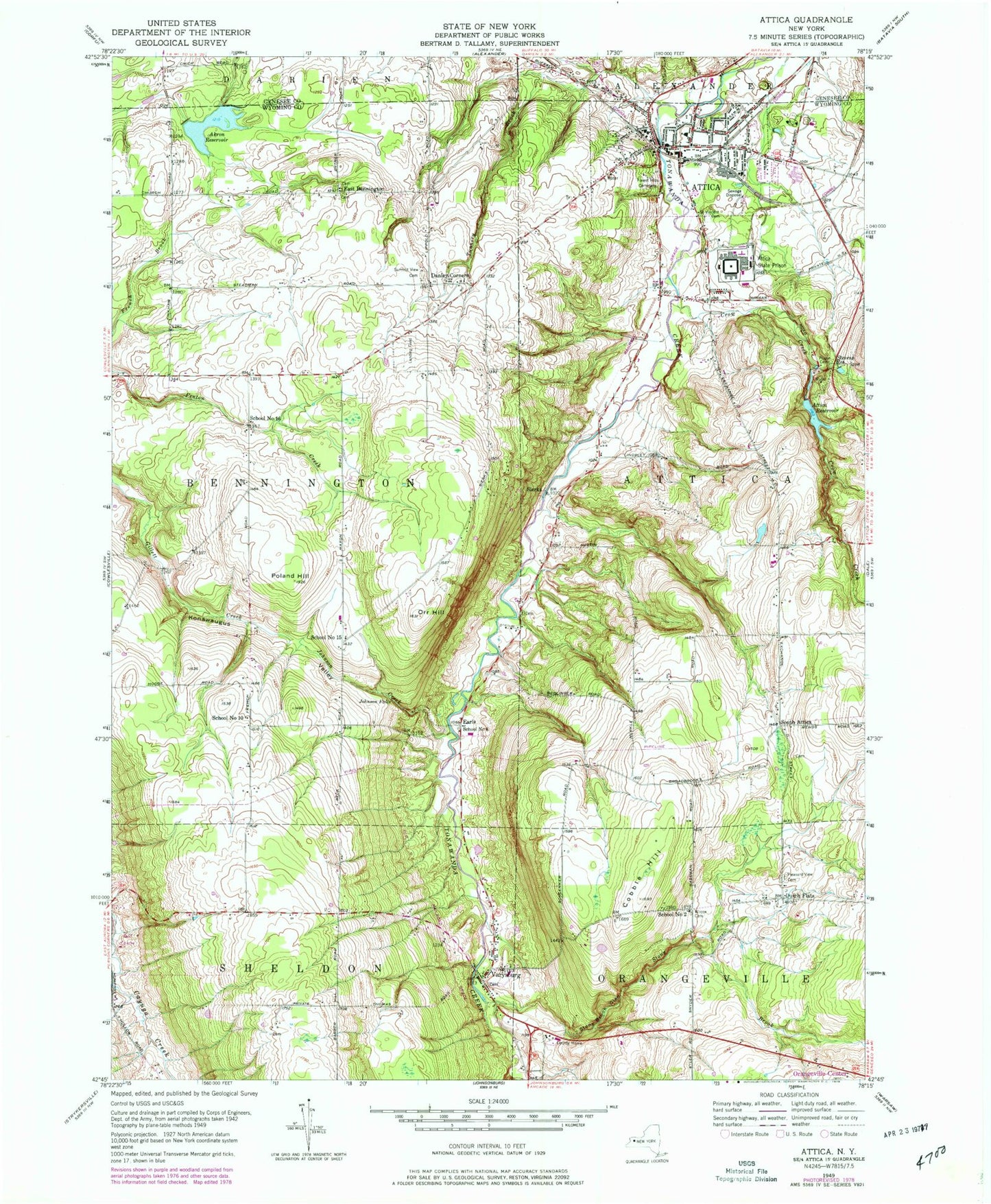
Classic USGS Attica New York 7.5'x7.5' Topo Map
Couldn't load pickup availability
Historical USGS topographic quad map of Attica in the state of New York. Map scale may vary for some years, but is generally around 1:24,000. Print size is approximately 24" x 27"
This quadrangle is in the following counties: Genesee, Wyoming.
The map contains contour lines, roads, rivers, towns, and lakes. Printed on high-quality waterproof paper with UV fade-resistant inks, and shipped rolled.
Contains the following named places: Akron Reservoir, Attica, Attica Correctional Facility, Attica Fire Department Station 1, Attica Fire Department Station 2, Attica High School, Attica Post Office, Attica Reservoir, Attica Senior High School, Attica Village Office, Cobble Hill, Community Baptist Church, Crow Creek, Danley Corners, Dutch Flats, Earls School Number 8, East Bennington, East Bennington German Cemetery, First Baptist Church, First Methodist Church, First Presbyterian Church, Forest Hill Cemetery, Friendly Acres Farm, Full Gospel Christian Tabernacle, Johnson Creek, Johnson Falls, Konawaugus Valley, Maxon Cemetery, New Life Fellowship, Orangeville Center Cemetery, Orr Hill, Pleasant View Cemetery, Poland Hill, Prison Cemetery, Quiet Times Golf Course, Saint Josephs Cemetery, Saint Joseph's Roman Catholic Church, Saint Joseph's School, Saint Luke's Episcopal Church, Saint Paul's Evangelical Church, Saint Vincent Cemetery, Saint Vincent's Roman Catholic Church, School Number 10, School Number 15, School Number 16, School Number 2, School Number 8, Sheldon Elementary School, Sierks, South Attica, South Attica Cemetery, Stevens Memorial Library, Stevens Reservoir, Stony Brook, Stony Brook Glen, Summit View Cemetery, The Byrncliff Golf Course, Trump Mountain Airport, Tunnery Brook, Varysburg, Varysburg Cemetery, Varysburg Post Office, Varysburg Volunteer Fire Department, Village of Attica, WBTF-FM (Attica), Wilcox Cemetery, Wyoming Correctional Facility, Wyoming County Home, ZIP Code: 14011


