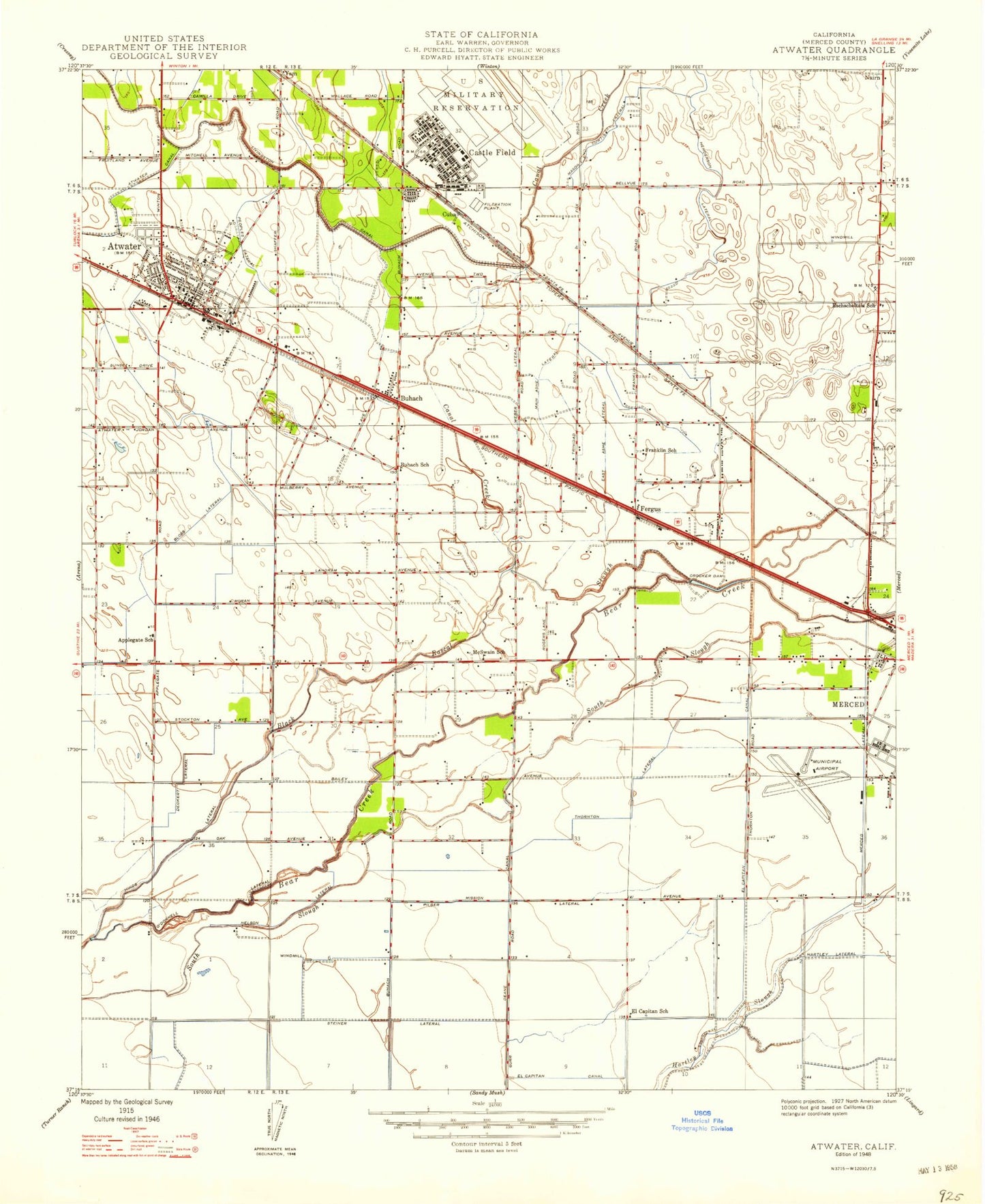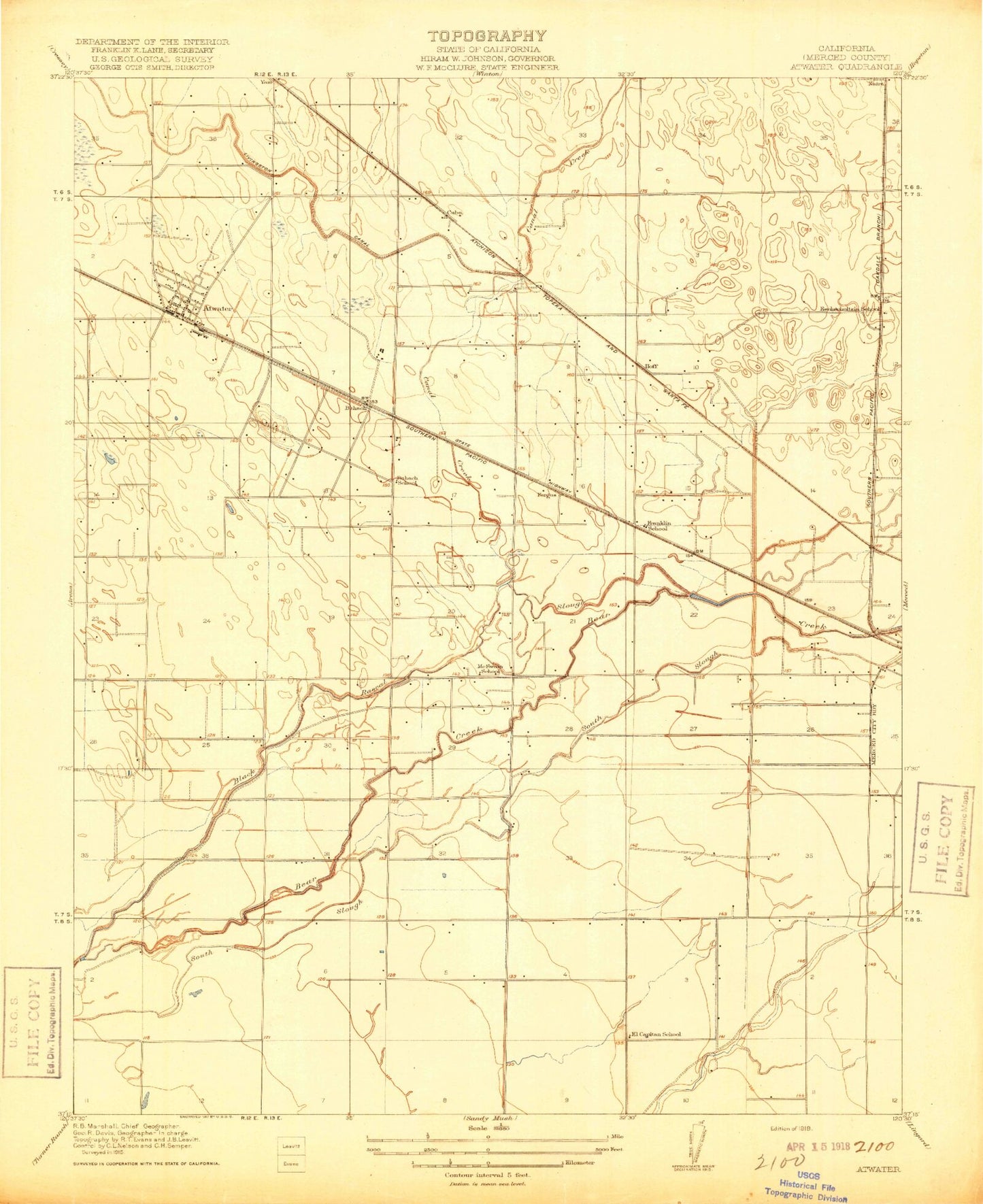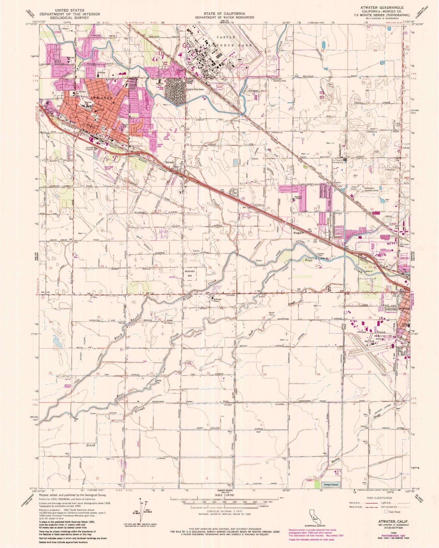
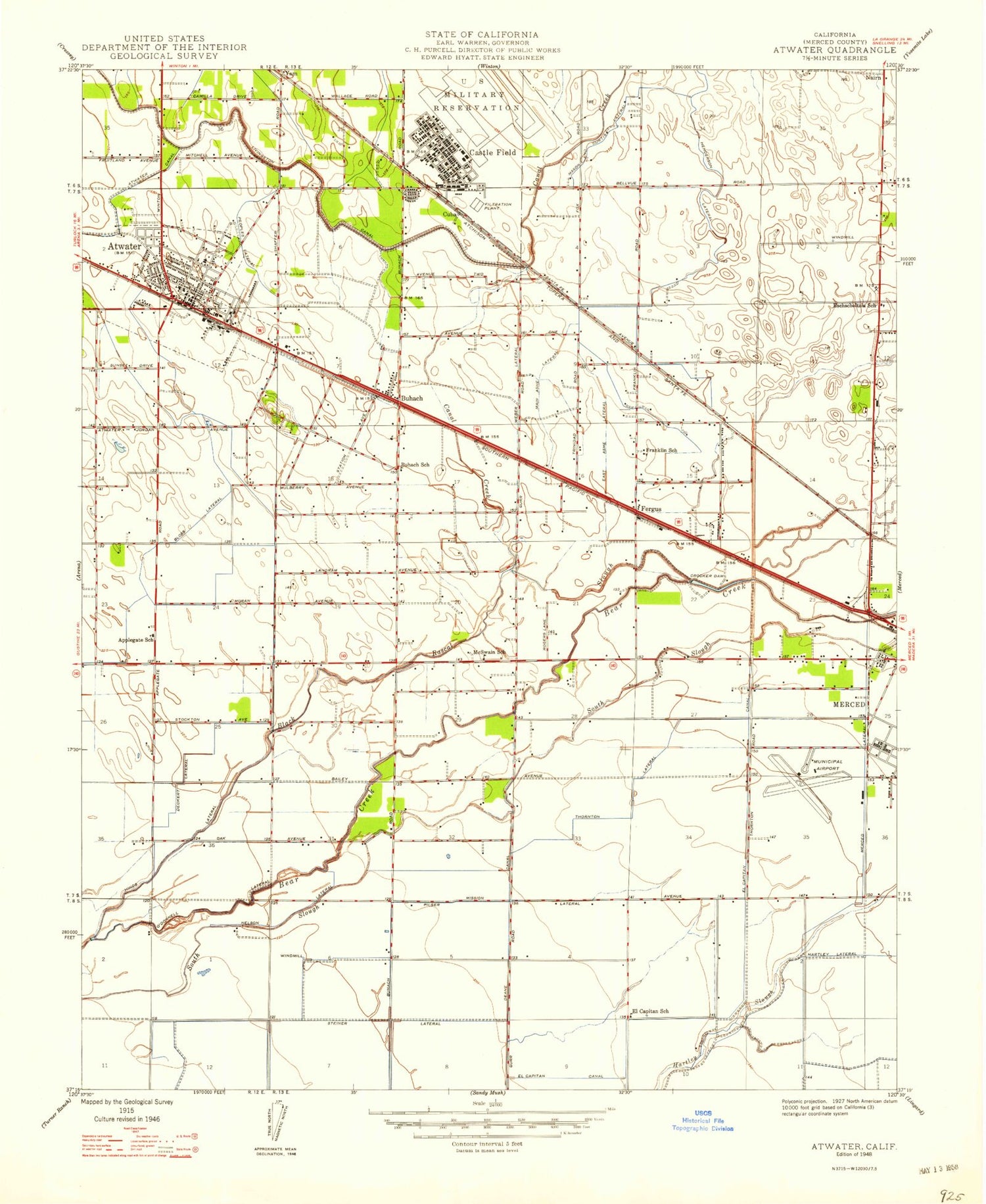

MyTopo
Classic USGS Atwater California 7.5'x7.5' Topo Map
Couldn't load pickup availability
Historical USGS topographic quad map of Atwater in the state of California. Map scale may vary for some years, but is generally around 1:24,000. Print size is approximately 24" x 27"
This quadrangle is in the following counties: Merced.
The map contains contour lines, roads, rivers, towns, and lakes. Printed on high-quality waterproof paper with UV fade-resistant inks, and shipped rolled.
Contains the following named places: Aileen Colburn Elementary School, Air Methods Medical Transport, Airport Industrial Park, Anberry Rehabilitation Hospital, Andy Albiani Park, Ariel Dear Academy, Ariel Dear Found Family Church, Atwater, Atwater Baptist Church, Atwater Branch Merced County Library, Atwater Business Park, Atwater Canal, Atwater Christian Life Church, Atwater City Hall, Atwater Drain, Atwater Fire Department Station 1, Atwater Fire Department Station 2, Atwater High School, Atwater Memorial Ballpark, Atwater Municipal Airport, Atwater Plaza Shopping Center, Atwater Police Department, Atwater Post Office, Atwater Town Center Shopping Center, Atwater United Methodist Church, Baker Library, Bear Creek Community Church, Bellevue Elementary School, Bethany Church of God in Christ, Beutel Dam, Black Rascal Creek, Bloss House Museum, Bloss Lateral, Bloss Memorial Hospital, Bloss Park, Buhach, Buhach Lateral, Buhacn Grammar School, California Highway Patrol Central Division - Merced, Calvario Centro Cristiano, Canal Creek, Castle Air Force Base Post Office, Castle Air Museum, Castle Airport, Castle Gardens, Challenger Learning Center, Church of Christ, City of Atwater, Crocker Dam, Cuba, Deane Canal, Deane Drain, Deckert Lateral, E L Walters Park, East Ashe Lateral, El Capitan Canal, El Capitan School, Elmer Wood Elementary School, Eschscholtzia School, Evergreen Christian Center, Fergus, First Baptist Church, First Church of God, Fluhr, Franklin Census Designated Place, Franklin Elementary School, Friendship Baptist Church, Fruitland Christian Preschool, Gurr Lateral, Heller Park, Henderson Lateral, Hesse Lateral, Hinds Lateral, Hoff, Holy Cross Lutheran Church, Islamic Center of Merced, KVRK-FM (Atwater), Landmark Tabernacle, Leontine Gracey Elementary School, Living Water Christian Fellowship Church, Lucky Shopping Center, Macready Park, Main Ashe Lateral, Manuel Bairos Park, Margaret Sheehy Elementary School, McSwain Census Designated Place, McSwain Elementary School, McSwain Lateral, Meadowbrook Lateral, Merced Bethel Seventh Day Adventist Church, Merced City Fire Department Station 52, Merced County Fire Department Franklin / Beachwood / McSwain Fire Station 61, Merced County Fire Department Station 62 Castle, Merced County Honor Farm, Merced County Human Services Agency, Merced County Sheriff's Office Merced, Merced Regional Airport/Macready Field, Mitchell Elementary School, Model Market Shopping Center, Mount Olive Baptist Church, Nairn, Nealon Lateral, O'Donnell Lateral, Osborn Park, Paden Drain, Parriera Drain, Peggy Heller Elementary School, Pilger Lateral, Ralston Park, Rancho Del Rey Golf Course, Riggs Ambulance Service, Saint Anthony School, Saint Anthonys Roman Catholic Church, Saint Nicholas Episcopal Church, Salvation Army Laotian Ministries, Shaffer Elementary School, Steiner Lateral, Stickney Lateral, Thomas Olaeta Elementary School, Thornton Lateral, Tin Flume Lateral, Tower Park, Tri-C Community Day School, Trindade Drain, Veterans Memorial Building, Veterans Park, Victory Baptist Church, Vieira Dairy Farm, West Buhach Lateral