MyTopo
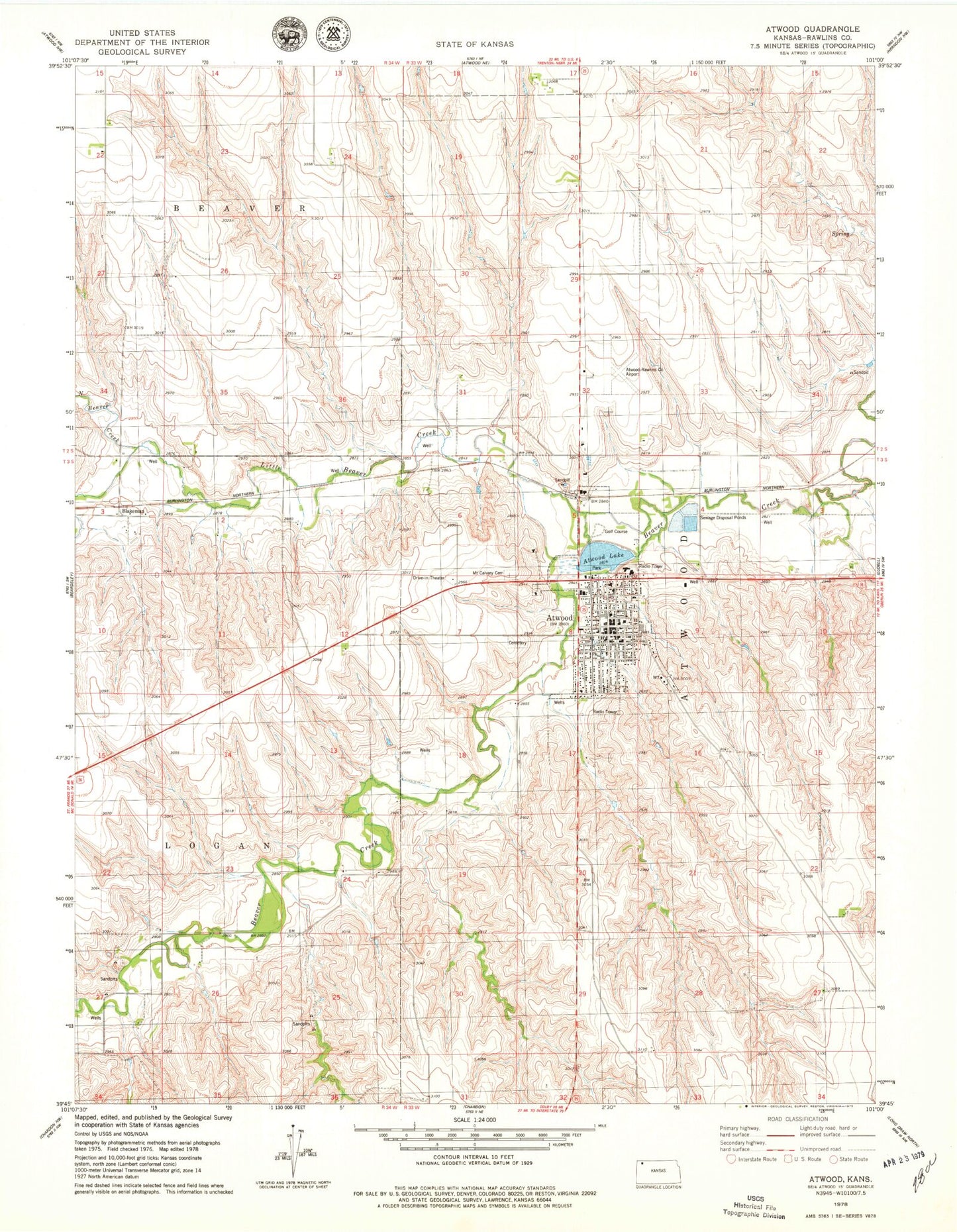
Classic USGS Atwood Kansas 7.5'x7.5' Topo Map
Couldn't load pickup availability
Historical USGS topographic quad map of Atwood in the state of Kansas. Map scale may vary for some years, but is generally around 1:24,000. Print size is approximately 24" x 27"
This quadrangle is in the following counties: Rawlins.
The map contains contour lines, roads, rivers, towns, and lakes. Printed on high-quality waterproof paper with UV fade-resistant inks, and shipped rolled.
Contains the following named places: Atwood, Atwood Baptist Church, Atwood City Hall, Atwood Country Club, Atwood Fire Department, Atwood Lake, Atwood Police Department, Atwood Post Office, Atwood Public Library, Atwood United Methodist Church, Atwood Wastewater Treatment Facility, Atwood-Rawlins County City-County Airport, Blakeman, City of Atwood, Disciples of Christ Christian Church, Kansas Department of Transportation District 3 Area 2 Office, Kingdom Hall of Jehovah's Witnesses, Little Beaver Creek, McDougal Agricultural and Snodgrass Grain Elevator Number 1, Mount Calvary Cemetery, North Atwood, North Beaver Creek, Rawlins County, Rawlins County Courthouse, Rawlins County Elementary School, Rawlins County Emergency Medical Services, Rawlins County Fairgrounds, Rawlins County Fire District 2 Atwood, Rawlins County Health Center, Rawlins County Health Department, Rawlins County Jail, Rawlins County Junior / Senior High School, Rawlins County Museum, Rawlins County Sheriff's Office, Redeemer Evangelical Lutheran Church, Sacred Heart Catholic Church, Township of Atwood, ZIP Code: 67730