MyTopo
Classic USGS Au Sable Point SW Michigan 7.5'x7.5' Topo Map
Couldn't load pickup availability
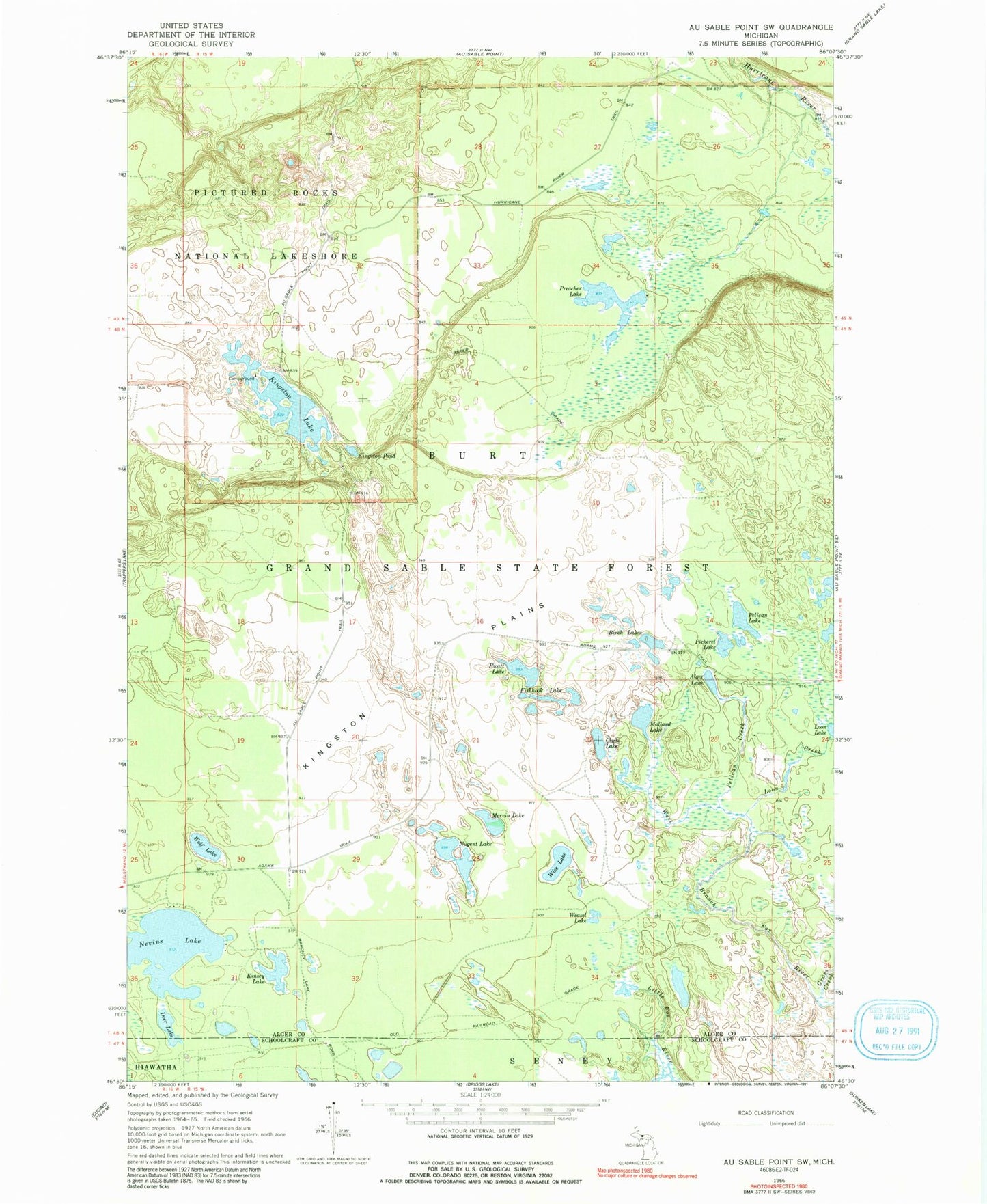
Historical USGS topographic quad map of Au Sable Point SW in the state of Michigan. Typical map scale is 1:24,000, but may vary for certain years, if available. Print size: 24" x 27"
This quadrangle is in the following counties: Alger, Schoolcraft.
The map contains contour lines, roads, rivers, towns, and lakes. Printed on high-quality waterproof paper with UV fade-resistant inks, and shipped rolled.
Contains the following named places: Alger Lake, Birch Lakes, Clyde Lake, Deer Lake, Ewatt Lake, Fishhook Lake, Grass Creek, Kingston Lake, Kingston Plains, Kingston Pond, Kinsey Lake, Loon Creek, Mallard Lake, Mervin Lake, Nevins Lake, Nugent Lake, Pelican Creek, Pelican Lake, Pickerel Lake, Preacher Lake, Weasel Lake, Wise Lake, Wolf Lake, Kingston Lake State Forest Campground