
MyTopo
Classic USGS Auburn Kansas 7.5'x7.5' Topo Map
Couldn't load pickup availability
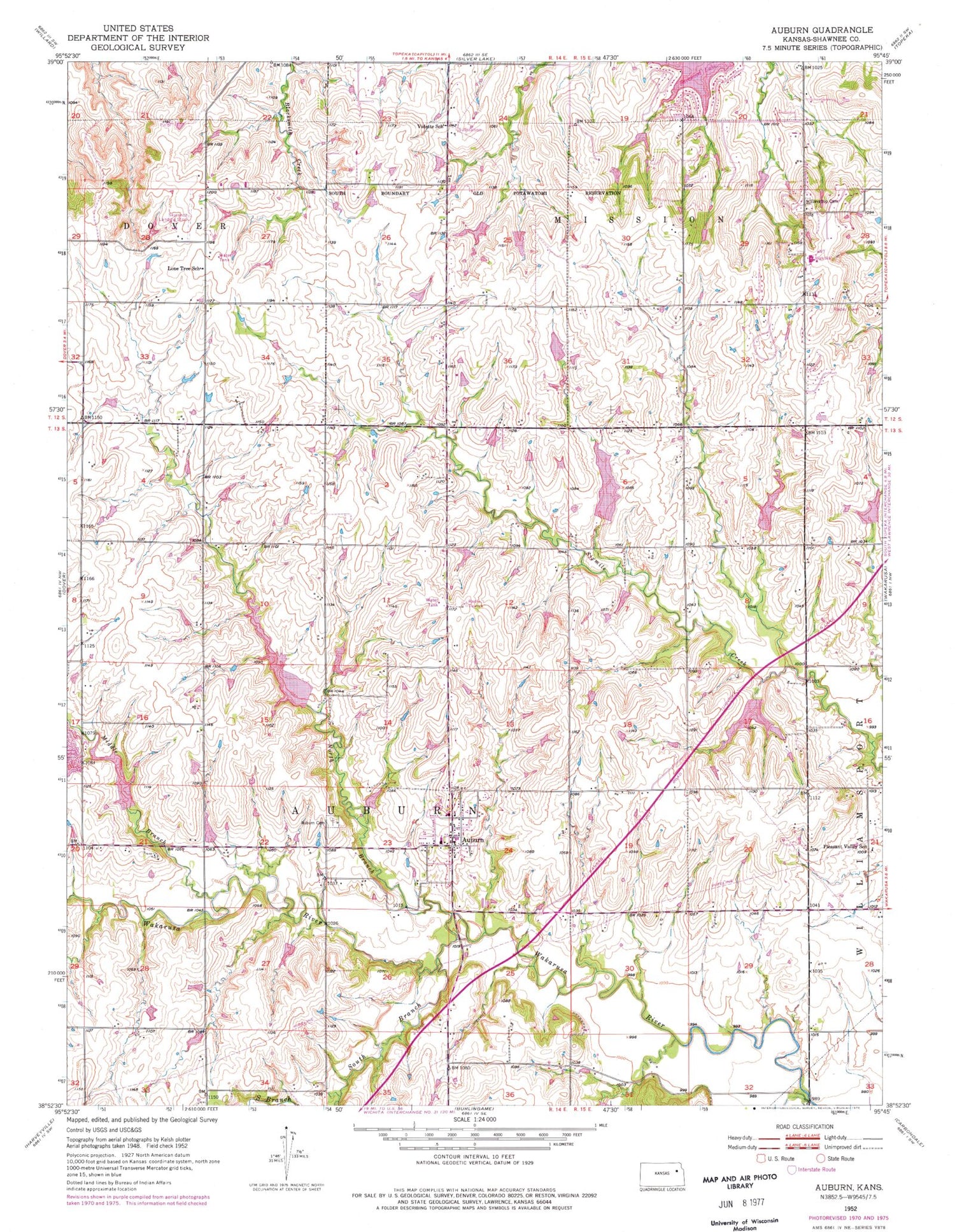
Historical USGS topographic quad map of Auburn in the state of Kansas. Map scale may vary for some years, but is generally around 1:24,000. Print size is approximately 24" x 27"
This quadrangle is in the following counties: Shawnee.
The map contains contour lines, roads, rivers, towns, and lakes. Printed on high-quality waterproof paper with UV fade-resistant inks, and shipped rolled.
Contains the following named places: Auburn, Auburn Cemetery, Auburn Elementary School, Auburn Police Department, Auburn Post Office, Auburn Presbyterian Church, Auburn United Methodist Church, Auburn Washburn Unified School District 437 Police Department, Auburn Washburn Unified School District Office, Auburn Wastewater Plant, City of Auburn, Dover Industrial Park, Elevation Cemetery, Homestead of Auburn Assisted Living Facility, Jay Shideler Elementary School, Lone Tree School, Middle Branch Wakarusa River, North Branch Wakarusa River, Pleasant Valley School, Prairie View Golf Club, Shawnee County Fire District 2 Auburn Station, Skyranch Landing Strip, South Branch Wakarusa River, Tallgrass Student Learning Center School, Township of Auburn, Vidette, Vidette School, Washburn Rural Alternative High School, Washburn Rural High School, Washburn Rural Middle School, Waveland, ZIP Codes: 66402, 66610


