
MyTopo
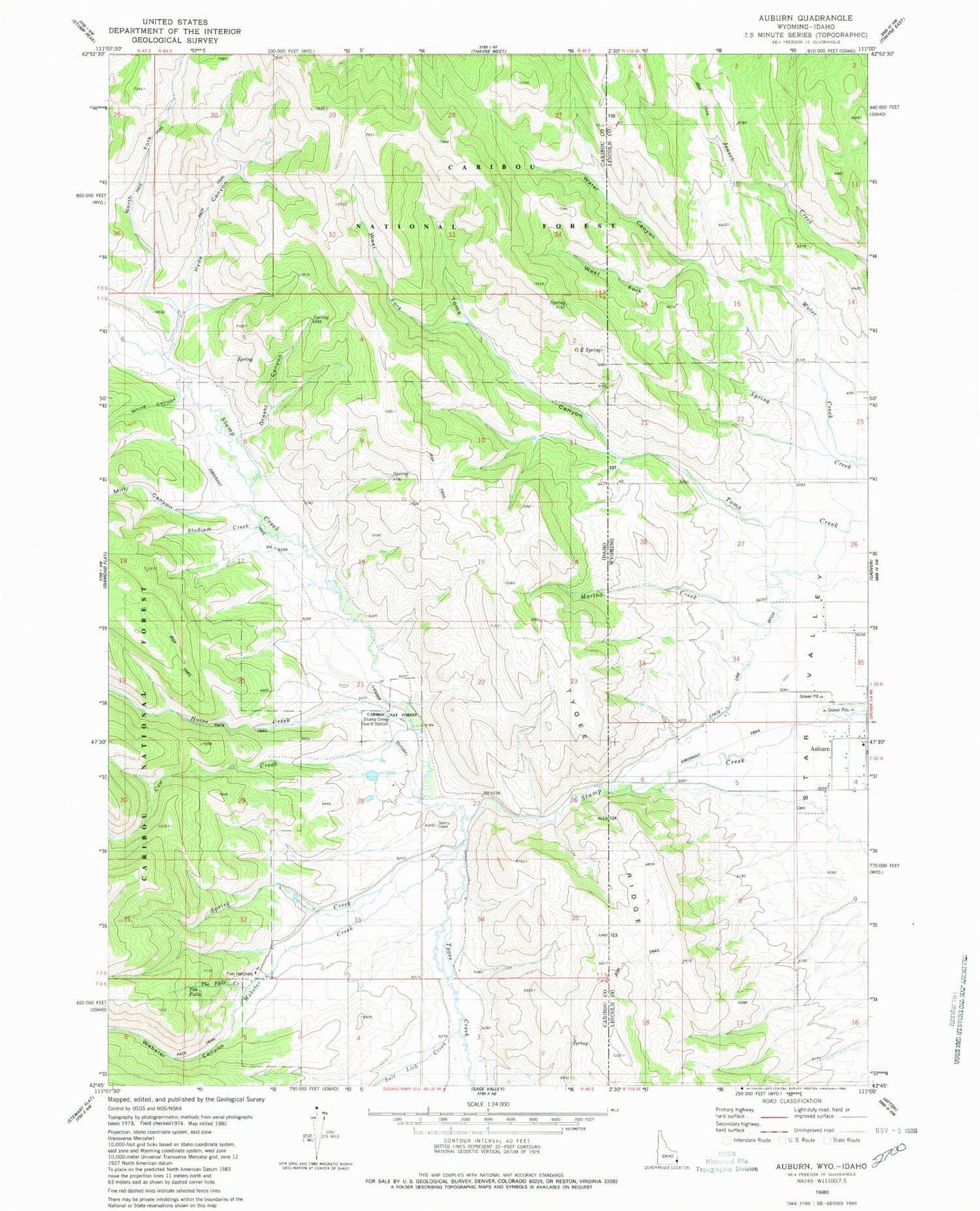
Classic USGS Auburn Wyoming 7.5'x7.5' Topo Map
Couldn't load pickup availability
Historical USGS topographic quad map of Auburn in the states of Wyoming, Idaho. Map scale may vary for some years, but is generally around 1:24,000. Print size is approximately 24" x 27"
This quadrangle is in the following counties: Caribou, Lincoln.
The map contains contour lines, roads, rivers, towns, and lakes. Printed on high-quality waterproof paper with UV fade-resistant inks, and shipped rolled.
Contains the following named places: Auburn, Auburn Cemetery, Auburn Census Designated Place, Auburn Post Office, Cow Creek, Emigrant Trail, Graehl Canyon, Horse Creek, Hyde Canyon, Martha Creek, Marthas Canyon, Mill Canyon, Miller Ranch, North Fork Hyde Canyon, O E Spring, Oe Spring, Petersons Ranch, Salt Lick Creek, Sheep Creek, Spring Creek, Stadium Creek, State Line Ditch, Stump Creek Guard Station, The Falls, The Falls Creek, Toms Canyon, Tygee Creek, Water Canyon, Water Creek, Webster Canyon, Webster Creek, West Fork Toms Canyon, West Fork Water Canyon, White Canyon


