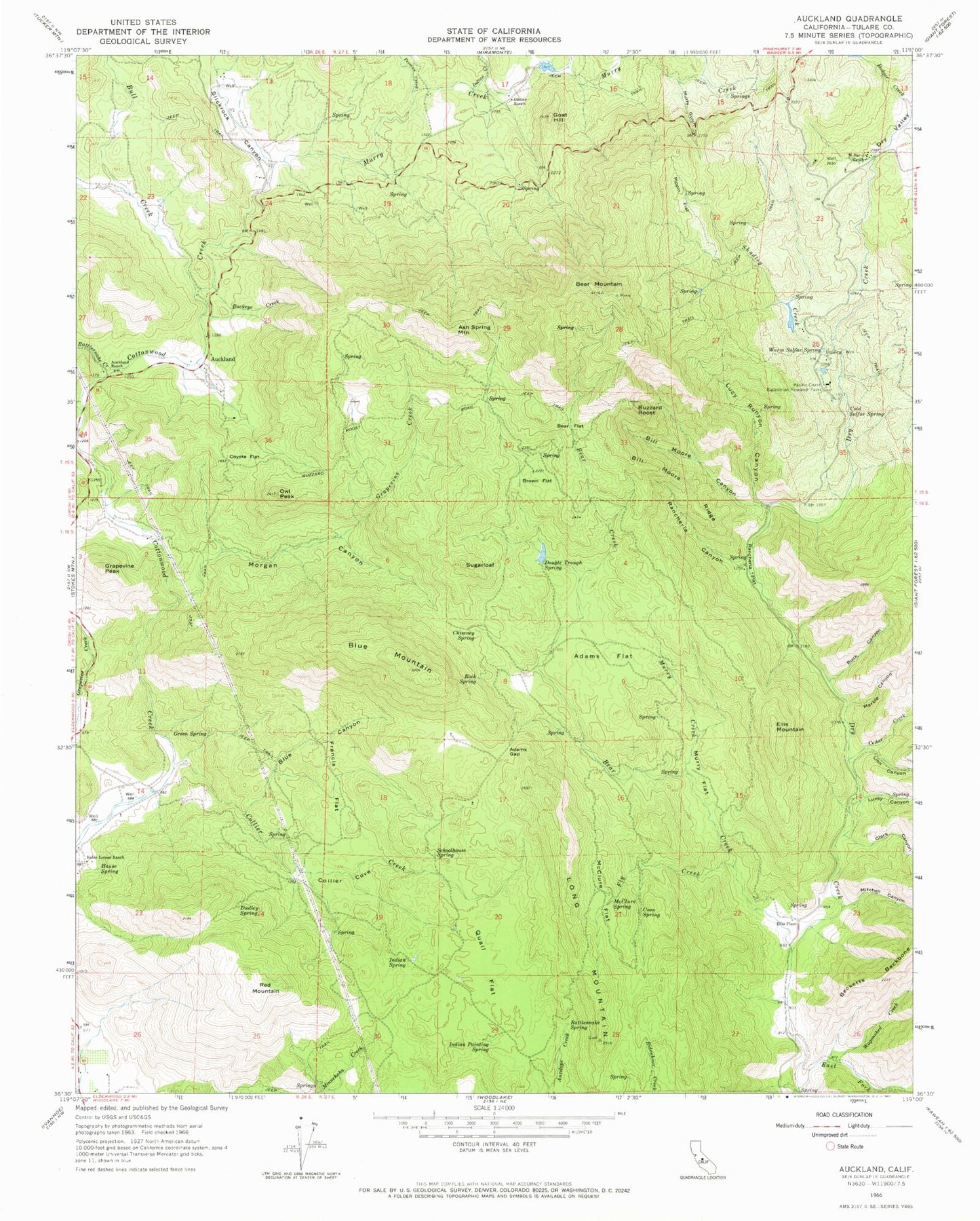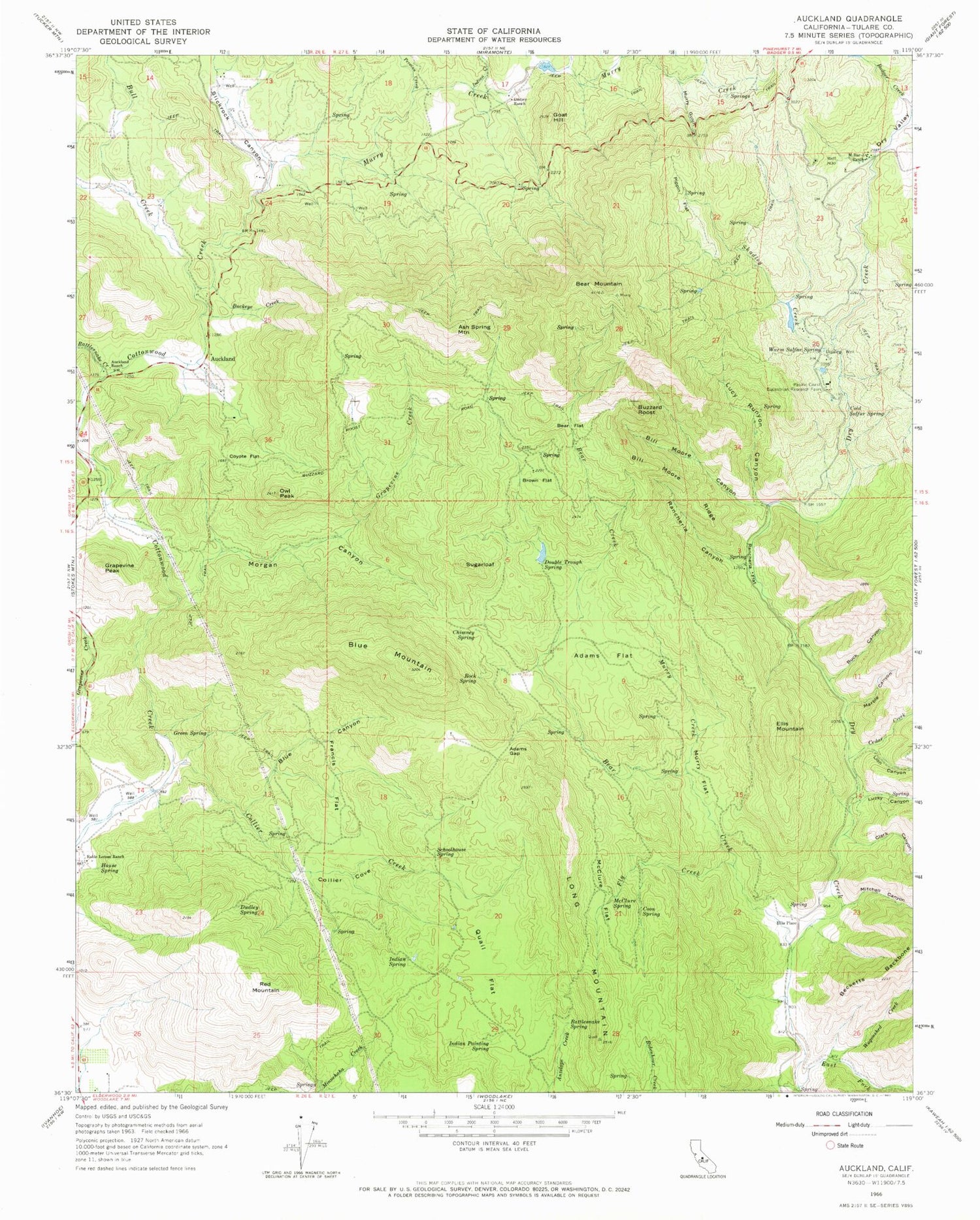
MyTopo
Classic USGS Auckland California 7.5'x7.5' Topo Map
Couldn't load pickup availability
Historical USGS topographic quad map of Auckland in the state of California. Map scale may vary for some years, but is generally around 1:24,000. Print size is approximately 24" x 27"
This quadrangle is in the following counties: Tulare.
The map contains contour lines, roads, rivers, towns, and lakes. Printed on high-quality waterproof paper with UV fade-resistant inks, and shipped rolled.
Contains the following named places: Adams Flat, Adams Gap, Ash Spring Mountain, Auckland, Auckland Ranch, Badger Creek, Bear Creek, Bear Flat, Bear Mountain, Bill Moore Canyon, Bill Moore Ridge, Blue Canyon, Blue Mountain, Brown Flat, Buck Canyon, Buckeye Creek, Bull Creek, Buzzard Roost, Cedar Creek, Chimney Spring, Clark Canyon, Cold Sulphur Spring, Collier Cove, Coon Spring, Cottonwood School, Coyote Flat, Double Trough Spring, Dry Valley, Dudley Ranch, Dudley Spring, East Fork Dry Creek, Elder Creek, Ellis Mountain, Ellis Place, Fly Creek, Francis Flat, Goat Hill, Grapevine Creek, Grapevine Peak, Green Spring, Harts Ranch, House Spring, Indian Creek, Indian Painting Spring, Indian Spring, Lion Canyon, Long Mountain, Lucky Canyon, Lucy Runyon Canyon, Marble Canyon, M-Bar-J Ranch, McClure Flat, McClure Spring, Mitchell Canyon, Morgan Canyon, Murry Creek, Murry Flat, Murry Gulch, Owl Peak, Pacific Coast Equestrian Research Farm, Persian Creek, Pippin Flat, Quail Flat, Rancheria Canyon, Rancheria Flat, Rattlesnake Creek, Rattlesnake Spring, Red Mountain, Roble Lomas Ranch, Rock Spring, Schoolhouse Spring, Shadley Creek, Slickrock Canyon, Sugarloaf, Wagonshed Creek, Warm Sulphur Spring, Woolley Canyon