
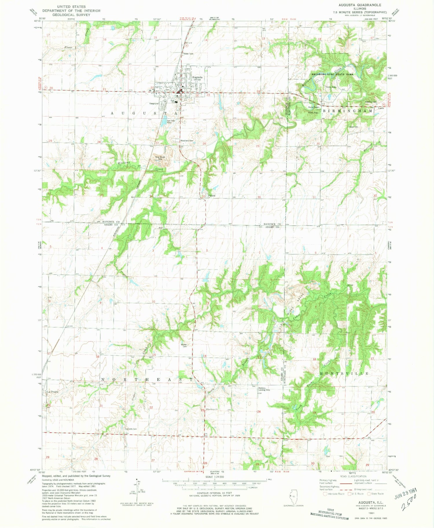
MyTopo
Classic USGS Augusta Illinois 7.5'x7.5' Topo Map
Couldn't load pickup availability
Historical USGS topographic quad map of Augusta in the state of Illinois. Map scale is 1:24000. Print size is approximately 24" x 27"
This quadrangle is in the following counties: Adams, Hancock, Schuyler.
The map contains contour lines, roads, rivers, towns, and lakes. Printed on high-quality waterproof paper with UV fade-resistant inks, and shipped rolled.
Contains the following named places: Augusta, Augusta Cemetery, Augusta Fire Station, Augusta Post Office, Baxter School (historical), Dron Cemetery, Elm Grove Church, Elm Grove School (historical), Faith Lutheran Church, Hawkins Cemetery, Highland School (historical), Leenerts Cemetery, Oakwood School (historical), Pine Grove School (historical), Pit 1 Triple S Mine, Pit 2 Triple S Mine, Pit 3 Triple S Mine, Pit 4 Triple S Mine, Pit 5 Triple S Mine, Pit 7 Triple S Mine, Pulaski, Pulaski Cemetery, Pulaski School (historical), Robbins Landing Strip (historical), Sherwood School (historical), South Branch Cedar Creek, South Fork Creek, Southeastern High School, Three Counties Mine, Township of Augusta, Township of Northeast, Village of Augusta, Walker Cemetery, Washington School (historical), Weinborg-King State Park, Woodlawn Cemetery


