MyTopo
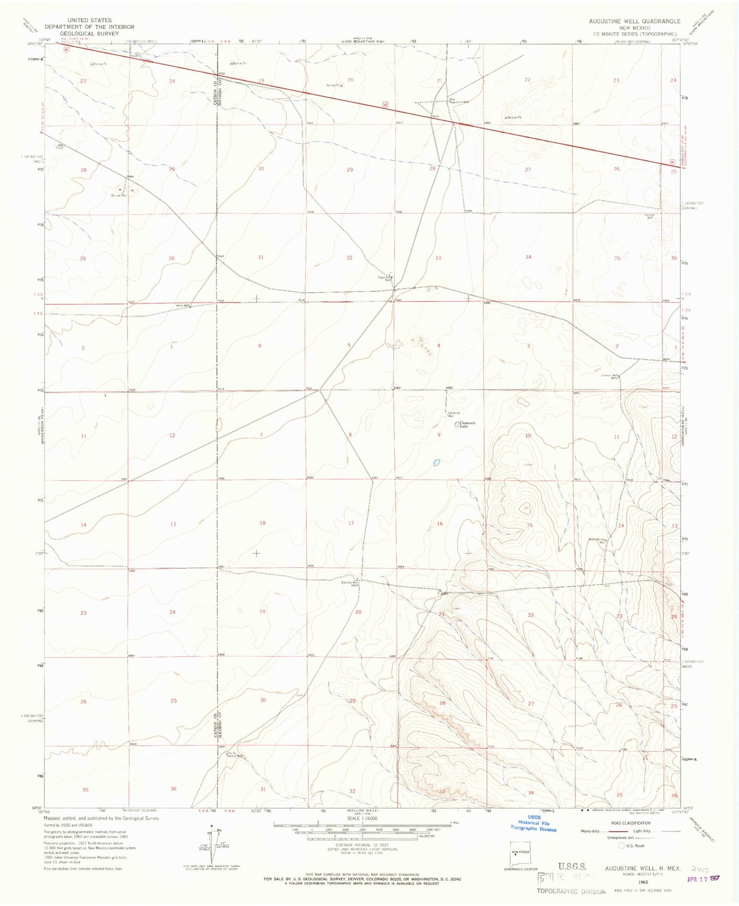
Classic USGS Augustine Well New Mexico 7.5'x7.5' Topo Map
Couldn't load pickup availability
Historical USGS topographic quad map of Augustine Well in the state of New Mexico. Map scale may vary for some years, but is generally around 1:24,000. Print size is approximately 24" x 27"
This quadrangle is in the following counties: Catron, Socorro.
The map contains contour lines, roads, rivers, towns, and lakes. Printed on high-quality waterproof paper with UV fade-resistant inks, and shipped rolled.
Contains the following named places: 10010 Water Well, Augustine, Augustine Well, Augustine Windmill, Bone Mocho Water Well, Bone Mocho Well, Chadwick Water Well, Clements Lake, Clements Well, Estafeta Well, Garcia Water Well, Heinz Water Well, Heinz Well, Lorenzo Well, National Radio Astronomy Observatory VLA Telescope, New Augustine Well, Newaugusti Water Well, South Garcia Well, VLA Water Well