MyTopo
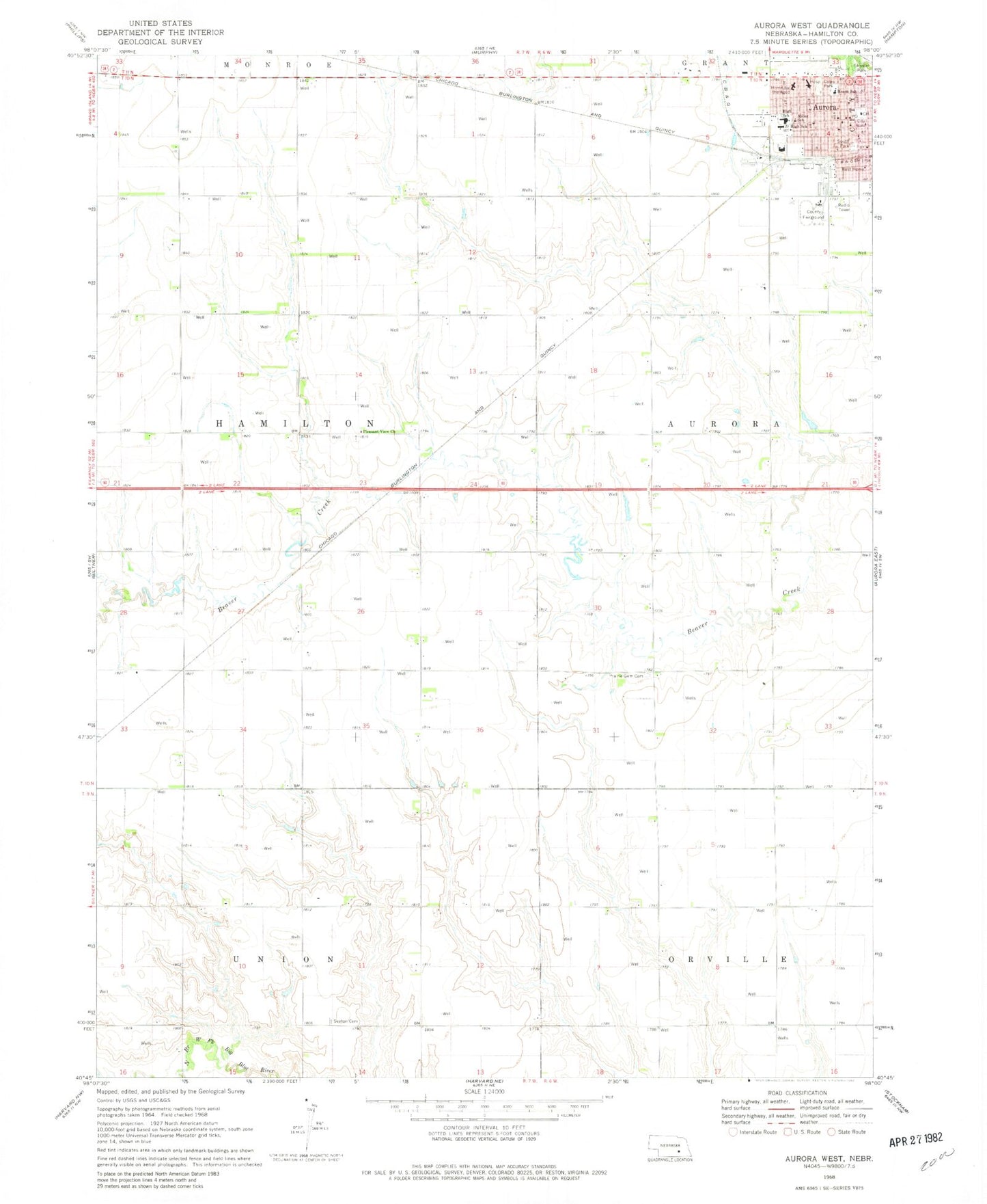
Classic USGS Aurora West Nebraska 7.5'x7.5' Topo Map
Couldn't load pickup availability
Historical USGS topographic quad map of Aurora West in the state of Nebraska. Map scale may vary for some years, but is generally around 1:24,000. Print size is approximately 24" x 27"
This quadrangle is in the following counties: Hamilton.
The map contains contour lines, roads, rivers, towns, and lakes. Printed on high-quality waterproof paper with UV fade-resistant inks, and shipped rolled.
Contains the following named places: Aarons Field, Assembly of God Church, Aurora, Aurora Cooperative Elevator Company Elevator, Aurora Dental Clinic, Aurora Mall, Aurora Police Department, Aurora Post Office, Aurora Public Schools, Aurora Volunteer Fire Department, Baha'i Faith, Central Park Square, City of Aurora, Coles Park, Deep Well Irrigation Historical Marker, Election Precinct 4, Evangelical Covenant Church, Evangelical Free Church, Faith Community Church, First Christian Church, Hamilton County, Hamilton County Ambulance Service, Hamilton County Courthouse, Hamilton County Courthouse Historical Marker, Hamilton County Fairgrounds, Hamilton County Sheriff's Office, Hamilton Manor, Hearn School, Hospice of Tabitha, KHNE-TV (Hastings), Kostal Dam, Kostal Reservoir, Kostal-Hawthorne Dam, Memorial Community Care, Memorial Community Health Hospital, Memorial Health Clinic, Memorial Hospital Heliport, Messiah Lutheran Church, Miller School, Modern Motel and Trailer Park, Pleasant View Church, Prairie Gem Cemetery, Saint Marys Catholic Church, Seaton Cemetery, Seventh Day Adventist Church, South Park, Streeter Park, Streeter Park Campground, Township of Hamilton, United Church of Christ, United Methodist Church, Village Square Mall, ZIP Code: 68818