
MyTopo
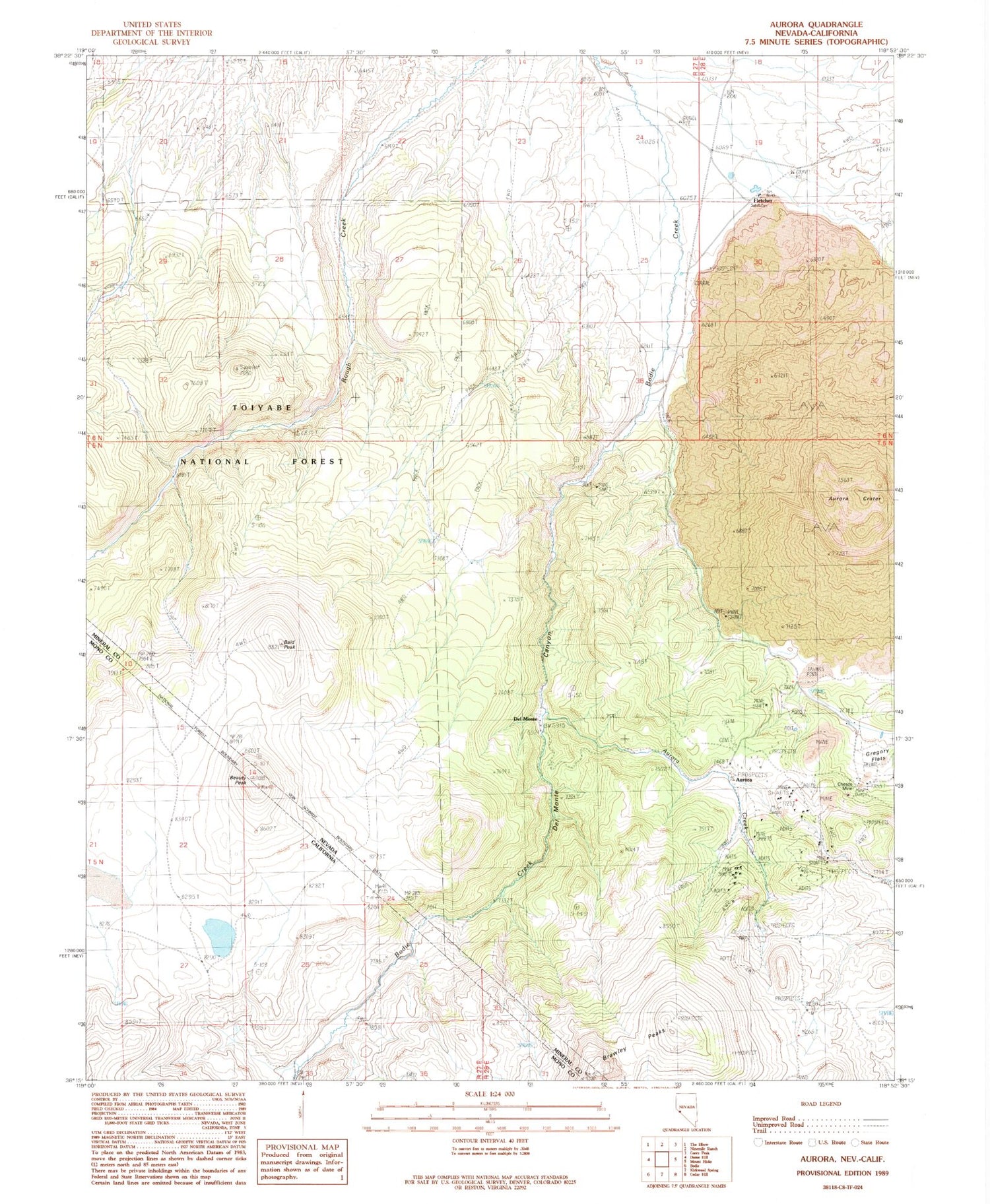
Classic USGS Aurora Nevada 7.5'x7.5' Topo Map
Couldn't load pickup availability
Historical USGS topographic quad map of Aurora in the states of Nevada, California. Map scale is 1:24000. Print size is approximately 24" x 27"
This quadrangle is in the following counties: Mineral, Mono.
The map contains contour lines, roads, rivers, towns, and lakes. Printed on high-quality waterproof paper with UV fade-resistant inks, and shipped rolled.
Contains the following named places: Antelope Mill (historical), Aurora (historical), Aurora Crater, Aurora Creek, Aurora Hill, Aurora Mill (historical), Aurora Post Office (historical), Aurora Tunnel, Bald Peak, Barrel Spring, Beauty Peak, Braly Peaks, Chesco Mine, China Camp, Del Monte, Del Monte Canyon, Dry Lake, East Braly Peak, Esmeralda (historical), Esmeralda Mill (historical), Esmeralda Post Office (historical), Esmeralda Ravine, Esmeralda Tunnel, Evergreen Ranch (historical), Five Mile House (historical), Fletcher, Fletcher Post Office (historical), Fletcher Spring, Gibbons Mill, H Harris Mill (historical), Horatio Tunnel, Humboldt Hill, Illinois Tunnel, Juanita Tunnel, Junction House (historical), Last Chance Hill, Mangum (historical), Martinez Hill, Martinez Tunnel, Middle Hill, Montezuma Tunnel, Montreal Tunnel, Moses Mill (historical), Napa Mill (historical), National Tunnel, Pine Creek Mill (historical), Pioneer Mill (historical), Popper Mine, Saint Marys Hill, Silver Hill, Spring Ranch (historical), Sugarloaf Mountain, Sunny Side Ranch (historical), Tamarack Spring, Teese and Company Mill (historical), Temple Chace Ranch (historical), Union Mill (historical), Union Tunnel, Verdi Vista Ranch (historical), West Braly Peak, Willow Ravine


