MyTopo
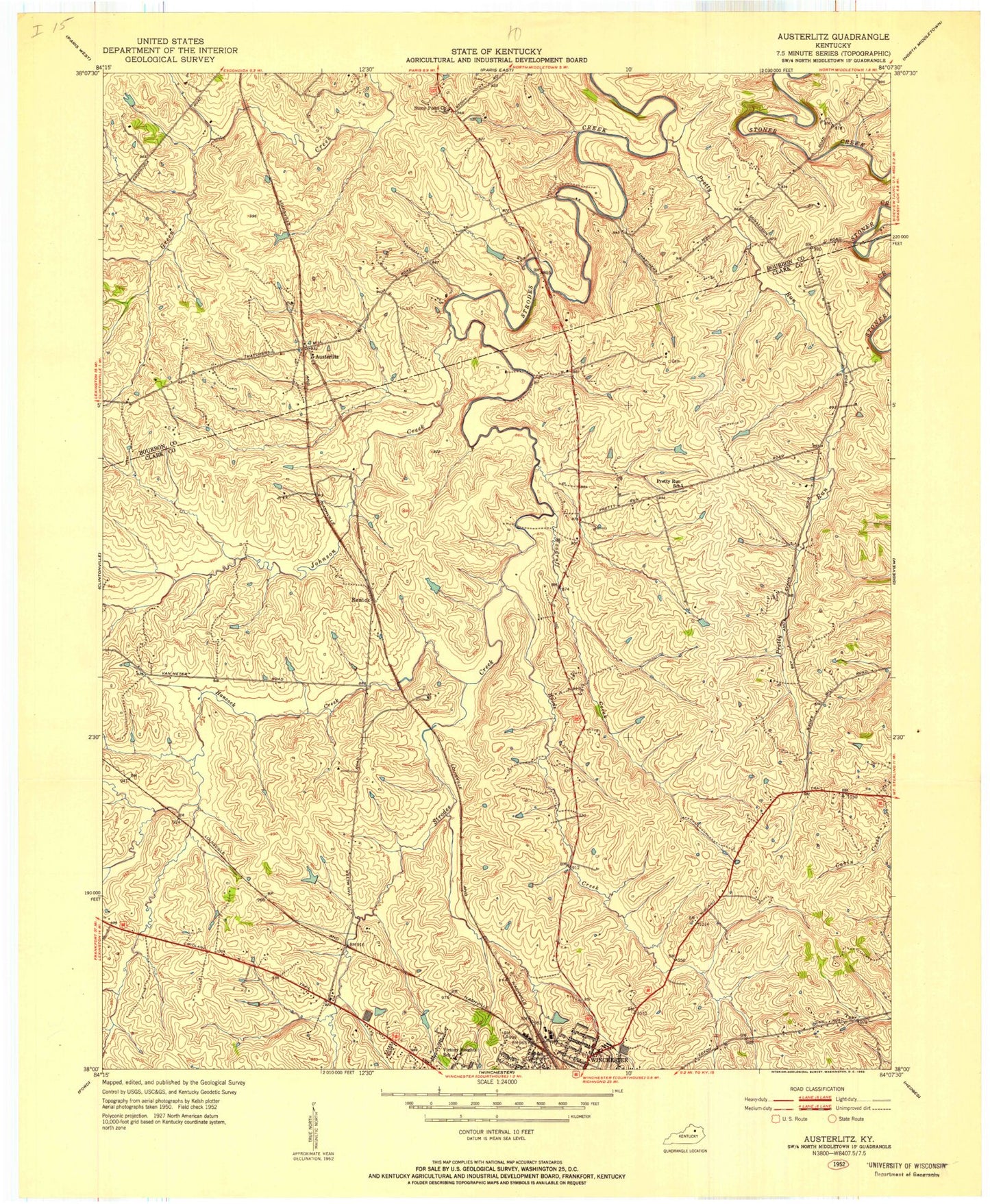
Classic USGS Austerlitz Kentucky 7.5'x7.5' Topo Map
Couldn't load pickup availability
Historical USGS topographic quad map of Austerlitz in the state of Kentucky. Map scale may vary for some years, but is generally around 1:24,000. Print size is approximately 24" x 27"
This quadrangle is in the following counties: Bourbon, Clark.
The map contains contour lines, roads, rivers, towns, and lakes. Printed on high-quality waterproof paper with UV fade-resistant inks, and shipped rolled.
Contains the following named places: Athlone Stock Farm, Austerlitz, Bel Air, Bellefonte Stock Farm, Bon Haven, Canewood Stock Farm, Central School, City of Winchester, Clark County Fire Department Station 1, Clark Regional Medical Center, Clark Regional Medical Center Heliport, Clarmont Memorial Gardens, Codell Airport, Constant Creek, Constant Station, Devils Backbone, Ecton Pike, Forest Retreat, Forrest Park, Gist Family Cemetery, Glendale Stock Farm, Greenwood Stock Farm, Hancock Creek, Holmhurst Stock Farm, Hoods Creek, Houckville Post Office, Indian Mound, Johnson Creek, Judianne Estates, Kinross Railroad Station, Maple Cottage Stock Farm, Meadowbrook, Oak Ridge Stock Farm, Patio Switching Station, Pleasant Hill Stock Farm, Pretty Run, Renick, Renick Field, Renick Station, Richland Stock Farm, Rockwell Village, Shala-Mar Estates, Silver Lake, Spring Hill, Spring Hill Stock Farm, Stony Point, Strodes Station, Strodes Valley Stock Farm, Suddith Post Office, Sycamore Baptist Church, Sycamore Stock Farm, Victory Heights, Victory Heights School, Vinewood Post Office, Vinewood Stock Farm, Welcome Hall, WHRS-AM (Winchester), Winchester Division, Winchseter Fire Department Station 3, Woodruff Creek