MyTopo
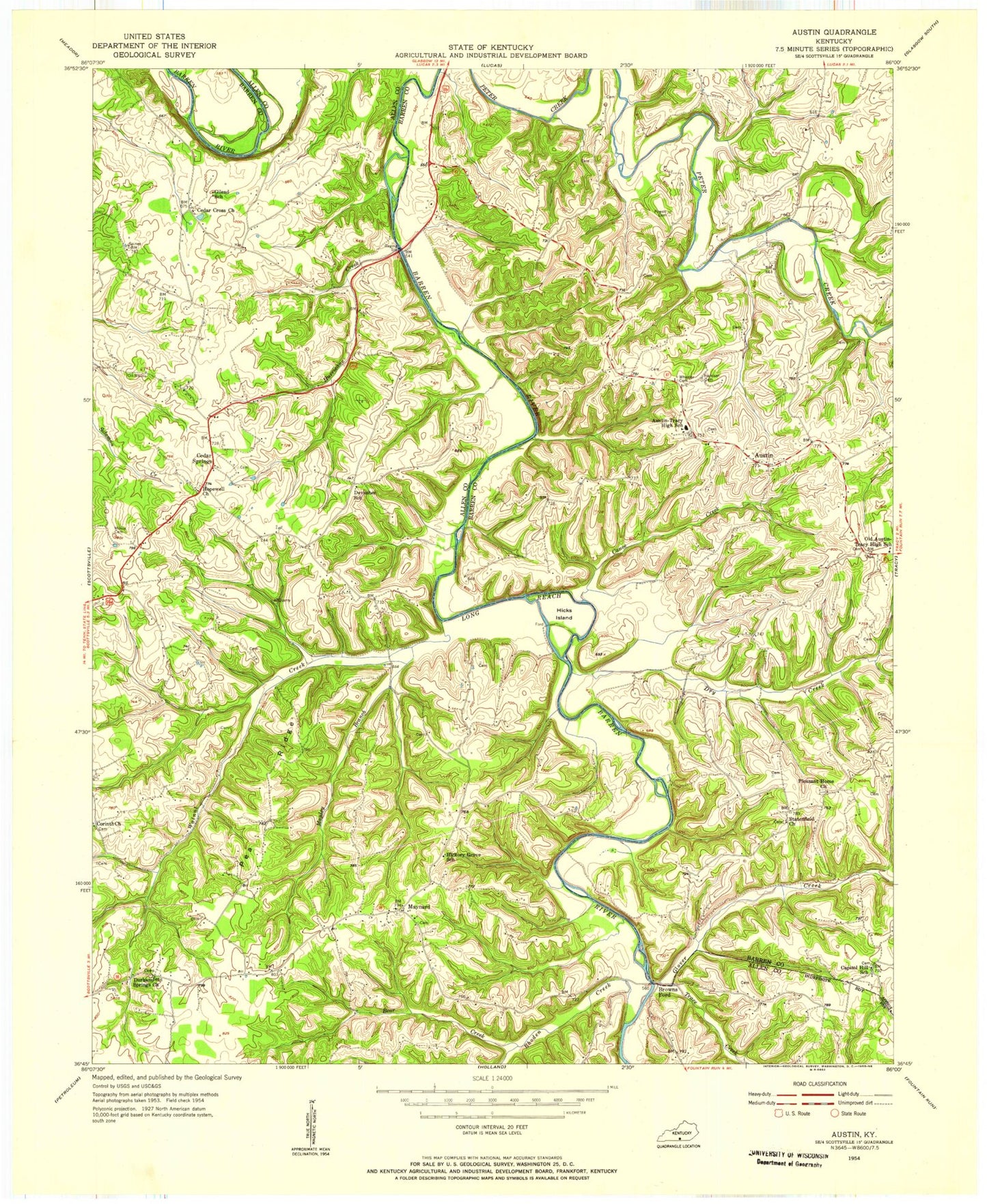
Classic USGS Austin Kentucky 7.5'x7.5' Topo Map
Couldn't load pickup availability
Historical USGS topographic quad map of Austin in the state of Kentucky. Map scale is 1:24000. Print size is approximately 24" x 27"
This quadrangle is in the following counties: Allen, Barren.
The map contains contour lines, roads, rivers, towns, and lakes. Printed on high-quality waterproof paper with UV fade-resistant inks, and shipped rolled.
Contains the following named places: Austin, Austin Boat Ramp, Austin Cemetery, Austin Post Office, Austin Tracy Fire Department, Austin-Tracy School, Barren River Lake, Barren River Lake State Resort Park, Barren River Lake State Resort Park Golf Course, Bear Creek, Broken Arrow Creek, Browns Ford Boat Ramp, Canoe Creek, Capitol Hill Church, Cedar Cross Church, Cedar Springs, Cedar Springs Fire Department, Cedar Springs Fire Department Substation, Corinth Church, Dry Creek, Durham Springs Church, Glover Creek, Hopewell Church, Hurricane Creek, Manley Branch, Mason Island, Maynard, New Bethel Church, Park Site Boat Ramp, Pea Ridge, Pleasant Home Church, Rhoden Creek, Trace Creek, Walnut Creek, Walnut Creek Boat Ramp