MyTopo
Classic USGS Austin Oregon 7.5'x7.5' Topo Map
Couldn't load pickup availability
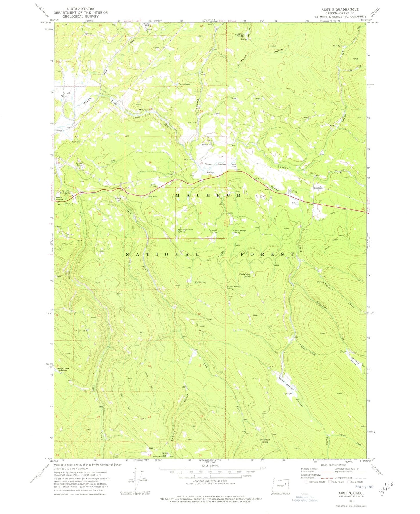
Historical USGS topographic quad map of Austin in the state of Oregon. Typical map scale is 1:24,000, but may vary for certain years, if available. Print size: 24" x 27"
This quadrangle is in the following counties: Grant.
The map contains contour lines, roads, rivers, towns, and lakes. Printed on high-quality waterproof paper with UV fade-resistant inks, and shipped rolled.
Contains the following named places: Austin, Big Springs, Bjerkson Flat, Blue Mountain Work Center, Camp Flat, Camp Noxage Spring, Crawford Creek, Dry Fork Clear Creek, Fly Creek, Frosty Gulch, Idaho Creek, Japanese Meadow, Frosty Meadow, Mill Creek, Olmstead Creek, Olmstead Meadow, Papoose Creek, Phipps Creek, Phipps Meadow, Quaking Aspen Spring, Rock Spring, Savage Creek, Section Corner Spring, Sheep Creek, Sixteen Gulch, Wiwaanaytt Creek, Wiwaanaytt Meadow, Steamboat Spring, Sullens Cow Camp, Summit Creek, Summit Spring, Twin Ponds, Wood Camp Spring, Newtons (historical), Little Phipps Creek, Rock Creek Spring, Penola Post Office (historical), Austin Post Office (historical), Fisks Post Office (historical)