
MyTopo
Classic USGS Autaugaville Alabama 7.5'x7.5' Topo Map
Couldn't load pickup availability
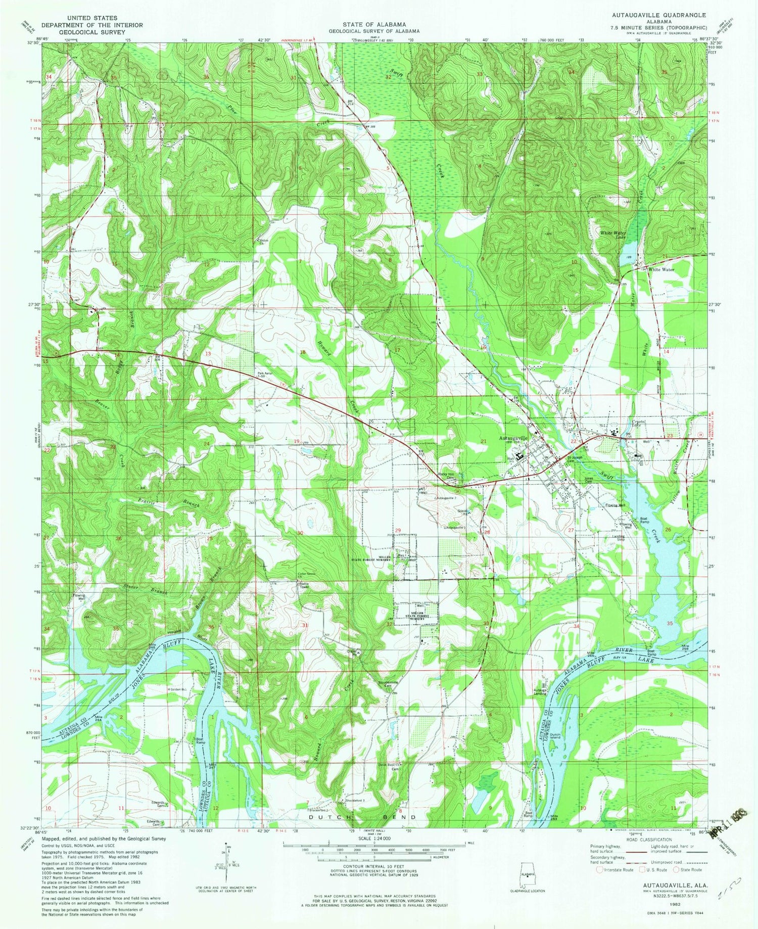
Historical USGS topographic quad map of Autaugaville in the state of Alabama. Map scale may vary for some years, but is generally around 1:24,000. Print size is approximately 24" x 27"
This quadrangle is in the following counties: Autauga, Lowndes.
The map contains contour lines, roads, rivers, towns, and lakes. Printed on high-quality waterproof paper with UV fade-resistant inks, and shipped rolled.
Contains the following named places: Autauga Landing, Autaugaville, Autaugaville Division, Autaugaville Elementary School, Autaugaville High School, Autaugaville Post Office, Autaugaville Volunteer Fire Department, Beaver Creek, Boggy Branch, Camp Alabama, Canaan Land Church, Cedar Grove Church, Crystal Lake, Crystal Lake Dam, Dutch Bend, Dutch Bend Church, Dutch Island, Gholson Bar, Gordon Bar, Greater Pine Grove Church, House Bluff, Howard Creek, Jones Cemetery, Miller State Forest Nursery, Old Augusta Church, Pauline Bar, Pine Creek, Rocky Hill Cemetery, Saint Joseph Cemetery, Shiloh Church, Stoudemire Cemetery, Stover Branch, Stricklands Landing, Swift Creek, Swift Creek Bar, Swift Creek Park, Town of Autaugaville, White Water, White Water Creek, Yellow Water Creek, ZIP Code: 36003


