
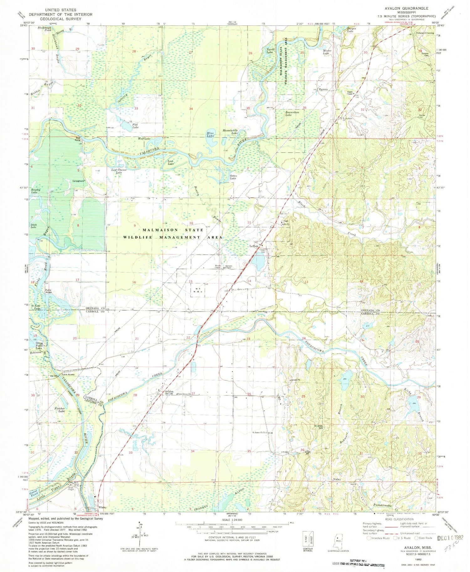
MyTopo
Classic USGS Avalon Mississippi 7.5'x7.5' Topo Map
Couldn't load pickup availability
Historical USGS topographic quad map of Avalon in the state of Mississippi. Map scale may vary for some years, but is generally around 1:24,000. Print size is approximately 24" x 27"
This quadrangle is in the following counties: Carroll, Grenada, Leflore.
The map contains contour lines, roads, rivers, towns, and lakes. Printed on high-quality waterproof paper with UV fade-resistant inks, and shipped rolled.
Contains the following named places: Avalon, Avalon Cut-Off, Babmore Branch, Beatty Bayou, Beaverdam Lake, Black Creek, Blue Lake, Church of Christ, Duncan Cemetery, Duncan Crossing, Durgin Lake, Flat Lake, Fletcher Lake, Holly Grove Church Number 2, Hope School, Jacklot Lake, Kirby Branch, Leflore, Lost Chance Lake, Lost Lake, Malmaison State Wildlife Management Area, Minter Lake, Musselwhite Lake, Neals Cemetery, Neals Chapel, O'Neal Lake, Ooten Lake, Oxberry Bayou, Parsons, Potacocawa Creek Structure Y-3la-17 Dam, Potacocawa Watershed Y-3la-1 Dam, Potacocawa Watershed Y-3la-2 Dam, Potacocowa Creek, Potacocowa Watershed Y-3la-18 Dam, Potacocowa Watershed Y-3la-28 Dam, Saint Andrews Church, Saint James Cemetery, Saint James Church Number 1, Saint James Church Number 2, Samuels Chapel, Scurlock School, Shiloh Cemetery, Shiloh Church, Supervisor District 5, Swins Chapel, Terrill Lake, Turpin Switch, Union Grove Church, Valley, Valley School, Wolf Lake, Woods Chapel, ZIP Code: 38940


