MyTopo
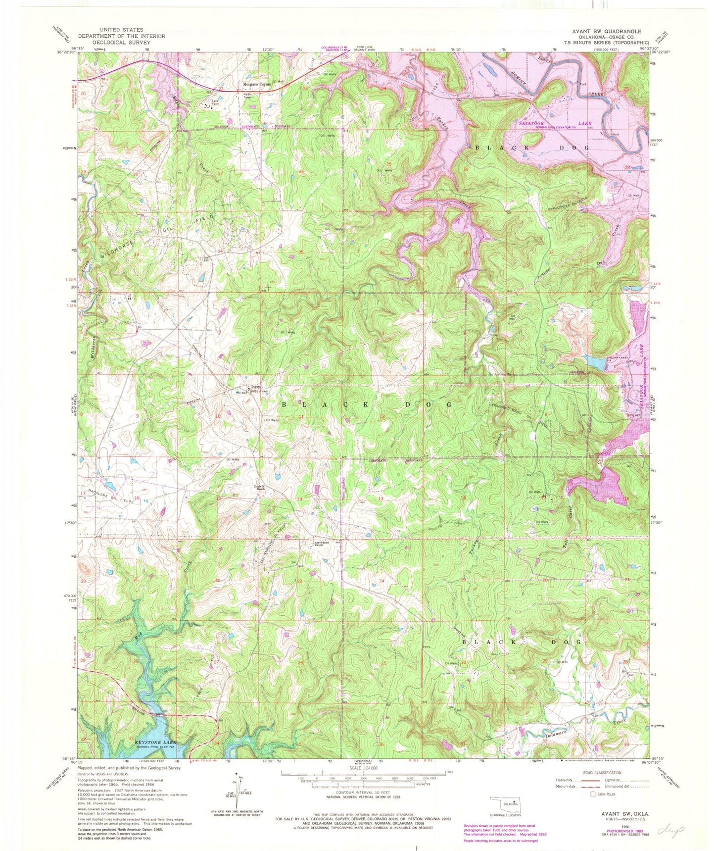
Classic USGS Avant SW Oklahoma 7.5'x7.5' Topo Map
Couldn't load pickup availability
Historical USGS topographic quad map of Avant SW in the state of Oklahoma. Typical map scale is 1:24,000, but may vary for certain years, if available. Print size: 24" x 27"
This quadrangle is in the following counties: Osage.
The map contains contour lines, roads, rivers, towns, and lakes. Printed on high-quality waterproof paper with UV fade-resistant inks, and shipped rolled.
Contains the following named places: Arrowhead Ranch, Branstetter Oil Field, East Madalene Oil Field, Edgewood South Oil Field, Lost Creek, Madalene Oil Field, Prue Oil Field, Triple M Ranch, Wildhorse Oil Field, Skiatook Lake, Morgans Corner, Oknoname 113002 Dam, Oknoname 113002 Reservoir, Oknoname 113003 Dam, Oknoname 113003 Reservoir, Oknoname 113004 Dam, Oknoname 113004 Reservoir, Oknoname 113066 Dam, Oknoname 113066 Reservoir, Oknoname 113067 Dam, Oknoname 113067 Reservoir, Township of Black Dog, Morgans Corner Fire Department