
MyTopo
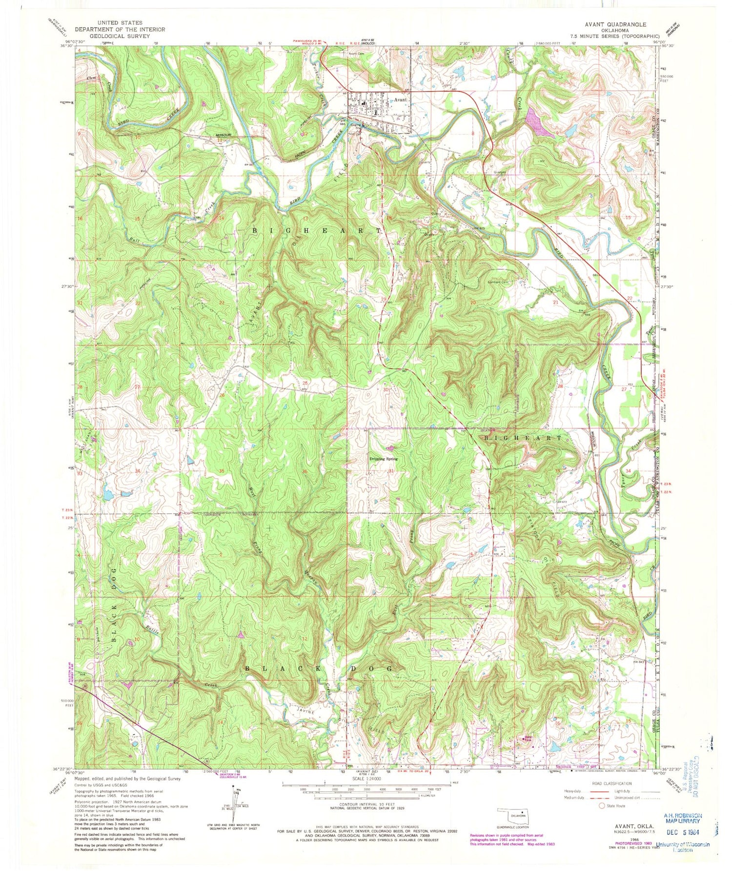
Classic USGS Avant Oklahoma 7.5'x7.5' Topo Map
Couldn't load pickup availability
Historical USGS topographic quad map of Avant in the state of Oklahoma. Typical map scale is 1:24,000, but may vary for certain years, if available. Print size: 24" x 27"
This quadrangle is in the following counties: Osage, Tulsa, Washington.
The map contains contour lines, roads, rivers, towns, and lakes. Printed on high-quality waterproof paper with UV fade-resistant inks, and shipped rolled.
Contains the following named places: Avant, Avant Cemetery, Avant Oil Field, Battle Creek, Bull Creek, Candy Creek, Clem Creek, Dripping Spring, East Prong Quapaw Creek, Javine Oil Field, Lombard Cemetery, Skiatook Oil Field, Tucker Creek, Tyner Creek, West Prong Quapaw Creek, Avant Water Supply Lake Dam, Avant Water Supply Lake, Oknoname 113005 Dam, Oknoname 113005 Reservoir, Oknoname 113068 Dam, Oknoname 113068 Reservoir, Oknoname 113069 Dam, Oknoname 113069 Reservoir, Oknoname 113070 Dam, Oknoname 113070 Reservoir, Avant Public School, Avant Post Office, Town of Avant, Avant Fire Department, Candy Lake Estate Airport, Avant Police Department, Kourtis Family Farm Airport


