MyTopo
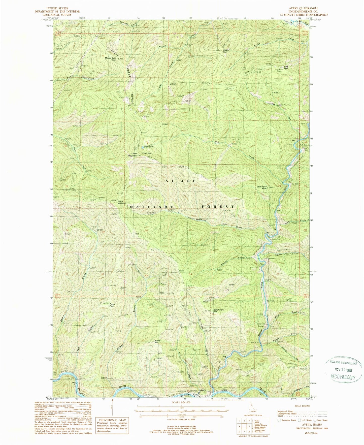
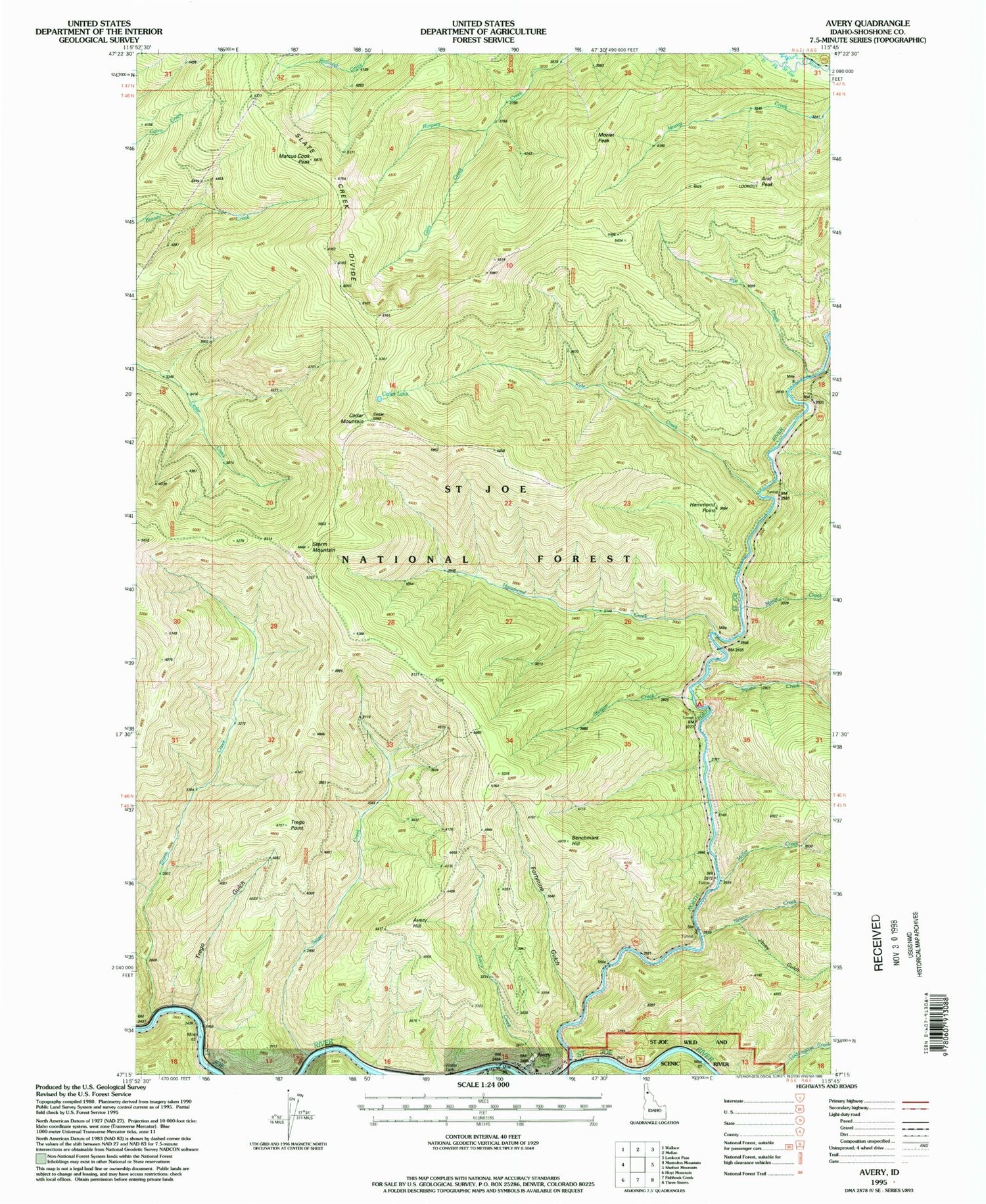
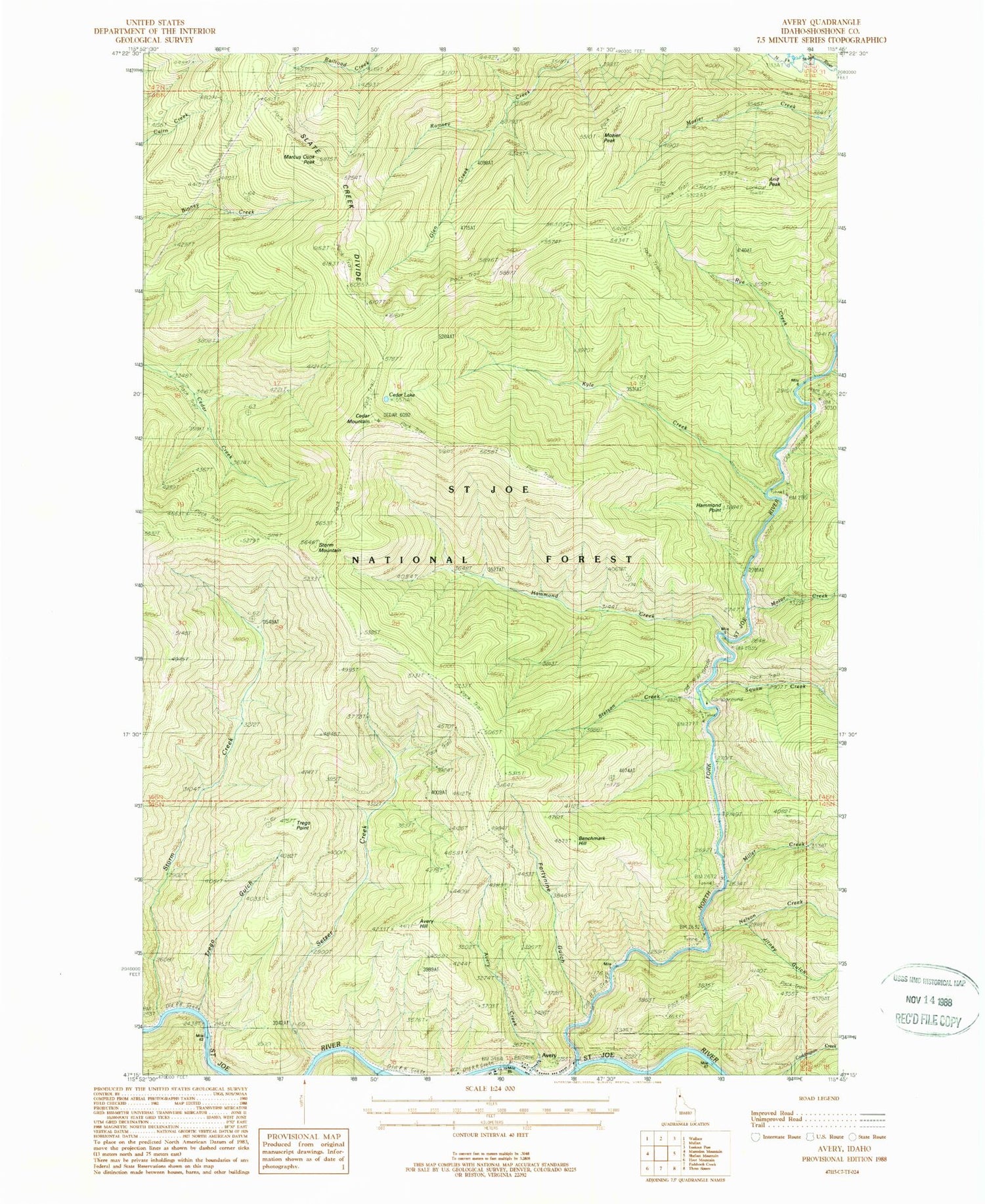
Classic USGS Avery Idaho 7.5'x7.5' Topo Map
Couldn't load pickup availability
Historical USGS topographic quad map of Avery in the state of Idaho. Map scale may vary for some years, but is generally around 1:24,000. Print size is approximately 24" x 27"
This quadrangle is in the following counties: Shoshone.
The map contains contour lines, roads, rivers, towns, and lakes. Printed on high-quality waterproof paper with UV fade-resistant inks, and shipped rolled.
Contains the following named places: Arid Peak, Arid Ridge Trail, Avery, Avery Creek, Avery Elementary - Junior High School, Avery Guard Station, Avery Hill, Avery Post Office, Benchmark Hill, Big Dick Creek, Cedar Lake, Cedar Mountain, Cedar Mountain Trail, Fortynine Gulch, Glen Creek, Hammond Creek, Hammond Point, Jitney Gulch, Kyle, Kyle Creek, Kyle Creek Trail, Marcus Cook Peak, Miller Creek, Motor Creek, Mozier Peak, Nelson Creek, North Fork Saint Joe River, Rye Creek, Setzer Creek, Stetson, Stetson Creek, Storm Creek, Storm Mountain, Telichpah Campground, Telichpah Creek, Theriault Creek, Trego Gulch, Trego Point, Trego Point Trail