MyTopo
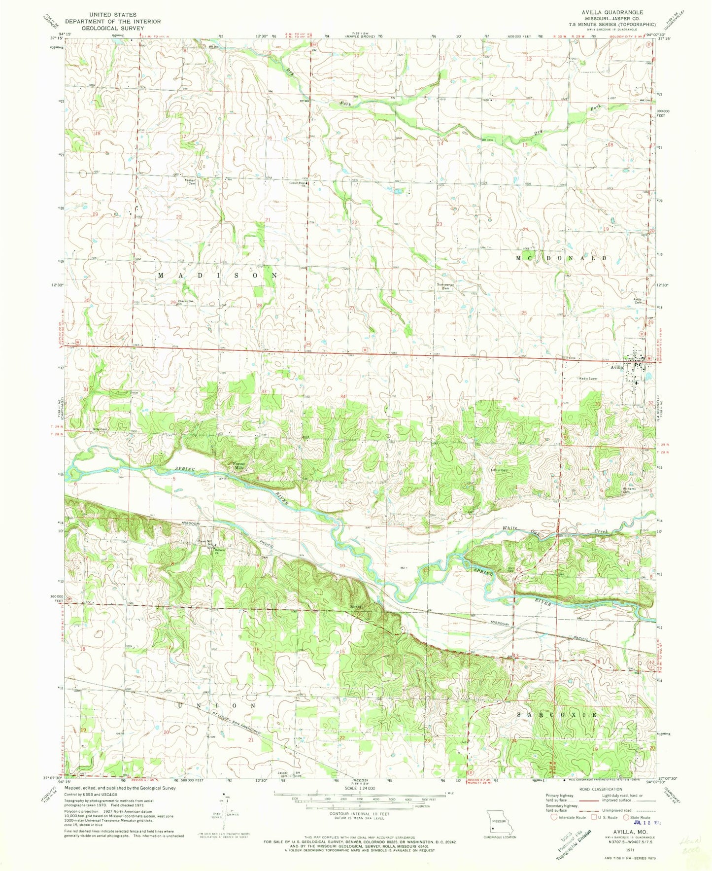
Classic USGS Avilla Missouri 7.5'x7.5' Topo Map
Couldn't load pickup availability
Historical USGS topographic quad map of Avilla in the state of Missouri. Map scale may vary for some years, but is generally around 1:24,000. Print size is approximately 24" x 27"
This quadrangle is in the following counties: Jasper.
The map contains contour lines, roads, rivers, towns, and lakes. Printed on high-quality waterproof paper with UV fade-resistant inks, and shipped rolled.
Contains the following named places: Andrews Airport, Arthur Cemetery, Arthur School, Avilla, Avilla Cemetery, Avilla Elementary School, Avilla Post Office, Bethany Church, Center Point Church, Center Point School, Charter Oak Church, Charter Oak School, Dimple, Elmira School, Empire School, Fasken Cemetery, Forest Mill School, Forest Mills, Grey Cemetery, Jasper Cemetery, Maple Lane Farms Lake, Melugin, Midway, Nimsick Airport, Route 66 Airfield, Summerset Cemetery, Sunderland Airport, Sunflower School, Temperance School, Town of Avilla, Township of Madison, White Oak Creek, Williams Cemetery, ZIP Codes: 64833, 64859