
MyTopo
Classic USGS Avintaquin Canyon Utah 7.5'x7.5' Topo Map
Regular price
$16.95
Regular price
Sale price
$16.95
Unit price
per
Couldn't load pickup availability
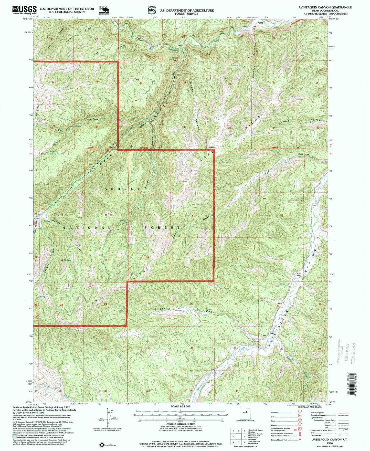
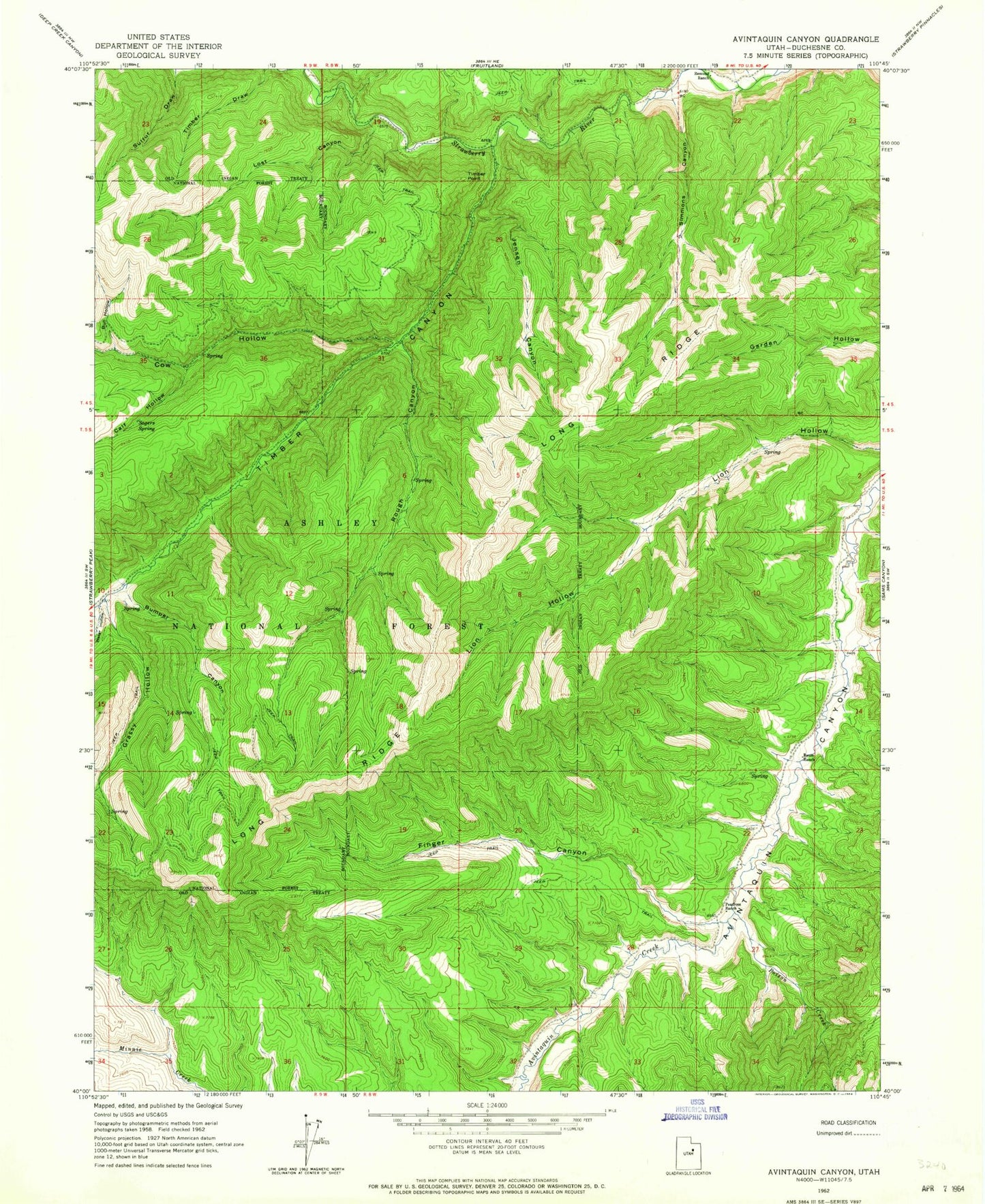
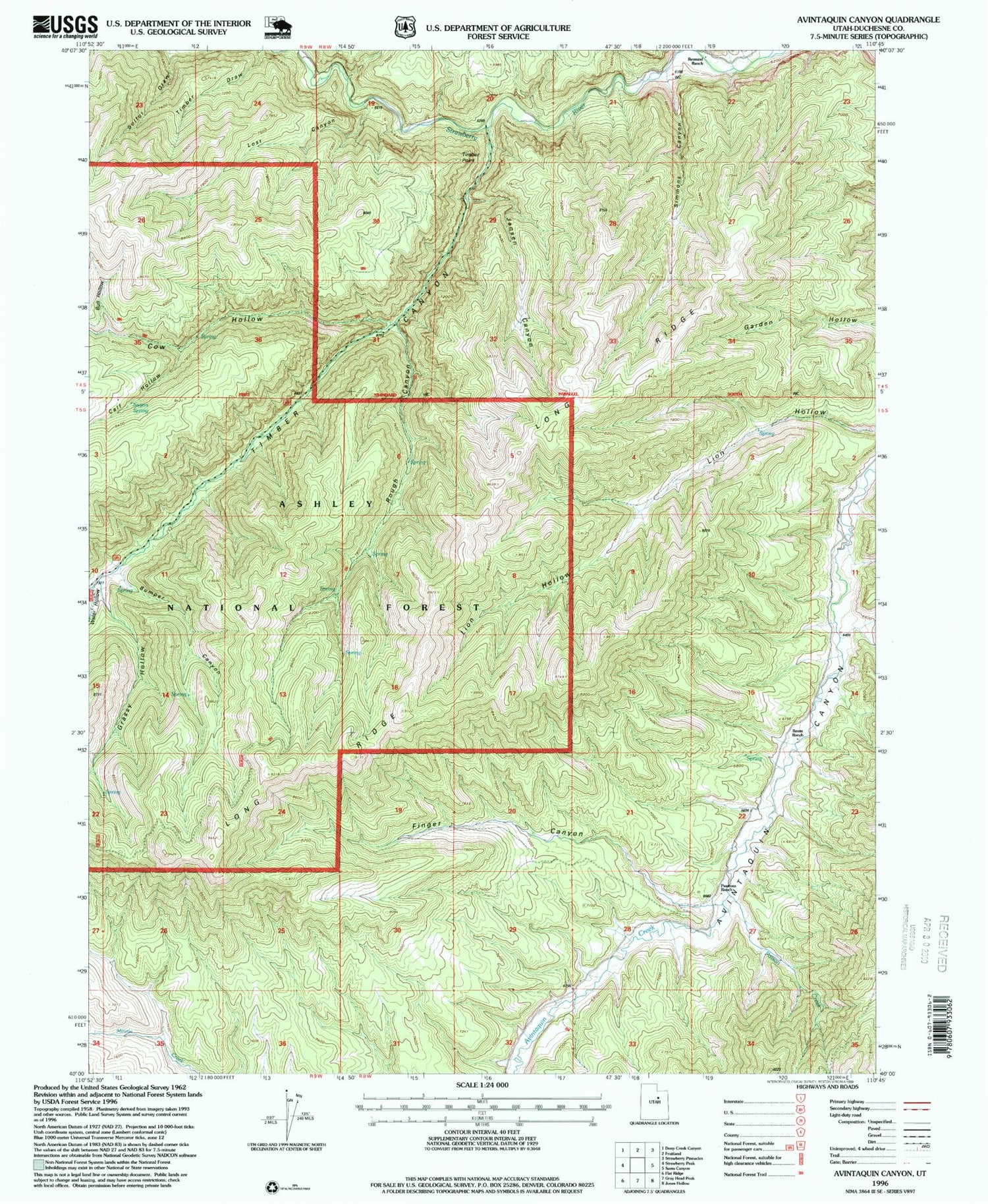
Historical USGS topographic quad map of Avintaquin Canyon in the state of Utah. Map scale may vary for some years, but is generally around 1:24,000. Print size is approximately 24" x 27"
This quadrangle is in the following counties: Duchesne.
The map contains contour lines, roads, rivers, towns, and lakes. Printed on high-quality waterproof paper with UV fade-resistant inks, and shipped rolled.
Contains the following named places: Baum Ranch, Bull Hollow, Bumper Canyon, Calf Hollow, Cow Hollow, Finger Canyon, Grassy Hollow, Jensen Canyon, Long Ridge, Lost Canyon, Peatross Ranch, Poison Creek, Remund Ranch, Rough Canyon, Sagers Spring, Simmons Canyon, Sulfur Draw, Timber Canyon, Timber Point, Water Hollow