MyTopo
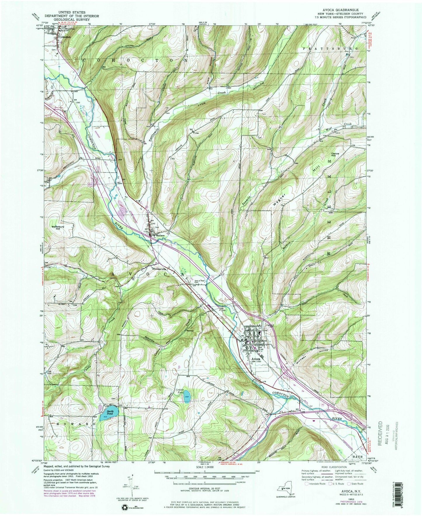
Classic USGS Avoca New York 7.5'x7.5' Topo Map
Couldn't load pickup availability
Historical USGS topographic quad map of Avoca in the state of New York. Map scale may vary for some years, but is generally around 1:24,000. Print size is approximately 24" x 27"
This quadrangle is in the following counties: Steuben.
The map contains contour lines, roads, rivers, towns, and lakes. Printed on high-quality waterproof paper with UV fade-resistant inks, and shipped rolled.
Contains the following named places: Avery Hollow, Avoca, Avoca Assembly of God, Avoca Central School, Avoca Free Library, Avoca Hose Company Ambulance Corps, Avoca Post Office, Avoca United Methodist Chruch, Avoca Volunteer Fire Department, Bloomerville, Cance Hill, Castle Creek, Cohocton Public Library, Cohocton Valley Home for Adults, Cotton Creek, First Baptist Church of Avoca, Goff Creek, Highland Cemetery, Larrowe Cemetery, Loucks Pond, Lyon Hollow, Maple View Cemetery, Michigan Hollow, Neils Creek, Old Avoca Cemetery, Olmsted Hill Cemetery, Pinecrest Home for Adults, Reynolds Creek, Salmon Creek, Smith Pond, Smith Pond Cemetery, Tenmile Creek, Town of Avoca, Twelvemile Creek, Vale of Rest Cemetery, Village of Avoca, Wagner Hill, Wallace, Wallace Cemetery, Wallace Special Fire District, Wallace Wesleyan Church, Waterbury Hill, West Creek, ZIP Codes: 14809, 14826