MyTopo
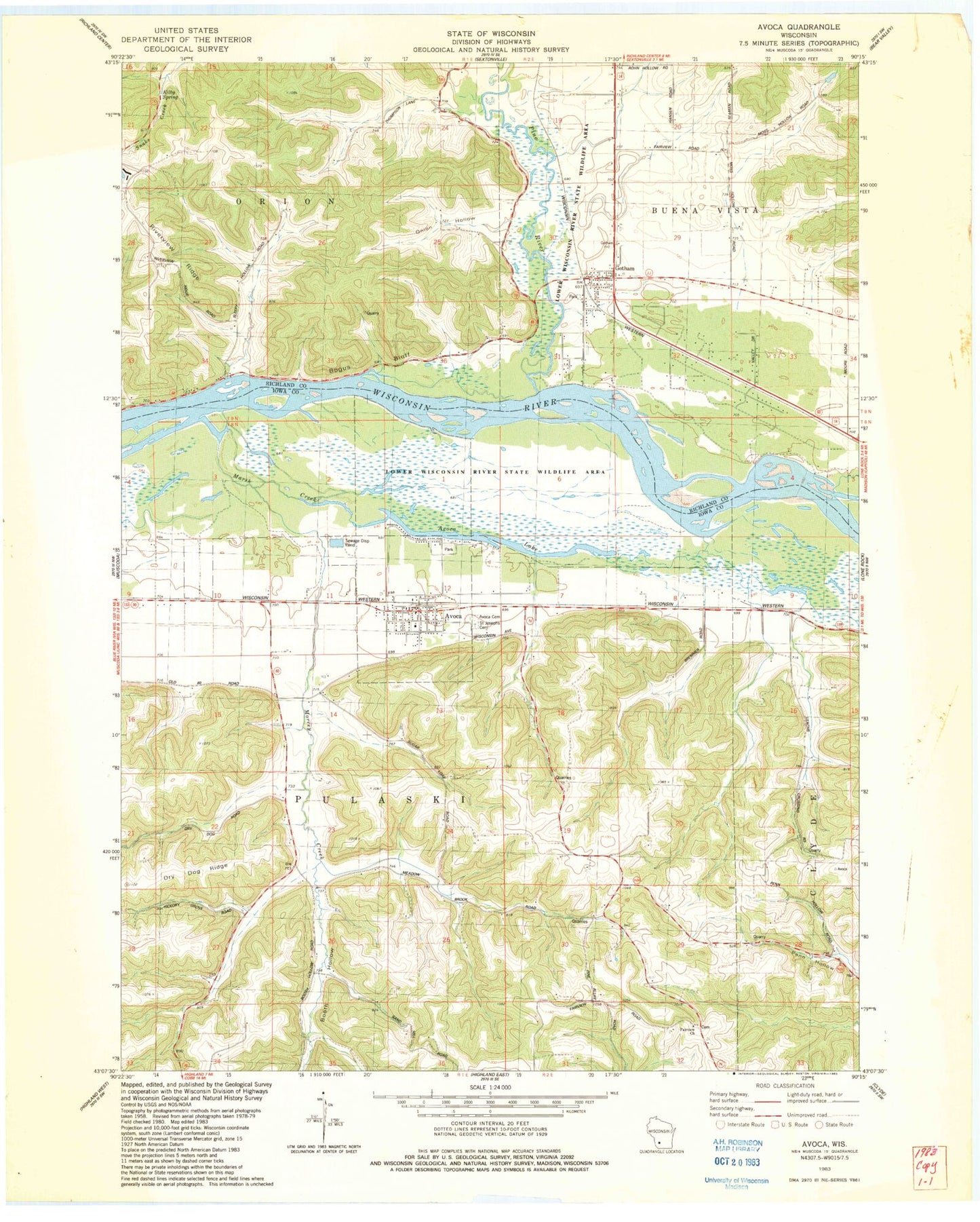
Classic USGS Avoca Wisconsin 7.5'x7.5' Topo Map
Couldn't load pickup availability
Historical USGS topographic quad map of Avoca in the state of Wisconsin. Map scale may vary for some years, but is generally around 1:24,000. Print size is approximately 24" x 27"
This quadrangle is in the following counties: Iowa, Richland.
The map contains contour lines, roads, rivers, towns, and lakes. Printed on high-quality waterproof paper with UV fade-resistant inks, and shipped rolled.
Contains the following named places: Akey School, Atwood Stock Dairy and Grain Farm, Avoca, Avoca and Rural Emergency Medical Services, Avoca and Rural Fire Department, Avoca Cemetery, Avoca Lake, Avoca Police Department, Avoca Post Office, Avoca Prairie-Savanna State Natural Area, Bear Creek, Beaver Dam Stock Farm, Bogus Bluff, Booth Hollow, Butternut Lane Farm, Evergreen Farm, Fairview Church, Gotham, Gotham Census Designated Place, Gotham Jack Pine Barrens State Natural Area, Gotham Post Office, Gotham United Methodist Church, Kilby Spring, Locust Corners Farm, Maplewood Farm, Marsh Creek, Meadow Brook School, Morrey Creek, Moss Creek Stock Farm, Onion Hollow, Orion Mussel Bed State Natural Area, Pine Bluff School, Pine River, Pine River Farm, Plainview Stock and Dairy Farm, River Valley Farm, Riverview Ridge, Riverview School, Saint Joseph's Cemetery, Scholten Dam, School Number 5, Seaman School, Town of Orion, Town of Pulaski, Village of Avoca, Walnut Grove Stock and Dairy Farm, ZIP Codes: 53506, 53540