MyTopo
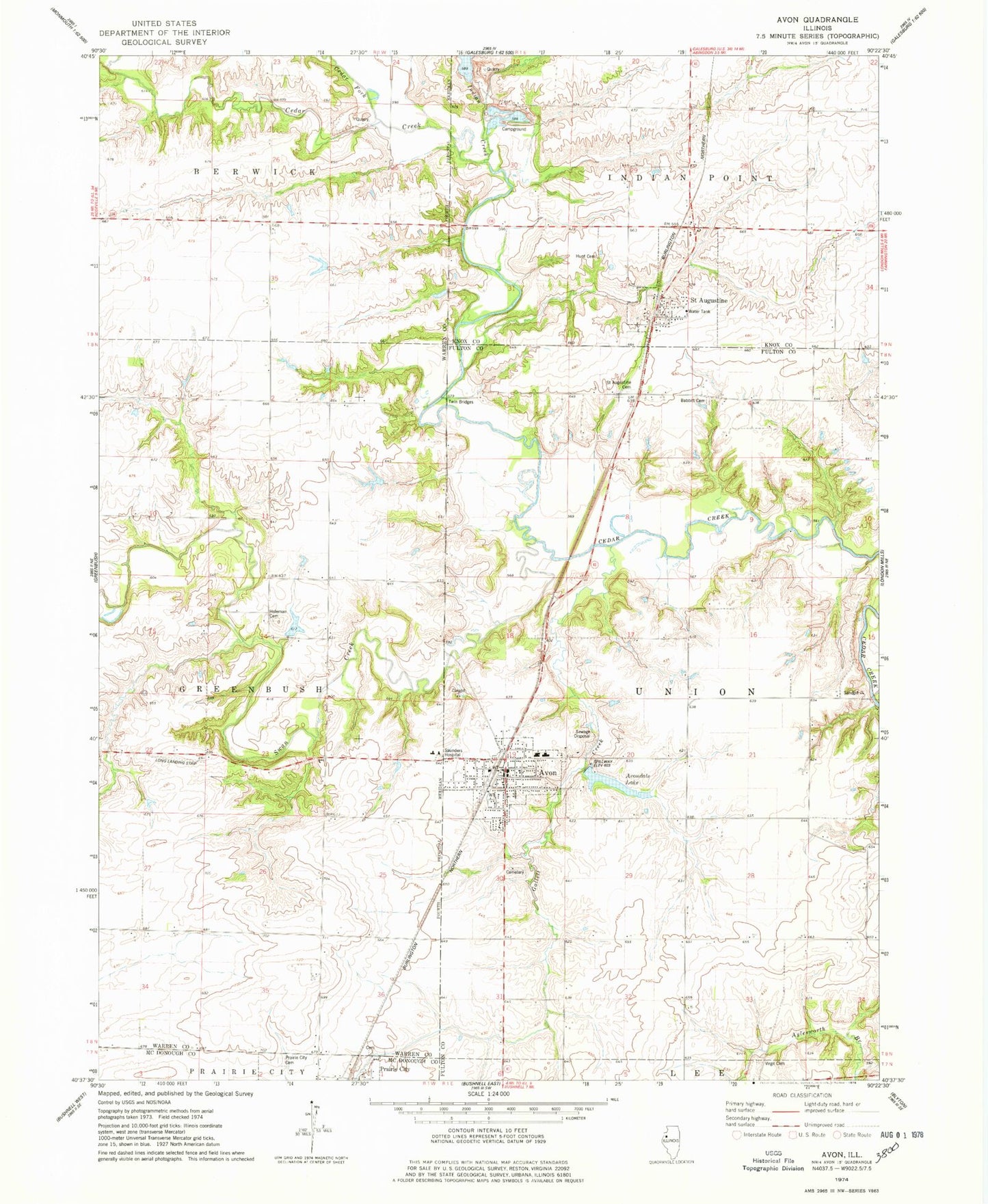
Classic USGS Avon Illinois 7.5'x7.5' Topo Map
Couldn't load pickup availability
Historical USGS topographic quad map of Avon in the state of Illinois. Map scale may vary for some years, but is generally around 1:24,000. Print size is approximately 24" x 27"
This quadrangle is in the following counties: Fulton, Knox, McDonough, Warren.
The map contains contour lines, roads, rivers, towns, and lakes. Printed on high-quality waterproof paper with UV fade-resistant inks, and shipped rolled.
Contains the following named places: Avon, Avon Cemetery, Avon Fire Protection District, Avon Grade School, Avon Police Department, Avon Post Office, Avon Public Library, Avon Senior High School, Avon United Methodist Church, Avondale Lake, Babbitt Cemetery, Cedar Fork, Federated Church, First Baptist Church of Avon, Gallett Creek, Greenleaf School, Gross School, Hatch School, Holeman Cemetery, Hunt Cemetery, Indian Creek, Lake Avon Country Club Reservoir, Lake Avon Country Club Reservoir Dam, Lincoln School, Long RLA Airport, Murks Strip, Old Prairie City Cemetery, Oldtown School, Olive School, Paul Lake, Paul Lake Dam, Prairie City Cemetery, Ross School, Sailer School, Saint Augustine, Saint Augustine Cemetery, Saint Augustine Post Office, Saunders Hospital, Saunders Hospital Heliport, Sloey School, Swan Creek, Township of Union, Twin Bridges, Valley Quarry, Village of Avon, Village of Saint Augustine, Virgil Cemetery, ZIP Codes: 61415, 61474