
MyTopo
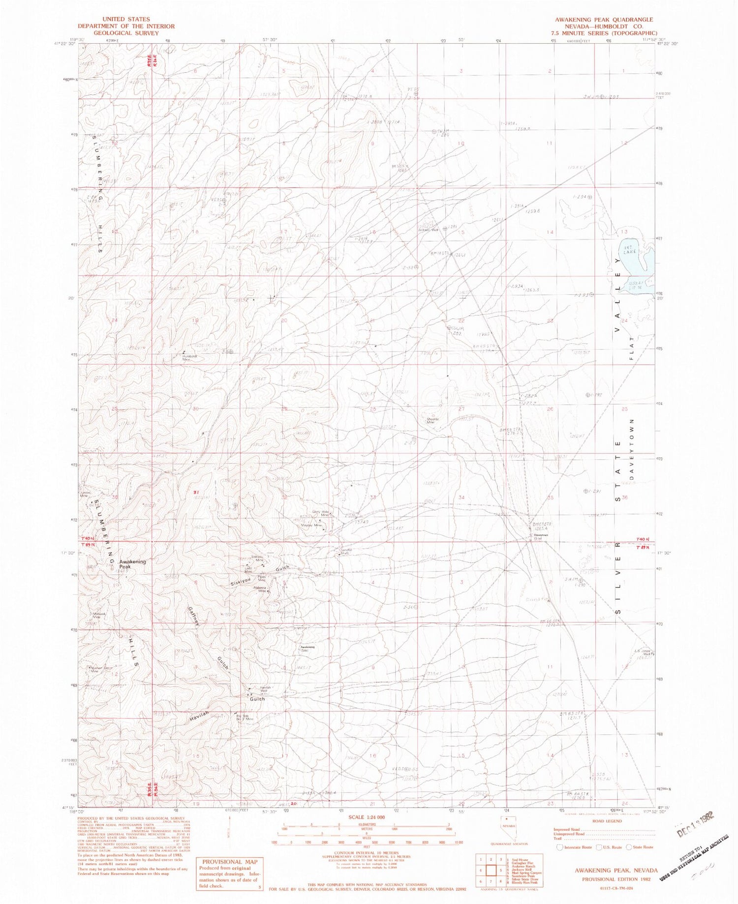
Classic USGS Awakening Peak Nevada 7.5'x7.5' Topo Map
Couldn't load pickup availability
Historical USGS topographic quad map of Awakening Peak in the state of Nevada. Map scale may vary for some years, but is generally around 1:24,000. Print size is approximately 24" x 27"
This quadrangle is in the following counties: Humboldt.
The map contains contour lines, roads, rivers, towns, and lakes. Printed on high-quality waterproof paper with UV fade-resistant inks, and shipped rolled.
Contains the following named places: Alabama Mine, Awakening, Awakening Mining District, Awakening Peak, Big Bob Number 2 Mine, Daveytown, Gaffney Gulch, Glory Hole Mine, Havalau Mine, Havilah Gulch, Havilah Well, Humboldt Canyon, Humboldt Mine, J S Jones Well, Jackson Well, Jumbo Mine, Ladd Mine, Mayday Mine, Mohawk Mine, Pipes Mine, Sandhill Shaft, Scheelite Mine, Sheelite Mine, Siskiyou Gulch, Siskiyou Mine, Spanish Girl Mine


